


 in Irish Weather History 4")


NHC monitoring two tropical systems in the Atlantic
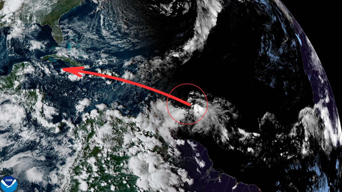
The US National Hurricane Center (NHC) is monitoring two tropical disturbances in the Atlantic Ocean, including one that appears to be moving towards the Caribbean.
A tropical wave located several hundred kilometres east of the Windward Islands continues to produce widespread showers and thunderstorms. Satellite observations suggest the system does not yet have a closed circulation, although winds of 50 to 55 km/h have been recorded north of the wave axis.
Conditions are only marginally favourable for development over the next couple of days as the system moves rapidly westwards at 30 to 40 km/h. It is expected to cross the Windward Islands and enter the Caribbean Sea early next week. By midweek, it is forecast to slow down over the central Caribbean, where conditions could become more supportive of further development.
Regardless of whether it strengthens, the disturbance is expected to bring heavy rain and gusty winds to the Windward Islands on Sunday and Sunday night. The NHC currently gives it a low (10 per cent) chance of formation within 48 hours and a 30 per cent chance over the next seven days.
The second system, a non-tropical area of low pressure located several hundred kilometres northeast of Bermuda, also has a low (10 per cent) chance of acquiring subtropical characteristics before turning northeast into cooler waters on Sunday.
This year’s Atlantic hurricane season has been quieter than widely forecasted but remains one of the more active in recent years, producing 14 named storms to date, including five hurricanes and two major hurricanes. The most significant so far was Hurricane Francine in September, which caused widespread flooding and wind damage across parts of the US Gulf Coast. The 2025 season officially runs until November 30.
Share this WeathÉire story:

