in Irish Weather History 1")


Mixed Weather Signals for Mid to Late January
From this weekend and through next week, Ireland and Britain will sit in a meteorological no man’s land between an energetic Atlantic to the west and deep cold over Scandinavia and north western Europe.
Beyond the weekend, ensemble guidance becomes increasingly scattered, suggesting forecast models are struggling to resolve the broader pattern for the second half of January.
Three main outcomes are under consideration. Ireland could return to a mobile Atlantic regime with frequent rain and occasional strong winds. Another possibility is that the country remains caught between a cool westerly airflow and much colder air to the north east. A third scenario would see the colder air eventually pushing further west.
In the short term, the middle ground appears most likely. Generally cool, near seasonal temperatures with spells of rain or showers should dominate through the weekend and into next week. After that, confidence drops sharply as the models begin to diverge.
Traditionally, the safest assumption in this part of the world is that the Atlantic eventually reasserts itself. This view is reinforced by the expectation of polar air plunging deep into North America over the coming days. Such a development would normally intensify the jet stream and drive low pressure systems eastwards across the Atlantic towards Ireland and Britain.
However, strong blocking over Greenland and to the north east of Europe may be sufficient to disrupt this process. Rather than running directly towards these islands, a reinvigorated jet stream could be forced onto a more southerly track at first before diverting northwards to the west of Greenland. This would open the door for colder air from the north east to feed westwards later next week.
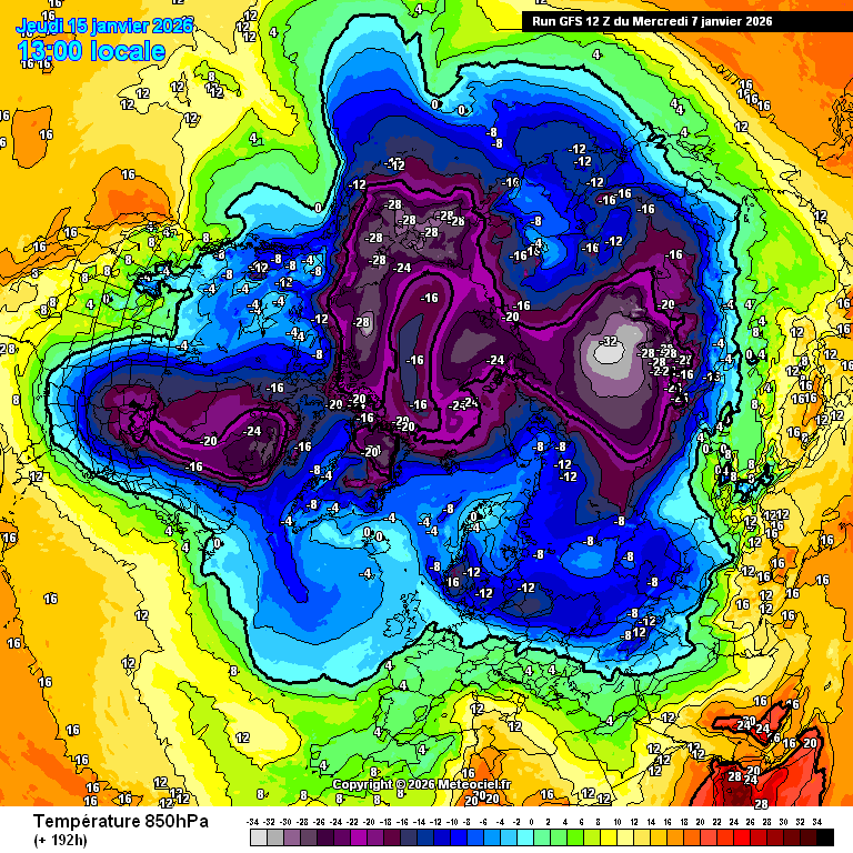
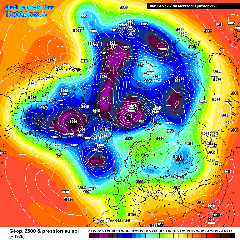
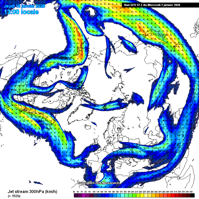
This afternoon’s GFS model illustrates that scenario. Blocking to the north west and north east diverts the jet stream south of its usual path, despite it being energised by intense cold over North America. Low pressure systems are initially steered towards Iberia before the jet stream shifts north again, allowing colder continental air to extend westwards into north western Europe late next week.
At this stage, the outlook remains finely balanced, with no clear winner emerging for the latter part of January.