in Irish Weather History 1")


Ireland’s path to cold in early February
As long as cold air remains firmly entrenched over the eastern half of the United States, the current weather pattern affecting Ireland is highly likely to persist.
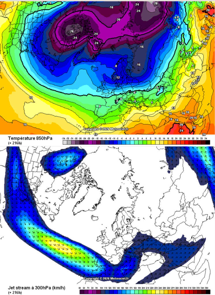
The recent deep southward surge of cold air across the United States has displaced an energised jet stream well to the south as it exits into the Atlantic. This provides the jet with a clear, uninterrupted trajectory towards Ireland and Britain, effectively bypassing disruption from the Greenland block (first batch of images).
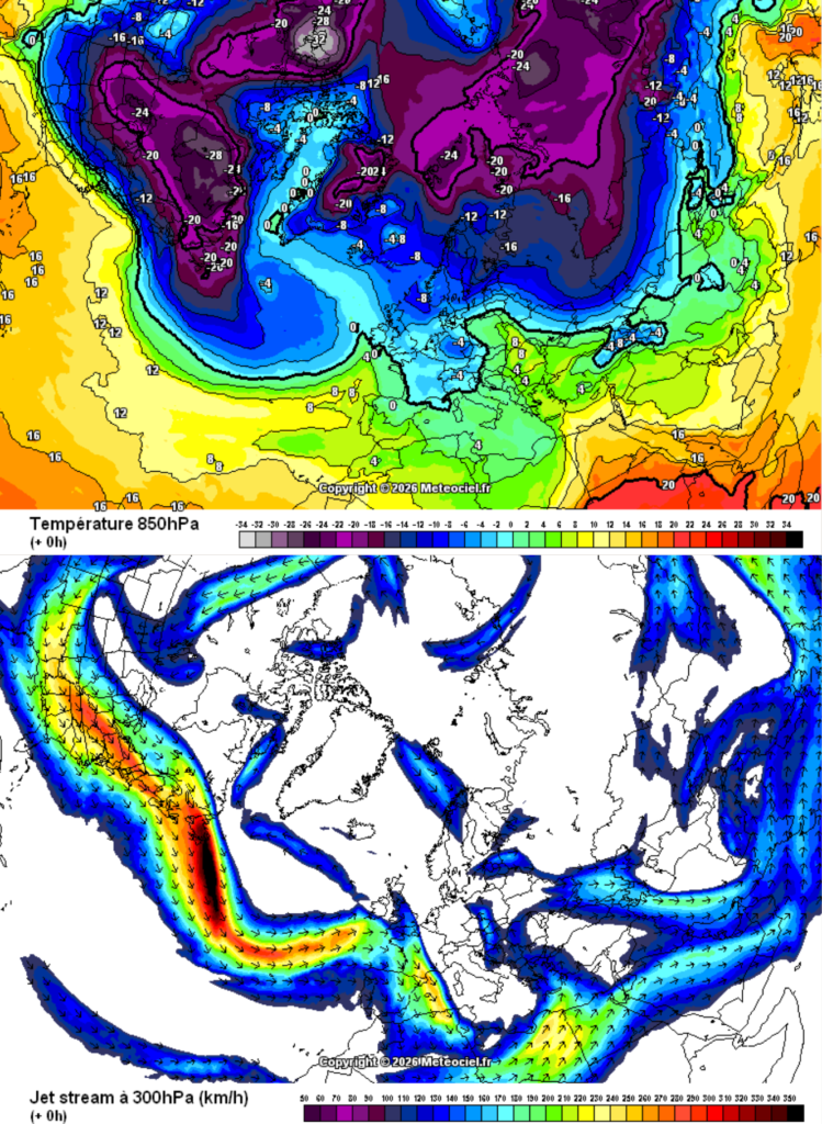
Should the cold over North America retreat to more northerly latitudes, as suggested in the 7–10 day timeframe, a less enegrised jet stream would be expected to exit North America further north. This would allow Greenland heights to exert greater influence, disrupting the Atlantic flow and steering low-pressure systems south of Ireland towards Iberia and France (second batch of images).
Provided heights remain in place over Scandinavia by that stage, and with much of Eurasia likely to remain under the influence of deep cold, a colder airmass would be able to spread westwards towards Ireland more readily. A lot of ifs and buts, but that’s the nature of forecasting medium to long term for an island on the edge of a 3,000 mile ocean radiator.