 in Irish Weather History 1")


Erin strengthens in Atlantic with US escaping brunt of major hurricane
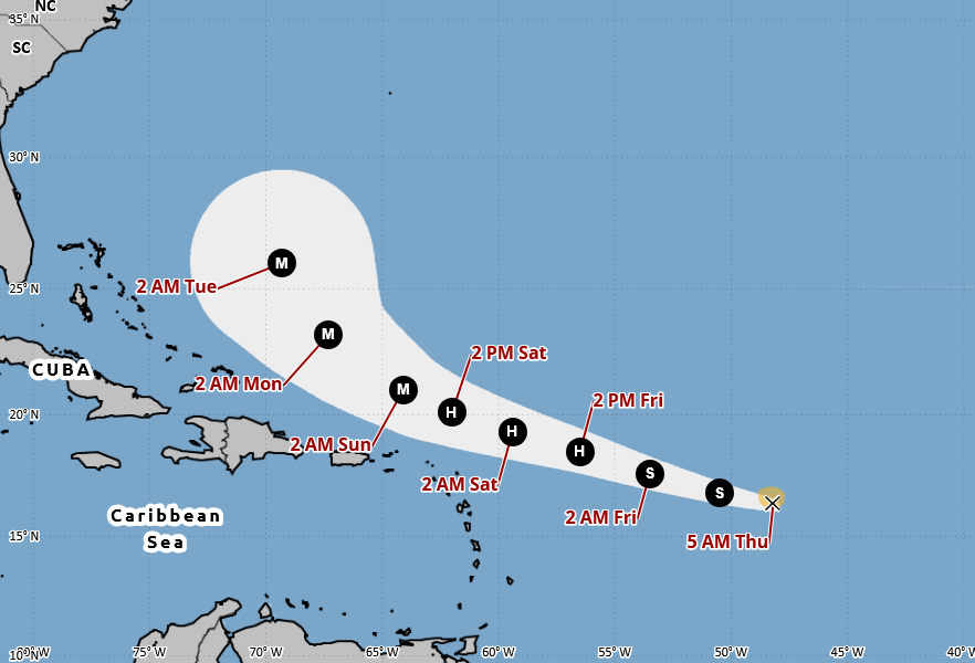
Hurricane Erin is expected to pass north of the northern Leeward Islands this weekend before curving away from the eastern seaboard of the United States, according to the US National Hurricane Center (NHC).
The system formed earlier this week in the tropical Atlantic after bringing flooding to the Cabo Verde islands. It is moving west at close to 30km/h, with sustained winds near 80km/h, and is forecast to intensify into a major hurricane by Sunday, with winds possibly exceeding 185km/h.
Current forecast models indicate Erin will track north early next week, avoiding a direct hit on the Caribbean islands or the US east coast. However, swells generated by the storm are likely to cause dangerous surf and rip currents along beaches from the Carolinas to New England, and possibly Bermuda.
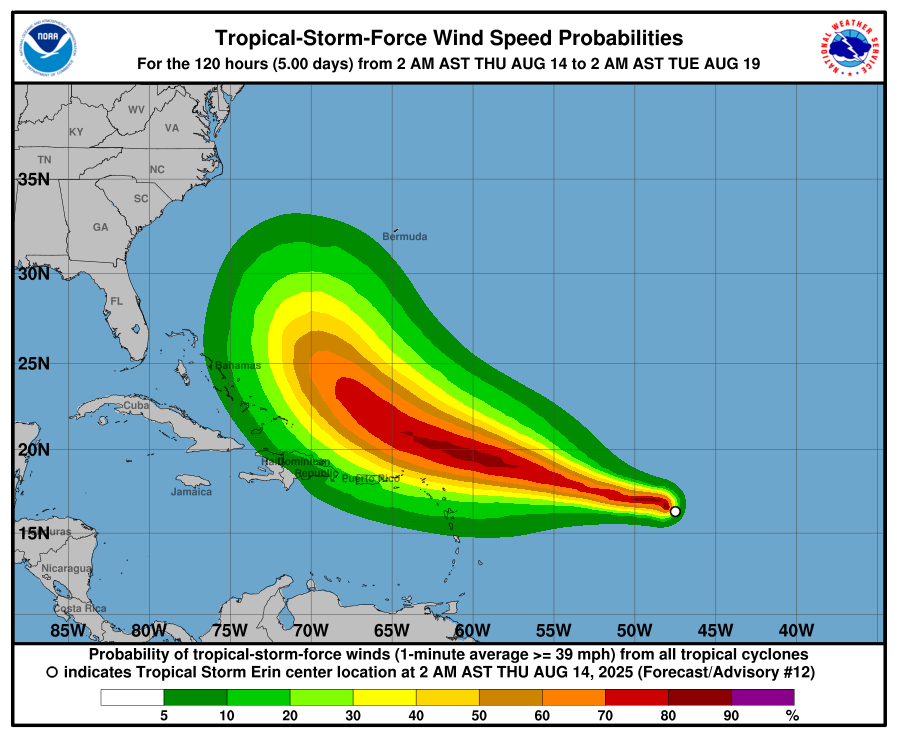
In its latest advisory, the NHC warned that locally heavy rainfall, high surf, rip currents and tropical-storm-force winds could affect parts of the northern Leeward Islands, the Virgin Islands and Puerto Rico this weekend as the core of the storm passes to the north. Residents in these areas have been urged to monitor its progress.
While uncertainty remains over possible impacts on the Bahamas, Bermuda and the US east coast next week, the centre said the risk of hazardous surf and rip currents across the western Atlantic is increasing. With the hurricane season approaching its peak, it added that now is a good time for residents in vulnerable areas to review preparedness plans.
Long-range models suggest Erin will weaken to a tropical storm as it moves east of Newfoundland, before dissipating in the Atlantic in 10 to 14 days. Remnants of the system could bring unsettled conditions to north-west Europe, including Ireland and Britain, around August 26th or 27th.
Share this WeathÉire story:

