 in Irish Weather History 1")


US forecasters track two Atlantic systems
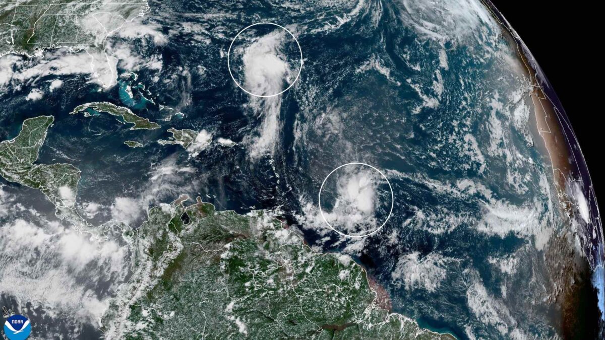
The US National Hurricane Center is monitoring two developing systems in the Atlantic, one of which is forecast to strengthen into a tropical storm later tonight.
Satellite data and reconnaissance flights indicate that an area of low pressure about 400 miles south-southeast of Bermuda has become better organised, with gale-force winds already detected. The system is expected to develop into a tropical storm before moving northwards over the coming days. While Bermuda has been advised to monitor its progress, the threat to the island has eased since Friday.
Further east, a tropical wave located some 650 miles from the Windward Islands is producing showers and thunderstorms. Forecasters say only limited development is likely before it reaches the islands late Sunday or Monday, bringing the risk of heavy rain and gusty winds. Unfavourable conditions in the central Caribbean are expected to hinder its chances of becoming a tropical cyclone.
Meanwhile, the remnants of ex-Hurricane Erin are forecast to reach Ireland from Monday. The system will become anchored to the south of Iceland and bring a return to more unsettled conditions, with outbreaks of rain and cooler air following the recent settled spell.


