 in Irish Weather History 1")


Colder Air Pooling Over the Arctic as Autumn Deepens
As September draws to a close, meteorological models are showing a significant cooling trend over the Arctic.
The latest Global Forecast System (GFS) model outputs suggest a notable decrease in 850 hPa temperatures over the Arctic region in the coming 16 days.
850 hPa, approximately 1.5 km above sea level, is a crucial level for assessing near-surface temperature anomalies. A sustained drop in temperatures at this level can signify the development of a colder air mass, which may influence weather patterns both locally and at lower latitudes.
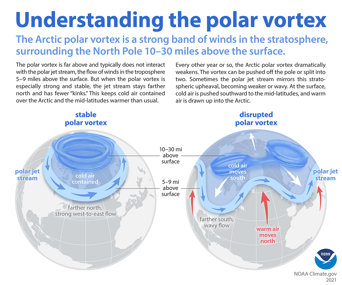
This cooling is indicative of the formation of a stronger and more stable polar vortex. The polar vortex is a large area of low pressure and cold air surrounding the Earth’s poles. During autumn, as the Arctic begins to cool, the temperature contrast between the polar region and the mid-latitudes increases, strengthening the vortex. A more robust vortex can lead to more persistent and colder Arctic conditions, with potential implications for weather patterns across the Northern Hemisphere.
Implications for Ireland
While the direct effects of Arctic cooling may not be immediately felt in Ireland, the strengthening of the polar vortex can influence atmospheric circulation patterns. A stable and strong polar vortex typically keeps cold Arctic air confined to the polar regions.
However, if the vortex weakens or becomes disrupted, it can allow cold air to spill southward, potentially leading to colder spells in mid-latitude regions, including Ireland.


