 in Irish Weather History 1")


Storm Jerry Under Surveillance: Hurricane Hunters Take Flight
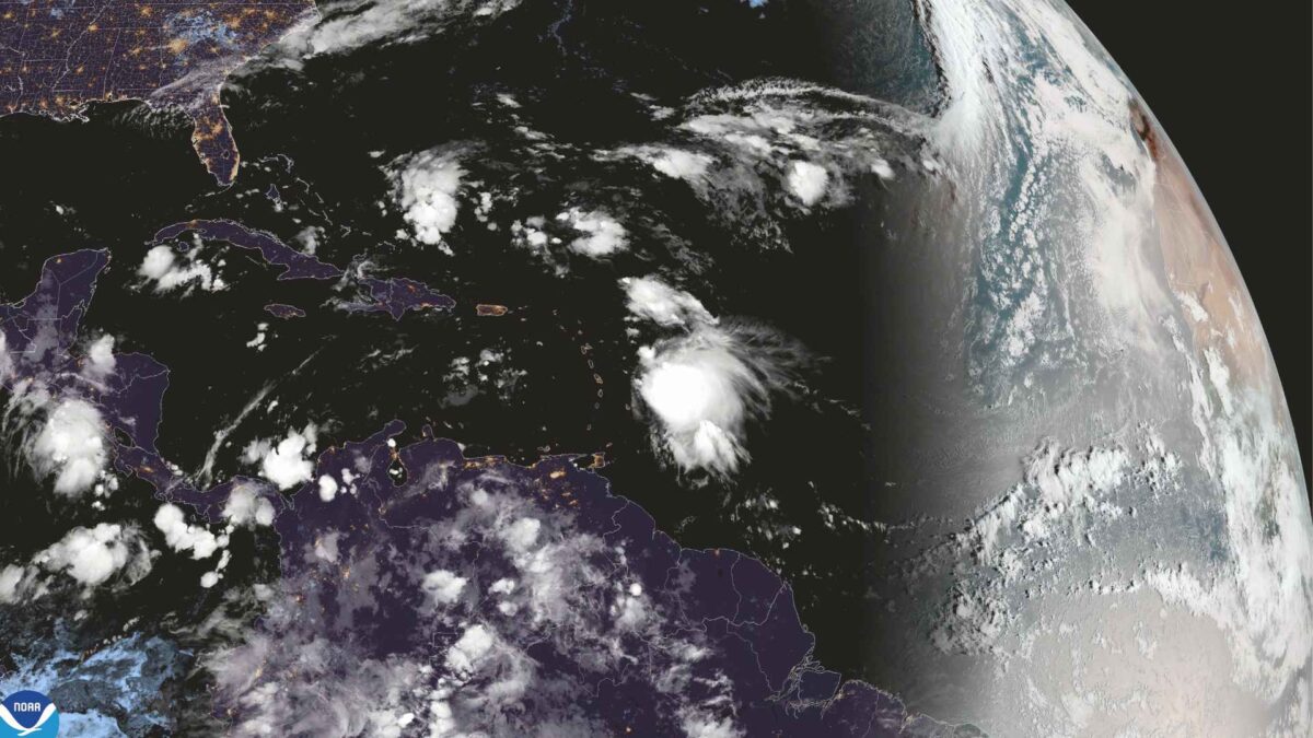
Tropical Storm Jerry is drawing increased scrutiny from meteorologists as NOAA and US Air Force Reserve hurricane hunters prepare to fly into the system today.
The reconnaissance mission is expected to provide vital data on the storm’s structure and intensity as it edges closer to the northern Leeward Islands.
The latest advisory from the US National Hurricane Center, issued at 10am Irish time, places Jerry’s centre roughly 640 kilometres east-southeast of the islands. The storm is moving west-northwest at 31 km/h, with sustained winds of 100 km/h and stronger gusts. Forecasters expect gradual strengthening over the coming days, with Jerry potentially reaching hurricane status by late Friday or Saturday.
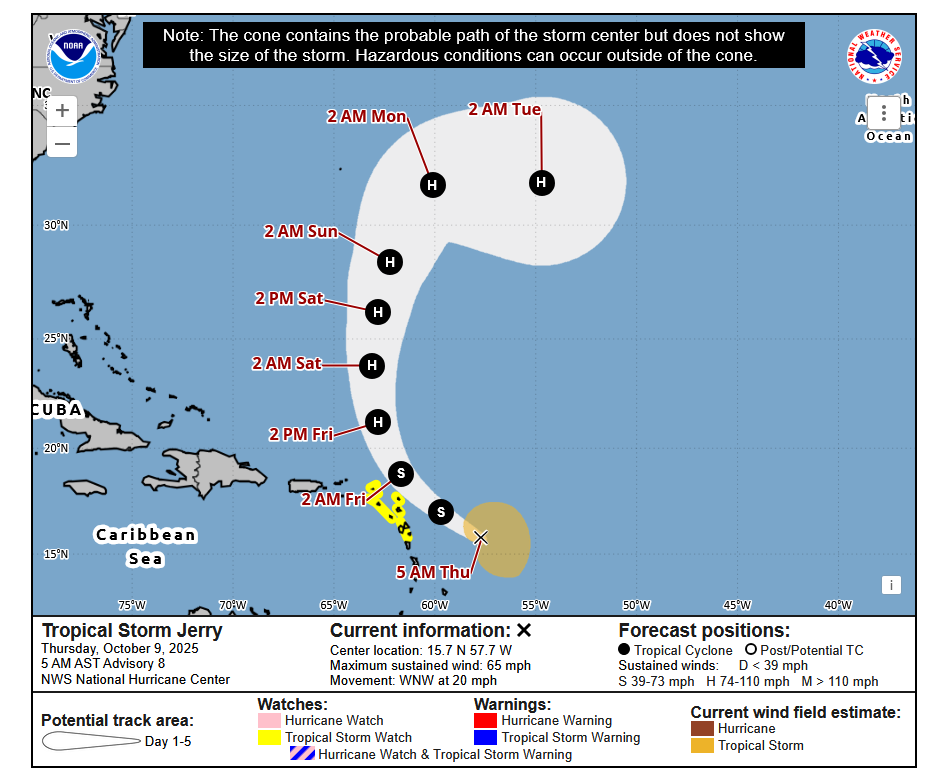
The hurricane hunter aircraft will gather real-time measurements from inside the storm, helping refine forecasts and improve warnings for communities in its path. Tropical Storm Watches remain in effect for several islands including Antigua, Barbuda, Anguilla, St Kitts, Nevis, Montserrat, and Guadeloupe, among others.
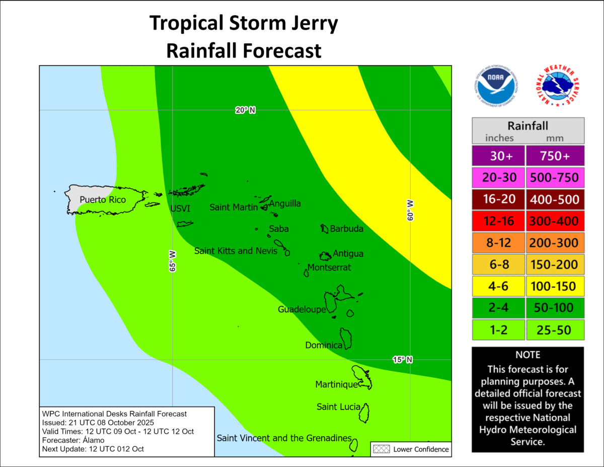
Rainfall totals of up to 15 centimetres are possible across the Leeward and Virgin Islands, raising concerns about flash flooding in urban and mountainous areas. Swells generated by Jerry are also beginning to reach the region, with dangerous surf and rip currents expected to spread westward tonight.
Weather Watch: Gale-Force System Near Azores Monitored for Tropical Development
A gale-force low-pressure system swirling several hundred miles west-northwest of the Azores is drawing attention from meteorologists, though chances of tropical development remain slim. The non-tropical disturbance is currently producing limited shower activity near its centre, but forecasters say there is a narrow window over the next 48 hours for the system to acquire subtropical or tropical characteristics.
The US National Weather Service and Meteo France have issued High Seas Forecasts for the area, including gale warnings, as the system continues to churn over the eastern Atlantic. However, environmental conditions are expected to become increasingly unfavourable, with cooler waters and stronger wind shear likely to inhibit further development.
The National Hurricane Center currently gives the system a low 10 percent chance of formation both in the short term and over the next seven days. While the threat appears minimal, maritime interests in the region are advised to stay informed as the situation evolves.
The Azores, a Portuguese archipelago often exposed to Atlantic weather systems, has seen its share of tropical and post-tropical activity in recent weeks, with Hurricane Gabrielle impacting the islands.
Share this WeathÉire story:

