 in Irish Weather History 1")


Satellite Captures ‘Cotton Bud’ Clouds Over Ireland
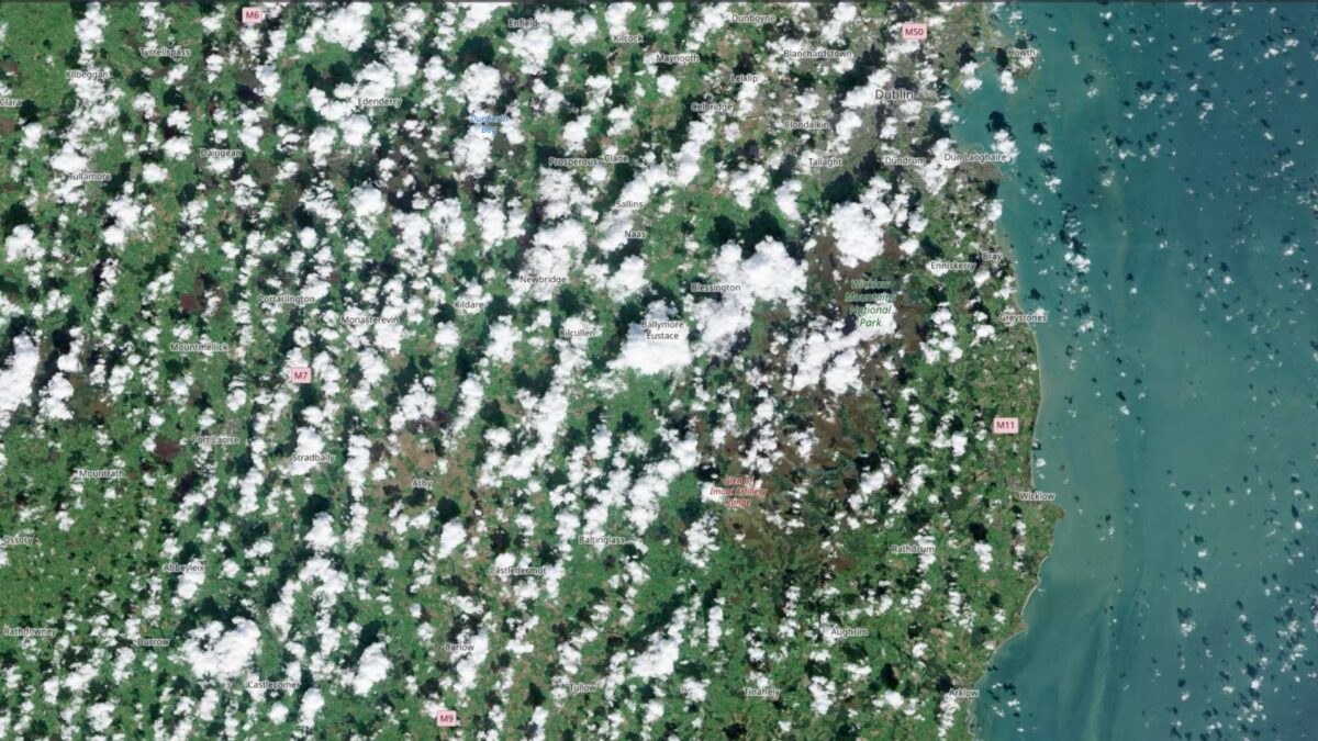
Images from the Copernicus Sentinel-2A satellite show distinctive “cotton bud” clouds forming over Ireland on Wednesday afternoon.
The clouds, known as cumulus humilis or fair-weather cumulus, are short-lived, lasting between five and forty minutes.
Cumulus humilis have flat bases with rounded tops, typically reaching no more than 3,000 metres or 10,000 feet. Unlike taller cumulus congestus clouds, which can indicate foul weather, these clouds are relatively low and spread out horizontally rather than vertically.
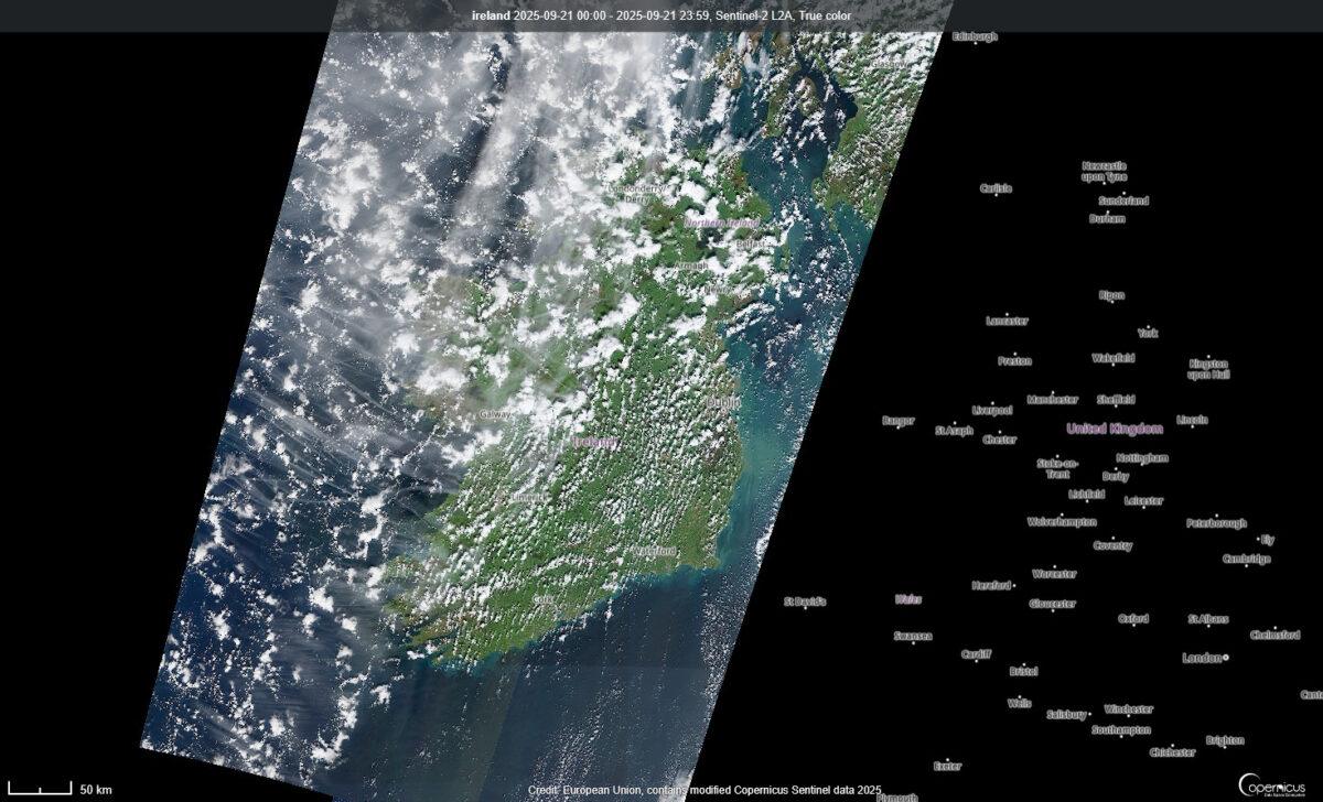
The formation of the clouds is linked to the interaction between land and sea. Land heats more quickly than water under the afternoon sun, causing warm air to rise and creating a low-pressure area. Cooler, moist air from the sea moves inland to fill the gap, and as it rises and condenses, clouds form. The effect is strongest when the Sun is highest in the sky, leading to more cloud development later in the afternoon.
Share this WeathÉire story:

