in Irish Weather History 1")


Hurricane Erin explodes into Category 5 storm
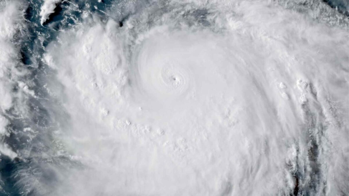
Hurricane Erin has intensified with remarkable speed into a Category 5 storm, the most powerful classification on the Saffir Simpson scale, with sustained winds of about 160 miles per hour (257 km/h).
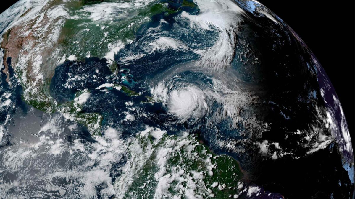
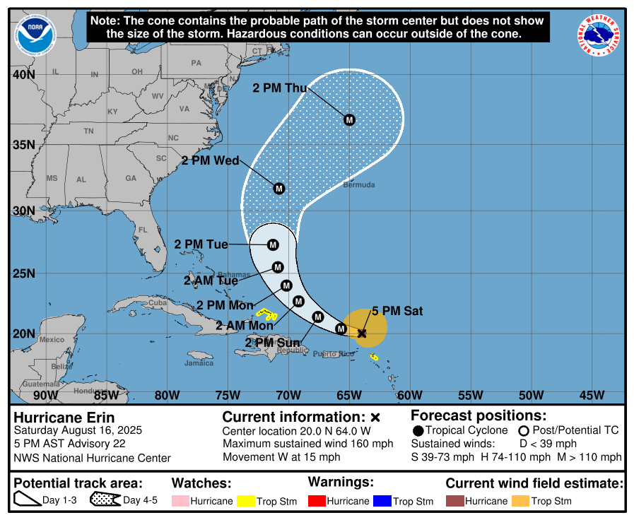
The US National Hurricane Center said on Saturday that the storm was centred north of the Leeward Islands and moving west at about 17 miles per hour. While not expected to make a direct strike on Puerto Rico or neighbouring islands, Erin’s outer bands could bring torrential rain, flash flooding and coastal surges.
Meteorologists have been struck by the storm’s rapid intensification. In the space of just 24 hours, Erin grew from a tropical storm into a full Category 5 hurricane, a pace rarely observed and one fuelled by unusually warm seas and favourable upper-air conditions.
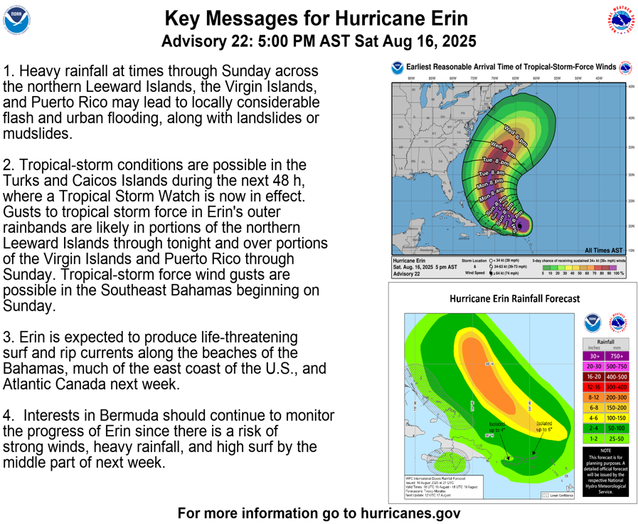
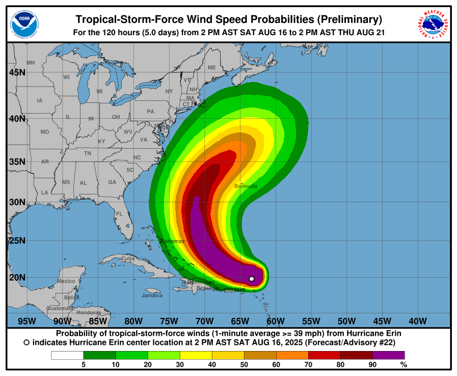
Hurricane Erin will bring periods of heavy rainfall to the northern Leeward Islands, the Virgin Islands and Puerto Rico through Sunday, with risks of flash flooding, landslides and mudslides. Tropical storm conditions are possible in the Turks and Caicos within 48 hours, while gusty rainbands may affect the Virgin Islands, Puerto Rico and the northern Leewards tonight into Sunday, and the southeast Bahamas from Sunday.
The storm will also generate life-threatening surf and rip currents along beaches in the Bahamas, much of the US east coast and Atlantic Canada next week. Bermuda remains at risk of strong winds, heavy rain and dangerous seas by midweek.
Impacts Further Afield
Hurricane Erin could ultimately help bring an end to Ireland’s ongoing spell of dry and settled weather in about ten days’ time.
The storm is not expected to reach Ireland as a hurricane. However, its remnants could steer the wider Atlantic weather pattern towards a more unsettled phase later this month. If this occurs, it may finally break the prolonged dryness that has persisted through much of August.
Ireland has experienced below-average rainfall for several weeks, with soil moisture deficits as high as 60mm in parts of Leinster and Munster, leading to restricted growth.
For now, conditions will stay largely dry and warmer than average, with only scattered showers in the week ahead. A shift to more unsettled weather will depend on how Erin interacts with the jet stream. Current guidance points to a possible breakdown of high pressure over Ireland around Monday, August 25th or Tuesday, August 26th. Long range weather model data shows the remnants of Erin tracking east to the north of Ireland.