 in Irish Weather History 1")


Coastal Flooding Expected from Erin, System to Weaken at Weekend
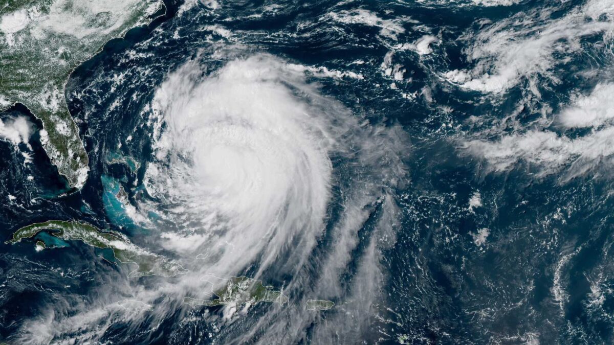
Hurricane Erin, currently classified as a Category 2 storm with sustained winds near 105 km/h, is expected to bring dangerous surf, rip currents, and coastal flooding to parts of the Bahamas, Bermuda, and the U.S. East Coast over the coming days.
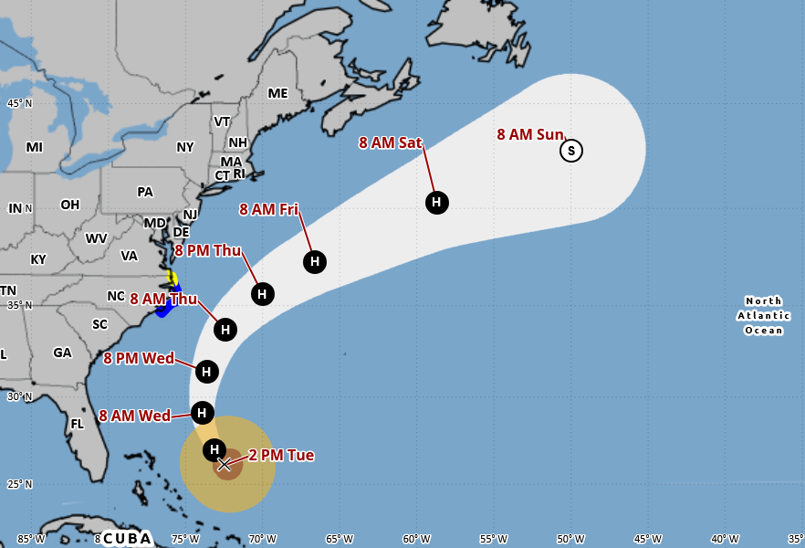
According to the National Hurricane Center, Erin’s structure remains disrupted by wind shear, although some restrengthening is forecast over the next 36 hours as upper-level winds become more favorable. The hurricane is moving northwest at approximately 15 km/h and is expected to turn northward around a subtropical high near Bermuda before accelerating northeast into the mid-latitude westerlies.
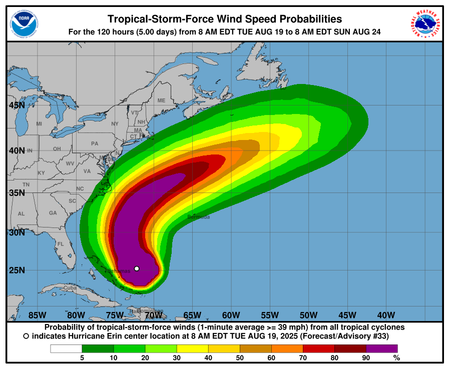
Forecasters warn that Erin’s tropical-storm-force winds are already expanding, with the outer bands expected to reach the North Carolina Outer Banks within the next two days. Tropical Storm and Storm Surge Warnings are now in effect for this area. Authorities anticipate heavy rainfall, strong winds, and large waves that could lead to beach erosion, road closures, and localised flooding.
“The hurricane’s size is above average, and the risk of tropical-storm-force winds may be higher than standard models indicate,” the NHC said.
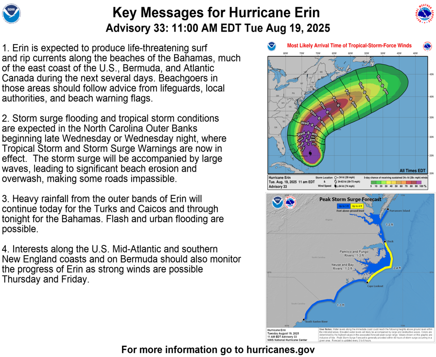
Erin is also producing dangerous surf and rip currents along the Bahamas and much of the U.S. eastern seaboard. Beachgoers in these regions are urged to follow local warnings and avoid entering the water. Flash and urban flooding are possible, particularly in the Turks and Caicos today and across the Bahamas tonight.
The Mid-Atlantic, southern New England, and Bermuda should also monitor the storm, with strong winds expected Thursday and Friday as Erin continues its northeastward track.
Residents and visitors along affected coastlines are advised to stay alert to updates from local authorities and the National Hurricane Center.
The hurricane will continue to weaken and continue its track to the northeast Atlantic this weekend. While Ireland’s weather will turn increasingly unsettled from late in the weekend through the beginning of next week, the remnants of Erin are not expected to produce significant winds in Ireland.


