 in Irish Weather History 1")


Remnants of ex-Hurricane Erin set to break August dry spell
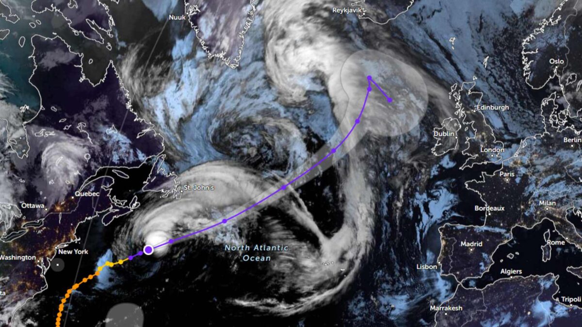
The remnants of ex-Category 5 Hurricane Erin are expected to pass between Iceland and Ireland this weekend, bringing an end to the recent dry spell and ushering in a more unsettled Atlantic regime.
Forecast models have for some time indicated that Erin’s remnants would interrupt what has been a drier-than-average August across much of Ireland. As projected since mid-month, the storm’s track will keep it to the northwest of Ireland, but its influence will extend across the country, bringing rainfall, fresher winds and a sea swell in the days ahead.
Erin underwent rapid intensification last weekend, strengthening into a Category 5 hurricane on the Saffir-Simpson scale, with sustained winds reaching 257km/h. The storm’s outer bands brought torrential downpours and coastal surges to the Leeward Islands before it curved northwards, sparing the Caribbean further damage.
The remnants of former hurricanes frequently influence Ireland’s weather in August. Recent examples include Hurricane Gert on August 21st, 2017, which triggered severe flooding and landslides in Donegal and the northwest. A year later, on August 18th, 2018, post-tropical cyclone Ernesto brought strong winds to the west and north. More recently, on August 11th, 2024, the remnants of ex-Hurricane Bertha delivered unseasonably windy and wet conditions across the country.
The most notable extratropical system to strike Ireland in August remains ex-Hurricane Charley, which tracked south of the country on August 25th, 1986, bringing strong winds and heavy rain, particularly to Leinster.
In the coming week, ex Hurricane Erin will bring about an end to the fine spell, with unsettled conditions persisting through the week.
Monday
Warm and humid to start, with sunshine in most areas before cloud and rain move into the west around midday. The rain, heavy at times, will spread eastwards through the afternoon and evening before turning more scattered overnight.
- Temperatures: 16–22 degrees
- Winds: Moderate south-southeast, freshening southerly
Tuesday
Heavy showers in the west and north, some spreading inland. Drier and brighter in the south and east.
- Temperatures: 16–20 degrees, coolest in the west
- Winds: Moderate to fresh south-westerly
Rest of the week
Cooler and more unsettled, with a succession of Atlantic systems bringing frequent rain and showers. Rainfall totals are expected to be well above average in the west, with nearer to normal amounts further east.


