One to Watch: Models Flag Risk of Deep Depression Over Ireland

The remnants of Tropical Storm Fernand, currently weakening over the mid-Atlantic, are being closely monitored as they could contribute to a spell of unsettled weather across Ireland on Saturday.
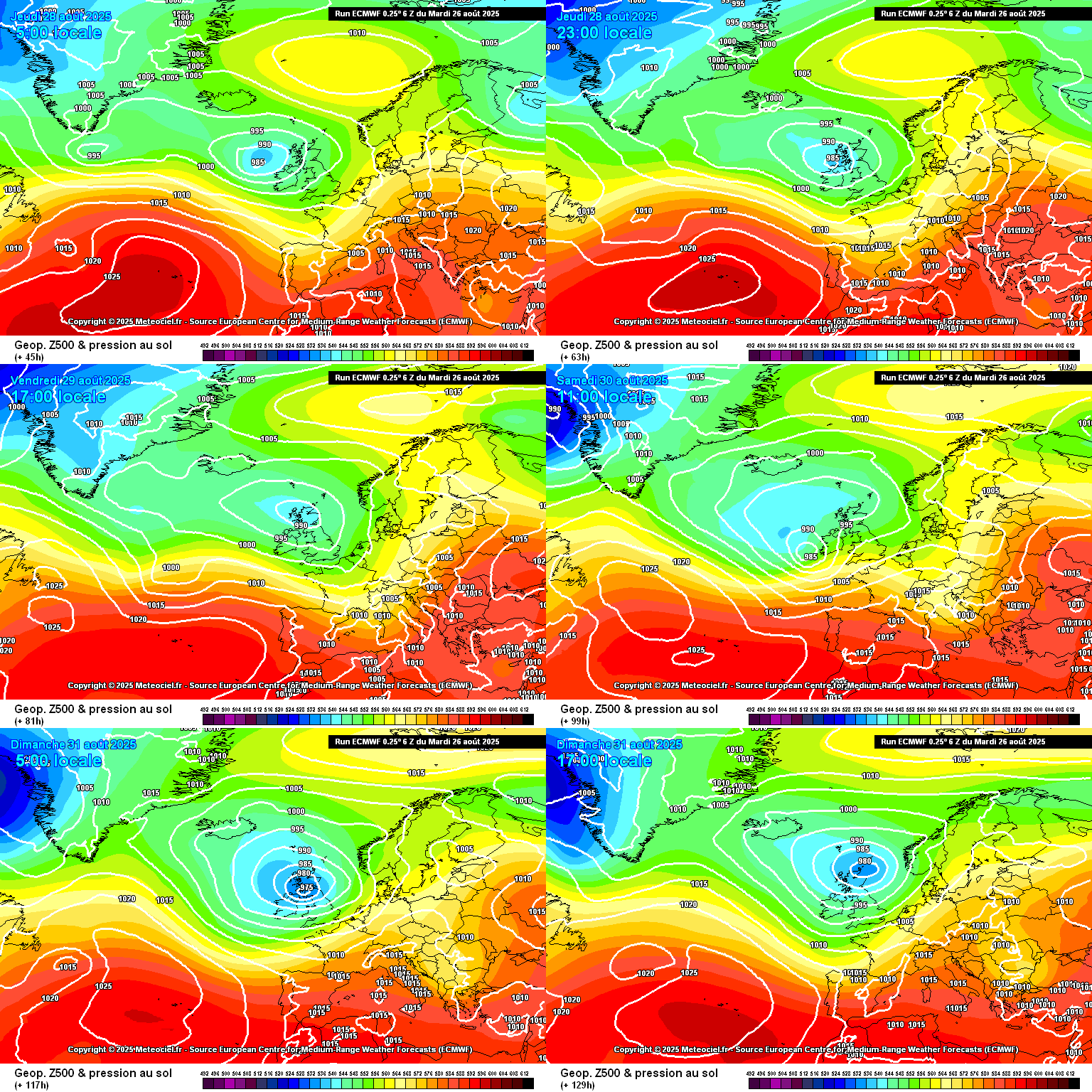
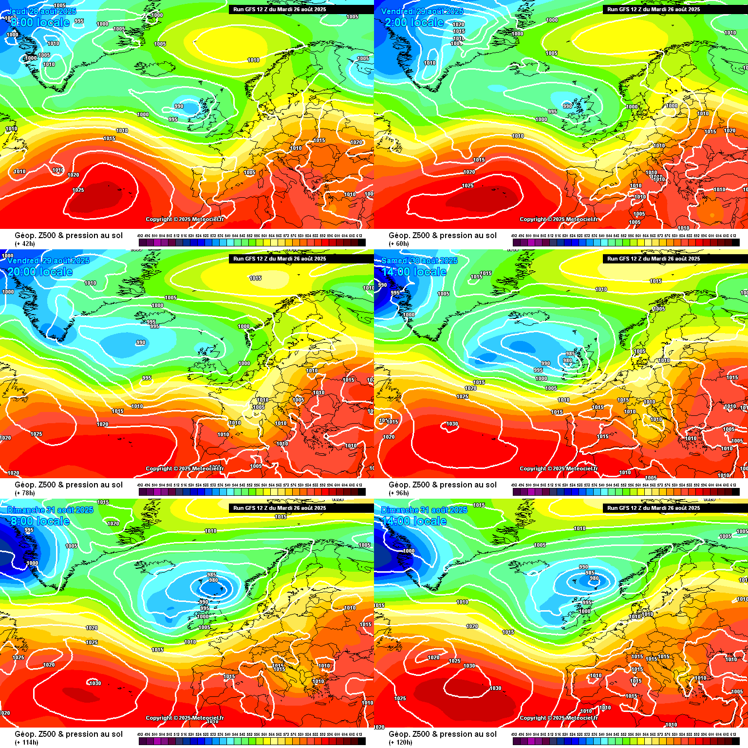
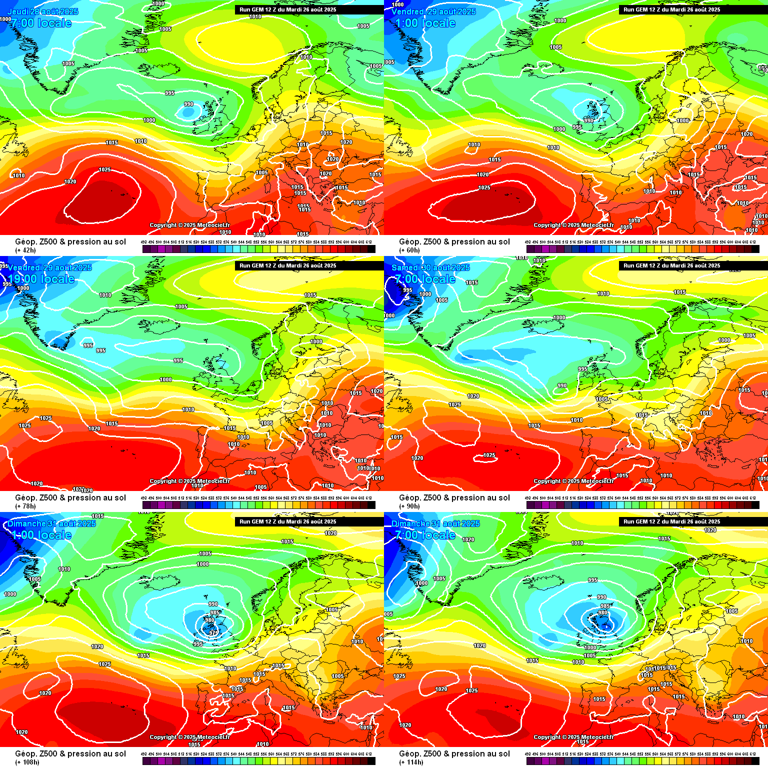
The system is expected to lose its tropical characteristics over the next 48 hours, breaking down into a trough. However, some weather models suggest its remnants could interact with a shortwave in the Atlantic, forming a depression that may deepen as it nears Ireland’s west coast.
Latest projections position the centre of the low over Connacht on Saturday afternoon, with the strongest winds forecast across Munster and Leinster before shifting towards the northern half of the country later in the day. While confidence in such forecasts diminishes beyond three days, the consistent alignment across model output marks this as one to watch.


Commenting on the winding down of Tropical Storm Fernand over the next two days, the US National Hurricane Center says the system has weakened to 35 knots with little convection near its centre, likely due to moving over a cooler patch of the Gulf Stream. However, it is forecast to encounter warmer waters and improved upper-level conditions later today, which could briefly allow convection to redevelop and winds to strengthen slightly through tomorrow morning.
The storm is expected to transition to a post-tropical system in about 36 hours and open into a trough within 48 hours, leading to dissipation. Fernand will continue moving northeastward at around 11 knots, with no significant change to the forecast track.
In the meantime, Ireland faces an extended period of unsettled weather running into the first half of September. Rainfall will be heaviest in the west, while temperatures remain on the cool side nationwide.
Wednesday will start wet across Leinster and Ulster as overnight rain clears east, before showers spread widely during the day, some merging into longer spells of rain in western areas overnight.
Thursday looks similarly unsettled, with heavy showers and longer spells of rain raising the risk of spot flooding, particularly in the west. On Friday, showers will be more scattered before another band of rain pushes in from the Atlantic overnight.
Saturday is expected to bring further rain, heavy at times, with the risk of localised flooding before conditions turn showery later. Mist and drizzle will linger along Atlantic coasts.
Sunday will continue the unsettled pattern, starting showery before a more persistent band of rain moves in from the west. Daytime temperatures will remain below seasonal norms, generally in the mid-teens.
Share this WeathÉire story:


