 in Irish Weather History 1")


US east coast on alert as Tropical Depression Nine strengthens
Authorities in the south-eastern United States are on alert this weekend as Tropical Depression Nine gains strength over the western Atlantic.
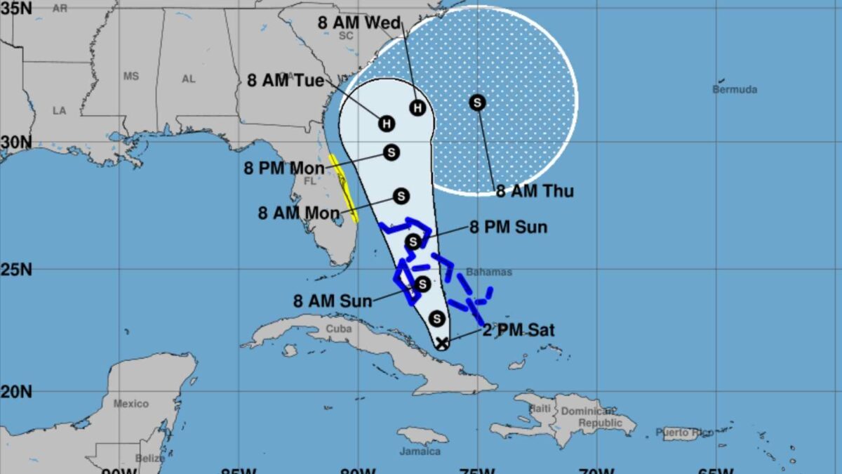
The system, which is expected to become a tropical storm overnight and a hurricane by early next week, is forecast to cross the Bahamas on Sunday before turning towards the US coastline.
At 6pm Irish time on Saturday the centre of the depression was located about 310 kilometres north-west of eastern Cuba and 190 kilometres south-south-west of the central Bahamas. Maximum sustained winds were near 55 kilometres per hour with higher gusts. It was moving north-west at about nine kilometres per hour and is expected to shift north-north-west through Monday. On its current track the system will move across the central and north-western Bahamas on Sunday and Sunday night and approach the south-east US coast early next week.
A tropical storm watch has been issued for Florida’s east coast from the Palm Beach and Martin County line to the Flagler and Volusia County line. The US National Hurricane Center has warned that additional watches and warnings could be posted later on Saturday or overnight as the forecast track becomes clearer. Residents along the coast from Florida to North Carolina have been advised to monitor updates closely and to prepare for possible tropical storm or hurricane conditions.
Heavy rain and coastal flooding are major concerns for the US mainland. Moisture from the system is expected to bring widespread downpours from coastal Georgia through the Carolinas and into the southern mid-Atlantic states early next week. The National Weather Service has warned that flash flooding, urban flooding and river flooding could occur in affected areas even if the storm remains offshore.
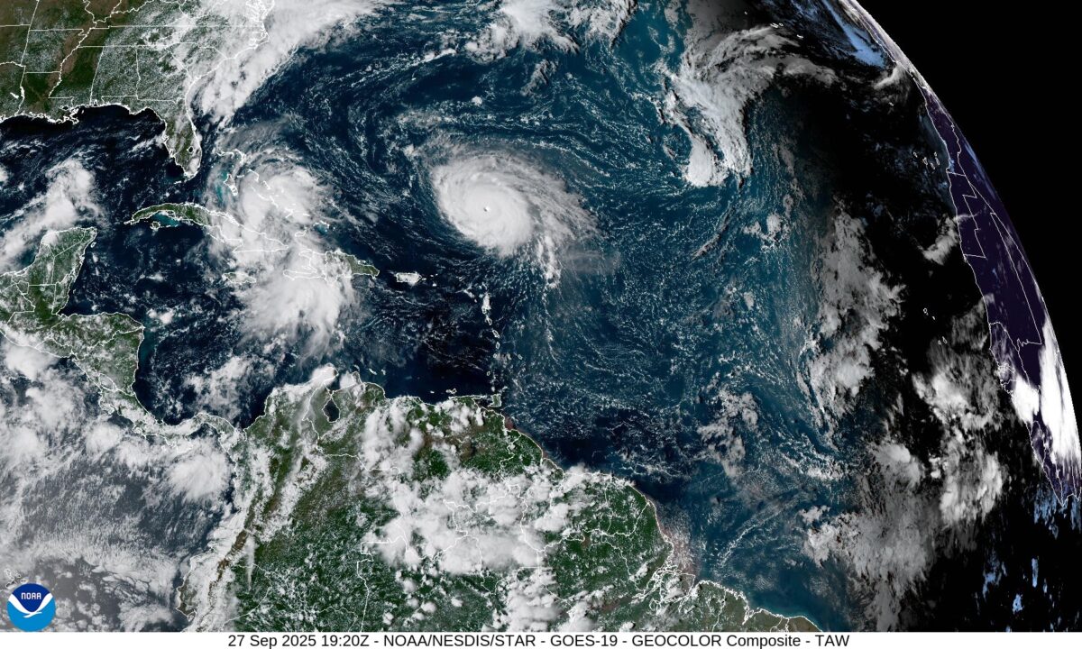
While eastern Cuba and the Bahamas are bracing for the most immediate impacts – with totals of up to 400 millimetres of rain possible in some locations and a storm surge of one to three feet above ground level in parts of the Bahamas – forecasters are increasingly focused on the threat to the US. Swells generated by the system and by Hurricane Humberto are already reaching the Bahamas and will spread to the south-east US coast in the coming days. These swells are likely to produce dangerous surf and rip current conditions along beaches from Florida northwards.
The National Hurricane Center said strengthening was expected during the next few days. “The system is forecast to become a tropical storm tonight and a hurricane by late Monday or Tuesday,” it said.
Emergency managers in Florida and neighbouring states have urged residents to ensure their emergency kits are in place and to follow the latest guidance as the track of the storm develops.
Share this WeathÉire story:

