 in Irish Weather History 1")


Humberto and Imelda Set to Shape Weather on Both Sides of the Atlantic
Two powerful Atlantic storms are driving dangerous conditions in the western Atlantic and are forecast to influence weather in Ireland and north-west Europe in the coming 10 days.
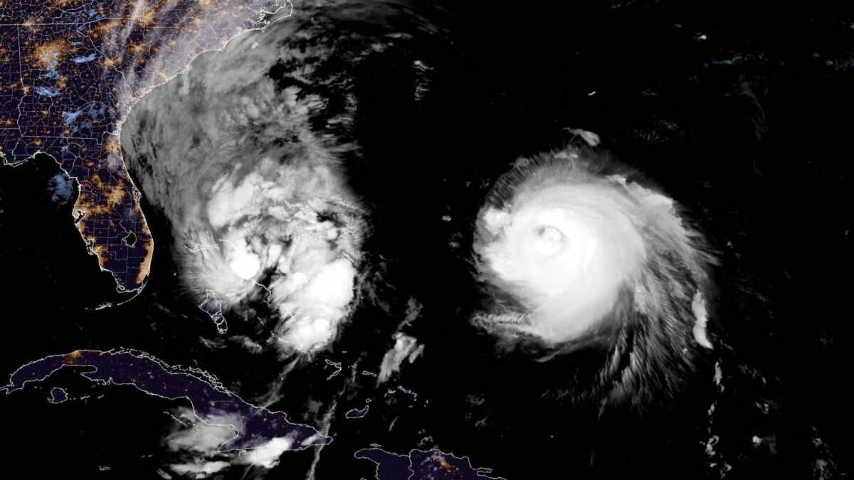
Hurricane Humberto, a major Category 4 system, is bearing down on Bermuda while Tropical Storm Imelda is strengthening over the Bahamas. Both storms are expected to transition into extratropical systems that will inject energy and moisture into the North Atlantic, steering a spell of unsettled weather towards Ireland and Britain.
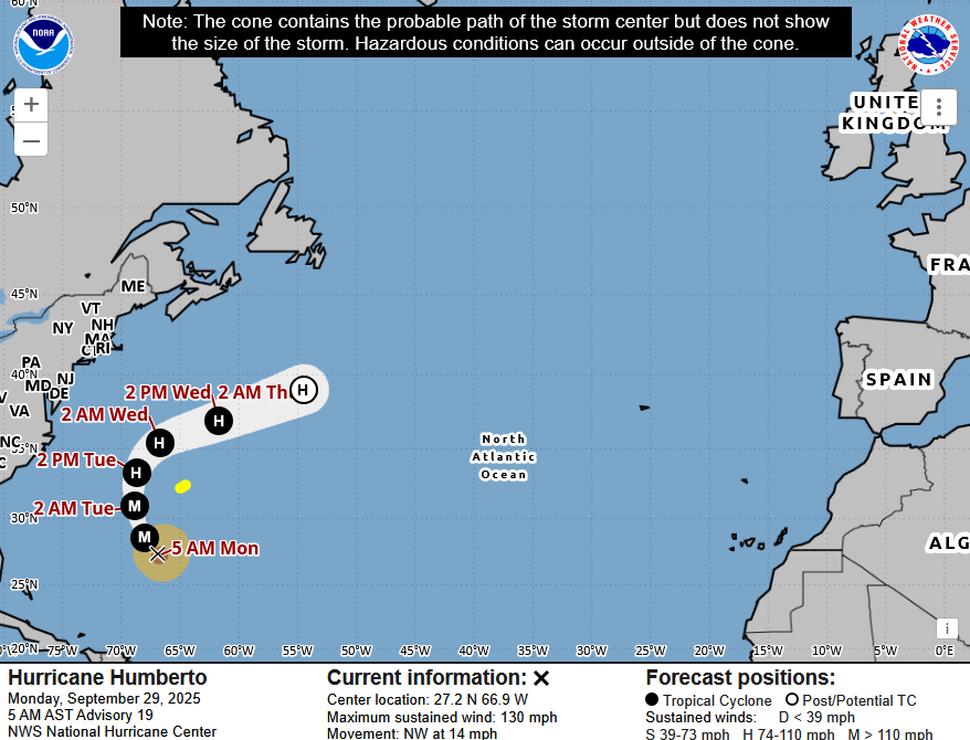
Humberto was located early on Monday about 600km south-southwest of Bermuda with maximum sustained winds of 215km/h. The storm forecast to turn north then accelerate east-northeastwards by Tuesday or early Wednesday, passing west and then north of Bermuda. Tropical storm conditions are possible on the island from Tuesday, with up to 50mm of rain expected. Humberto’s hurricane-force winds extend 95km from its centre and tropical storm-force winds reach nearly 300km.
The hurricane is already generating dangerous swells across the northern Leeward Islands, Puerto Rico and Bermuda, with life-threatening surf and rip currents expected along much of the US east coast this week. Humberto is expected to remain a major hurricane into Tuesday before gradually weakening. Its remnants are likely to bring periods of heavy rain and strong winds to Ireland later this week as it becomes absorbed into the Atlantic westerly flow.
Imelda, meanwhile, was centred about 100km south of Great Abaco Island and 475km southeast of Cape Canaveral, Florida, on Monday morning with maximum sustained winds of 75km/h. Moving north at 13km/h, it is forecast to strengthen into a hurricane on Tuesday as it crosses the northwestern Bahamas before turning sharply east-northeast away from the southeastern US.
The system is producing heavy rain of 50 to 200mm across the Bahamas and eastern Cuba with flash flooding and mudslides possible. Up to 100mm of rain is also forecast for parts of the US southeast coast through Tuesday. Swells from both Imelda and Humberto are expected to continue affecting the Bahamas and much of the US east coast, creating dangerous surf and rip currents.
The remnants of Imelda could further energise the Atlantic pattern and bring additional unsettled weather to north-west Europe around October 9th and 10th.


