 in Irish Weather History 1")


Hurricane Imelda Bears Down on Bermuda
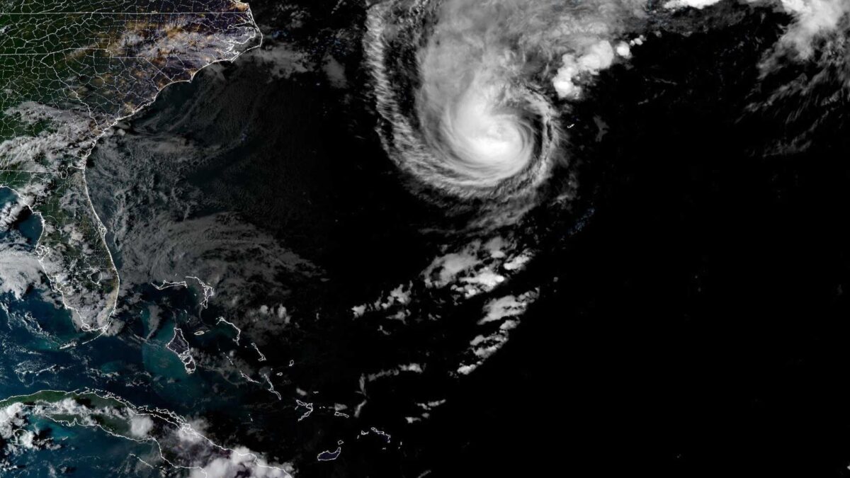
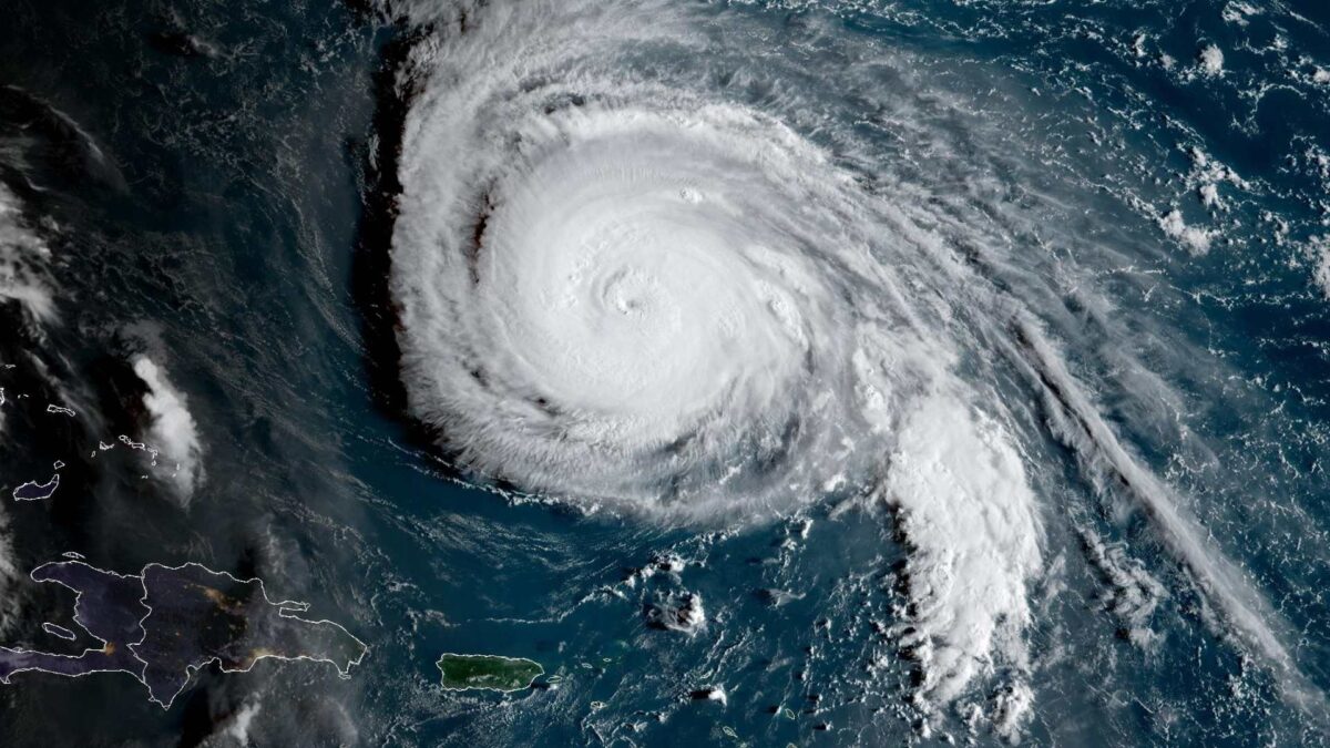
Bermuda was bracing for the full force of Hurricane Imelda on Wednesday night as the powerful storm neared the island, bringing hurricane-force winds, torrential rain and the threat of coastal flooding.
The US National Hurricane Center (NHC) said the storm’s centre was about 300km west-southwest of Bermuda at 5pm local time, moving quickly east-northeast at 35km/h. Imelda was sustaining winds of 160km/h (100mph), with stronger gusts.
A hurricane warning remains in effect for the British overseas territory, with forecasters urging residents to stay indoors and complete preparations as conditions deteriorate. By Wednesday evening, sustained winds above 70km/h were already being recorded, with exposed sites registering gusts over 100km/h.
Forecasters warned of 50 to 100 millimetres of rain overnight and into Thursday, which could trigger flash flooding. Dangerous storm surge and large waves were expected to cause coastal inundation in areas facing onshore winds.
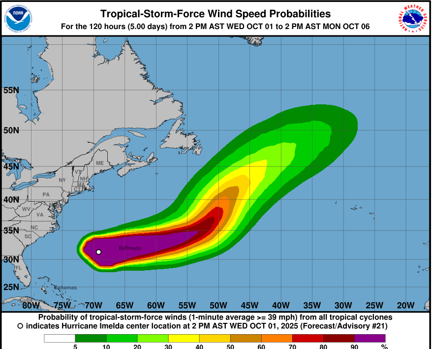
Although Imelda could strengthen further before passing Bermuda, it is forecast to lose tropical characteristics on Thursday as it accelerates into the north Atlantic. The system is not expected to impact directly on Ireland’s weather.
The NHC also warned that swells from the storm will continue to batter Bermuda and spread along the US east coast, the Bahamas and parts of the Caribbean later this week, bringing hazardous surf and rip currents.
Local authorities said emergency services were on high alert, with officials urging residents to monitor updates and avoid unnecessary travel until the storm passes.

Live Webcam
The 2025 Atlantic hurricane season to date
The 2025 Atlantic hurricane season, which began on June 1 and runs through November 30, has been marked by a series of notable developments, including a prolonged period of inactivity, the formation of multiple major hurricanes, and significant impacts on coastal regions.
Early Season Activity
The season commenced slowly, with the first named storm, Tropical Storm Andrea, forming on June 24—three weeks later than the average start date. This was followed by Tropical Storms Barry, Chantal, and Dexter, all of which were short-lived and weak, contributing to a quiet early season. These early storms had minimal impact and did not intensify significantly.
Mid-Season Quiet Period
From mid-June to mid-September, the Atlantic basin experienced an unusually long period of inactivity. This hiatus was the longest since 1992, with no named storms forming between June 24 and August 15. This can be attributed to factors such as wind shear, dry air, and stable atmospheric conditions that suppressed tropical development during the climatological peak of the season.
Resurgence and Major Hurricanes
Activity resumed in mid-August with the formation of Hurricane Erin, a large, long-lived, and powerful hurricane.Hurricane Gabrielle, which reached Category 4 strength before veering away from Bermuda and heading toward the Azores, formed in September. Shortly thereafter, Hurricane Humberto intensified into a Category 5 storm, becoming the second major hurricane of the season.
Humberto’s remnants are currently merging with the jet stream, transitioning into an extratropical cyclone named Storm Amy that will impact Ireland this Friday.
Season Statistics
As of October 1, the season has produced nine named storms, four hurricanes, and three major hurricanes (Category 3 or higher). The Accumulated Cyclone Energy (ACE) index, which measures the intensity and duration of storms, stands at 90.2 units, slightly below the 1991–2020 average. Notably, there have been no U.S. landfalls through September, a rare occurrence in recent years.
Outlook
With two months remaining in the official season, the potential for further storm development remains. Conditions in the Atlantic Ocean continue to be conducive to tropical cyclone formation, and forecasters are monitoring the basin closely for any emerging systems.
Share this WeathÉire story:

