in Irish Weather History 1")


Hurricane watch issued as Melissa strengthens in Caribbean
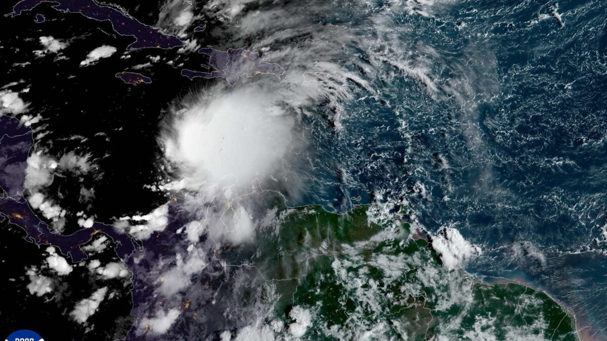
Tropical Storm Melissa has formed in the Caribbean and is expected to bring heavy rain and flooding to parts of Haiti, the Dominican Republic and Jamaica later this week.
At 5am EDT (10am GMT) on Wednesday the storm was located about 495km south-southwest of Port-au-Prince, Haiti, moving west-northwest at 11 km/h.
Maximum sustained winds were near 85 km/h with higher gusts. Gradual strengthening is expected with Melissa potentially reaching hurricane strength on Thursday.
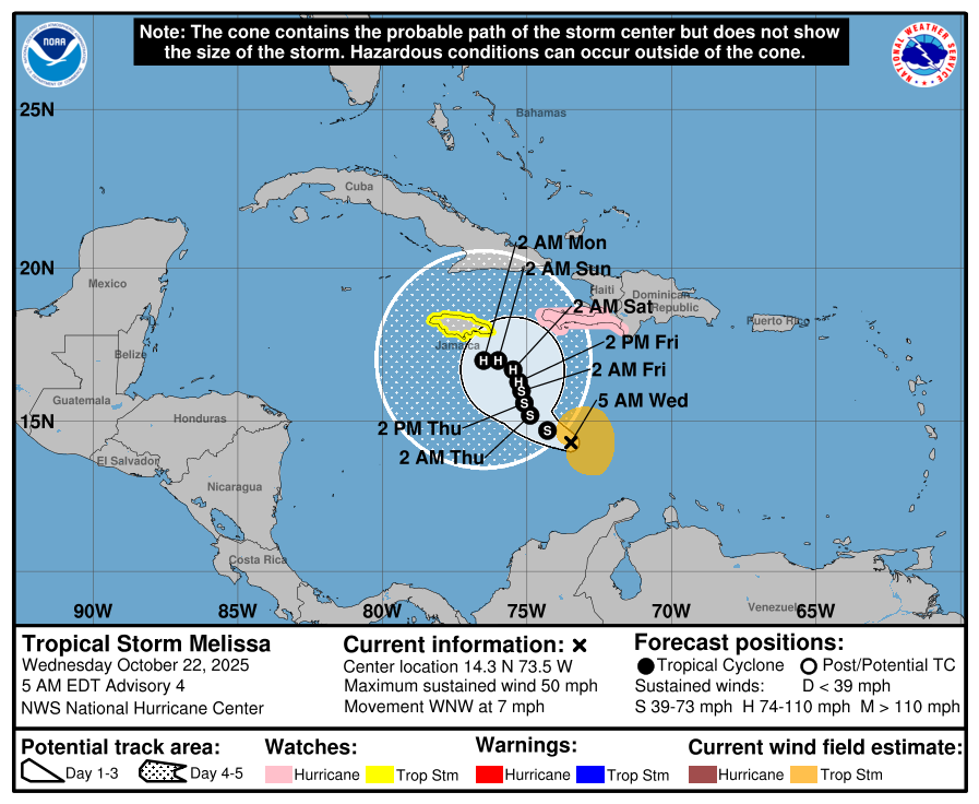
A Hurricane Watch is in effect for the southwestern peninsula of Haiti from the Dominican border to Port-au-Prince. A Tropical Storm Watch has been issued for Jamaica. Tropical storm conditions are possible within 48 hours and hurricane conditions may occur in Haiti by late Thursday.
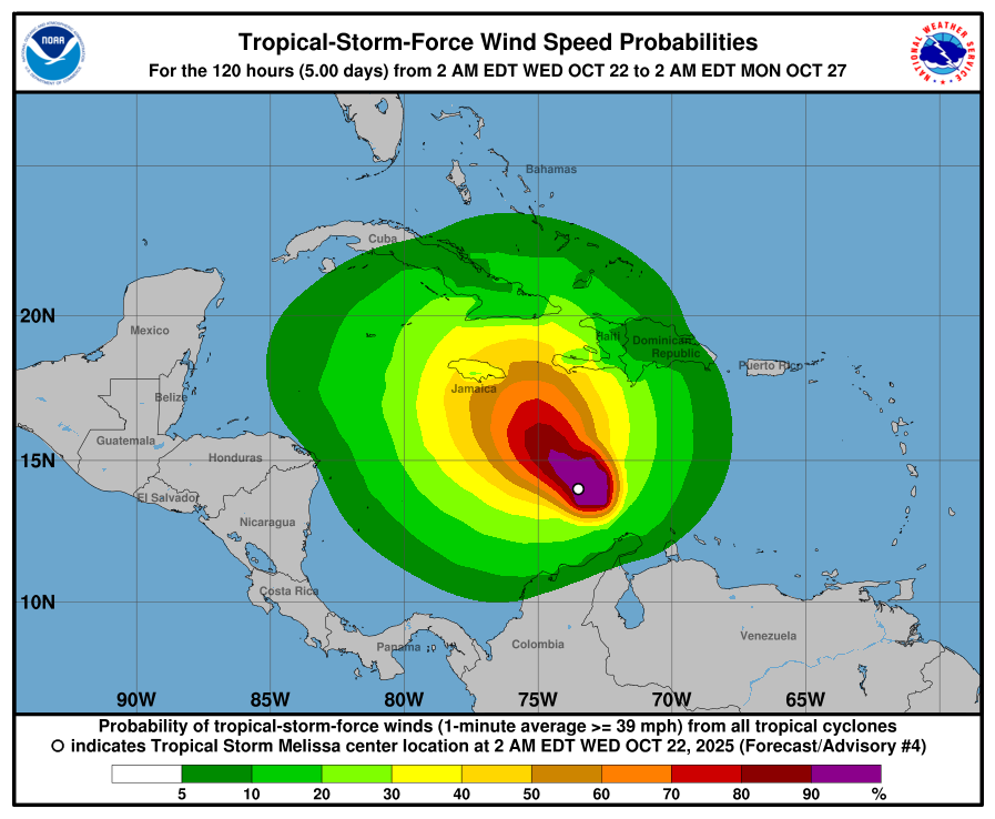
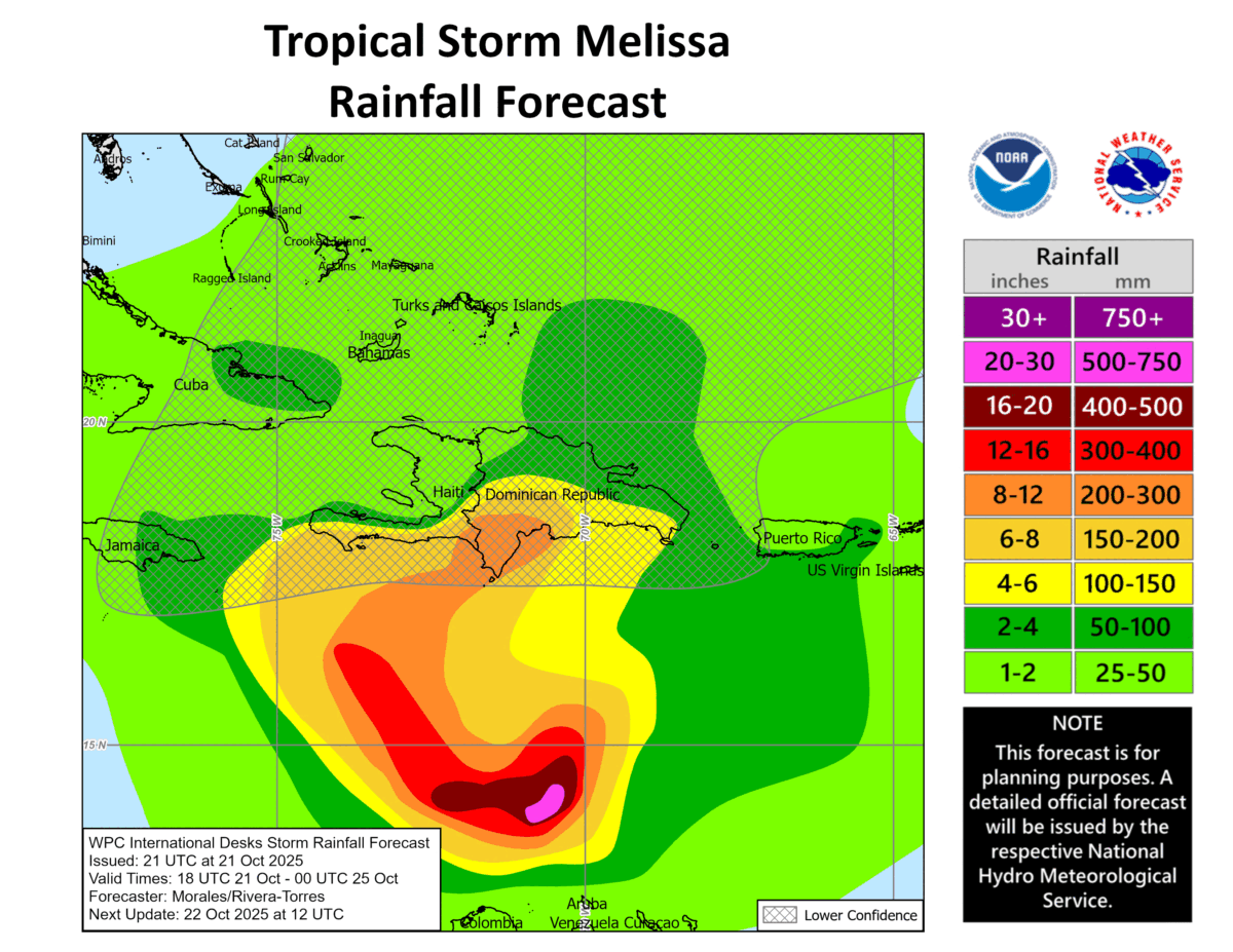
Melissa is expected to bring 125 to 250mm of rain to southern Haiti, the southern Dominican Republic and eastern Jamaica through Saturday with locally higher totals possible. Northern Haiti, the northern Dominican Republic and western Jamaica may see 50 to 100mm of rain. The storm could trigger flash flooding and landslides.
Authorities in affected areas have been urged to monitor forecasts and warnings and prepare for hazardous conditions.
The storm is being monitored by an Air Force Hurricane Hunter aircraft, which is providing updated data on wind speeds and pressure. The 2025 Atlantic hurricane season has already seen multiple storms affecting the Caribbean and the western Atlantic, with activity expected to continue into November.
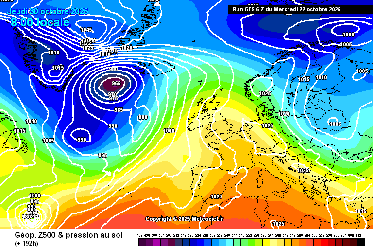
Meanwhile, long range computer models suggest that the remnants of Melissa could track quickly across the Atlantic toward Ireland at the end of the month into early November. The GFS model shows the northeasterly track of Melissa. WeathÉire will continue to monitor.