in Irish Weather History 1")


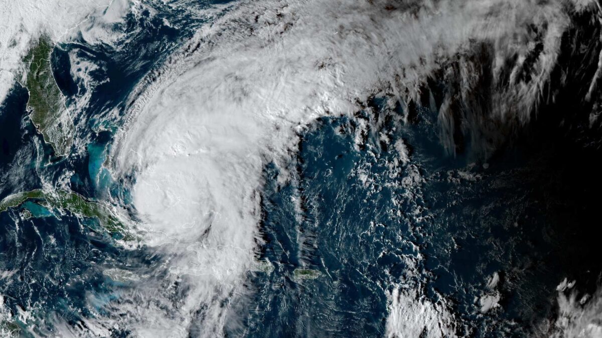
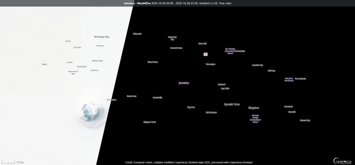
Satellite Reveals Calm Eye of Hurricane Melissa Over Jamaica
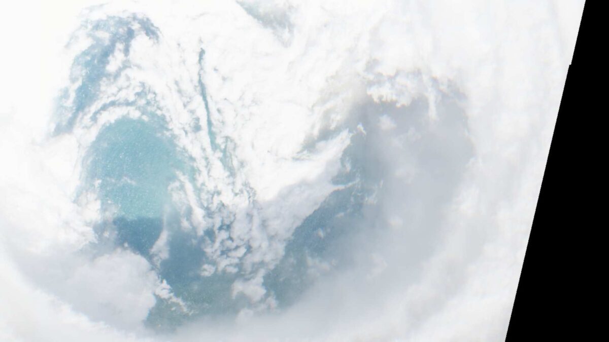
The Copernicus Sentinel-2A satellite captured a striking image of Hurricane Melissa’s eye just moments before it made landfall in western Jamaica on Tuesday.
The calm centre of the storm is in sharp contrast to its outer walls, which carried winds exceeding 185 miles per hour (297 km/h).
Earlier in the day, the U.S. Air Force Reserve’s 53rd Weather Reconnaissance Squadron, known as the Hurricane Hunters, encountered unusually severe turbulence while flying into the storm and were forced to turn back.
Jamaica is now facing the aftermath of the strongest storm ever recorded to strike the island. The Category 5 hurricane left widespread destruction across much of the country.
Hundreds of thousands of residents remain without electricity as roads are blocked by fallen trees, landslides and floodwaters. The southern parish of St Elizabeth has been particularly hard hit, with large areas submerged.
Authorities have warned that storm surges of up to four metres (13 feet) along the southern coast, combined with heavy rainfall in inland areas, could trigger further flooding and landslides. Emergency services are working to reach isolated communities and evacuate residents where possible.
Damage to infrastructure is extensive. Hospitals, schools and roads have been severely affected while power and telecommunications networks are disrupted across much of the island. Early estimates suggest the economic cost could reach nearly three-quarters of Jamaica’s annual output, with agriculture and tourism among the hardest hit sectors.
Rainfall has now diminished across Jamaica, though additional scattered showers are possible. This could add another 2 to 4 inches, bringing total storm rainfall to 12 to 24 inches, with isolated areas in mountainous regions potentially receiving up to 30 inches. Catastrophic flash flooding and numerous landslides are expected to continue.
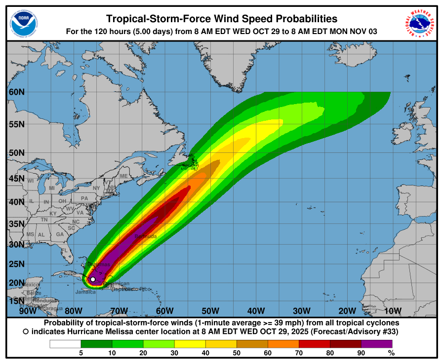
Meanwhile, Hurricane Melissa continues to move northeast. As of 7 pm Irish time on Wednesday, the storm was located 110 miles (175 km) south-southeast of the central Bahamas and 955 miles (1535 km) southwest of Bermuda. Maximum sustained winds were near 100 miles per hour (155 km/h) with higher gusts. The storm is moving northeast at 15 miles per hour (24 km/h). Hurricane-force winds extend outward up to 40 miles (65 km) from the centre, with tropical-storm-force winds reaching 185 miles (295 km).
Hurricane warnings are in effect for parts of Cuba, the Bahamas and Bermuda, while tropical storm warnings cover Haiti, parts of Cuba and the Turks and Caicos Islands. Residents in these areas are advised to remain sheltered and follow instructions from local authorities.
Melissa is expected to pass across the southeastern and central Bahamas today and may approach Bermuda by Thursday night. Storm surges, heavy rainfall and dangerous surf conditions are forecast to continue across the region, with life-threatening hazards in multiple countries.