in Irish Weather History 1")


Europe’s new satellite begins hourly air pollution monitoring
The European Union’s Copernicus Sentinel-4 mission has delivered its first preliminary images from space, offering an early look at its ability to track air pollutants across Europe every hour.
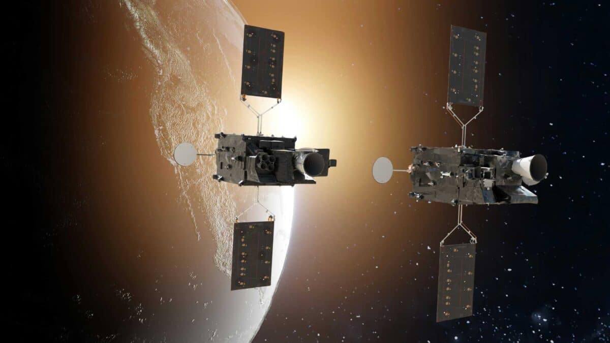
The satellite operates on board EUMETSAT’s Meteosat Third Generation Sounder 1 (MTG-S1) and will provide authorities with more timely data to issue health warnings, improve air quality forecasts and reduce economic and environmental impacts.
Air pollution remains Europe’s greatest environmental health threat, contributing to hundreds of thousands of premature deaths in 2022 alone.
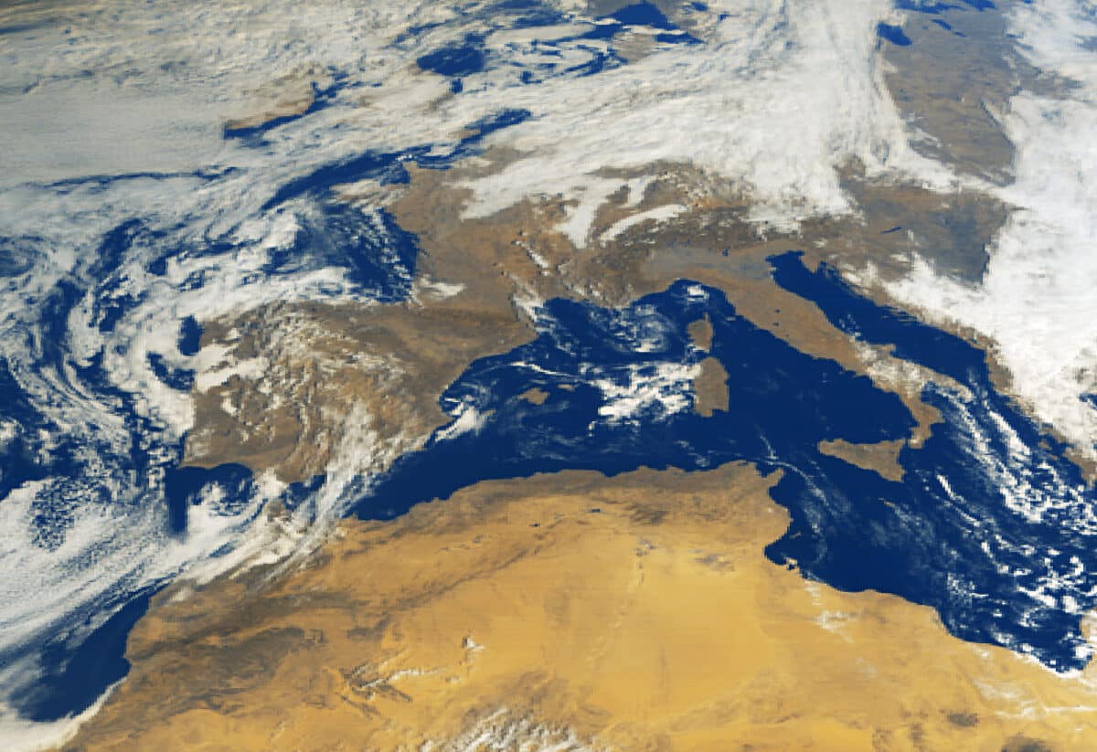
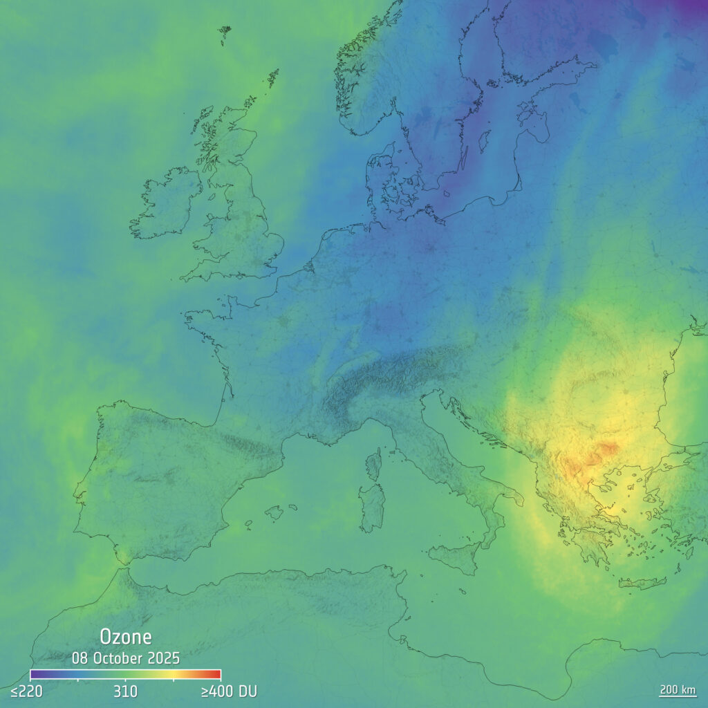
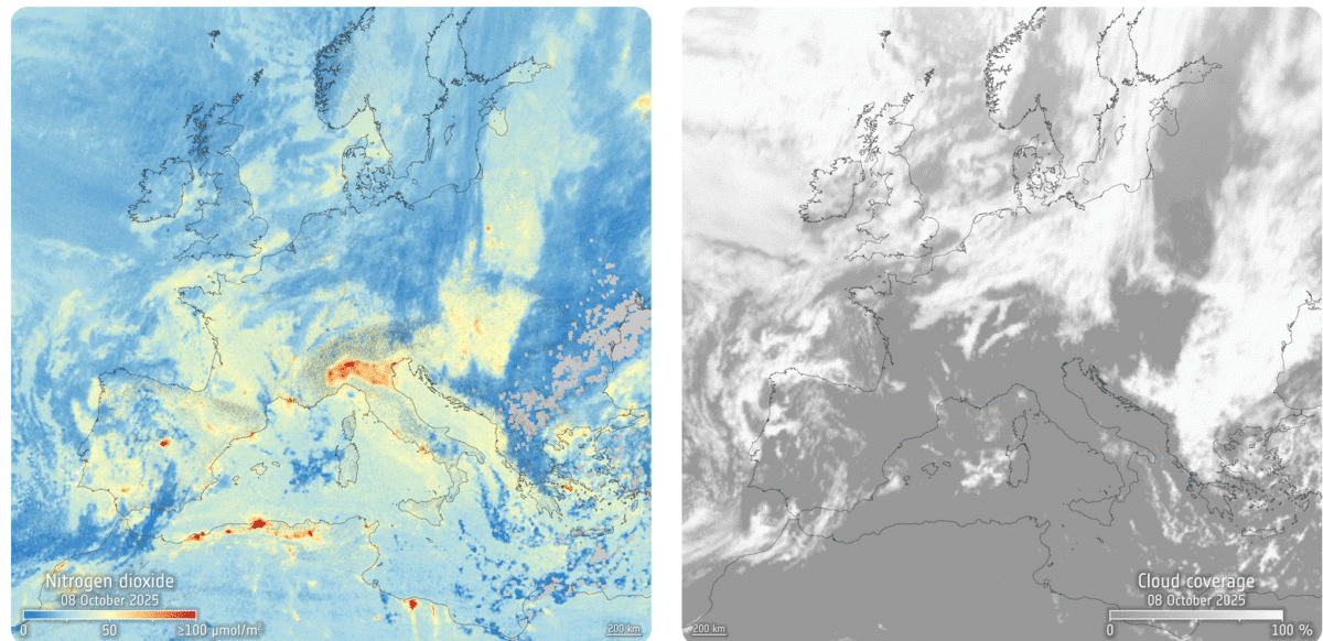
The first images, captured on 8 October 2025, reveal nitrogen dioxide hotspots over Italy’s Po Valley, elevated ozone levels across the Balkans, Bulgaria and Greece, and sulphur dioxide plumes from both natural and human sources.
Copernicus Sentinel-4 is currently undergoing its commissioning phase, during which systems are tested and fine-tuned to meet accuracy and reliability standards. Once fully operational, it will provide hourly observations of pollutants from geostationary orbit, allowing experts to track changes during the day, such as rush-hour traffic peaks, and to observe how pollutants form in urban centres and surrounding areas.
Phil Evans, Director-General of EUMETSAT, said: “Exposure to pollutants such as nitrogen dioxide, ground-level ozone and fine particulate matter affects millions of Europeans every day and costs society hundreds of billions of euros annually. Sentinel-4 represents a fundamental advance in our ability to monitor these pollutants. These first images show the mission’s potential to save lives and improve health outcomes.”
Lieven Bydekerke, EUMETSAT Copernicus Programme Manager, added: “These initial data provide an early glimpse of Sentinel-4’s ability to capture rapid changes in air pollution across Europe. Hourly observations of these hazardous pollutants over an entire continent have never been possible before.”
Developed under the Copernicus programme, the mission is implemented through a partnership between the European Commission, the European Space Agency (ESA) and EUMETSAT. The data will be made available through the Copernicus Atmosphere Monitoring Service (CAMS), operated by the European Centre for Medium-Range Weather Forecasts (ECMWF), improving air quality forecasts and public health protection across Europe.