 in Irish Weather History 1")


Satellite Shows West Coast Bays Clouded by River Silt
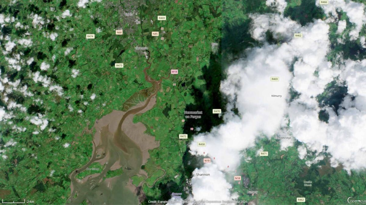
Imagery from the European Space Agency’s Copernicus Sentinel-2A satellite has captured large amounts of silt and soil being washed into bays along Ireland’s west coast following last week’s return to unsettled weather.
The images, taken yesterday, show plumes of brown water spreading out from several river mouths. Zoomed-in views highlight the River Fergus flowing into the Shannon Estuary at Clarecastle in Co Clare, the Garavogue River entering Sligo Bay, and the River Maine discharging into Castlemaine Harbour in Co Kerry.
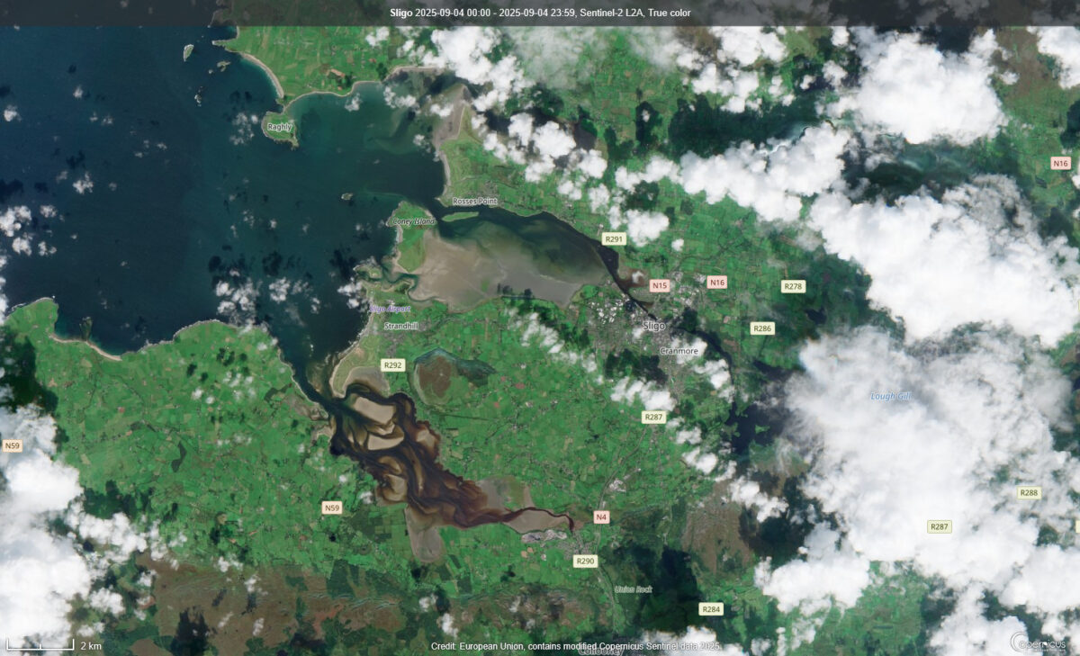
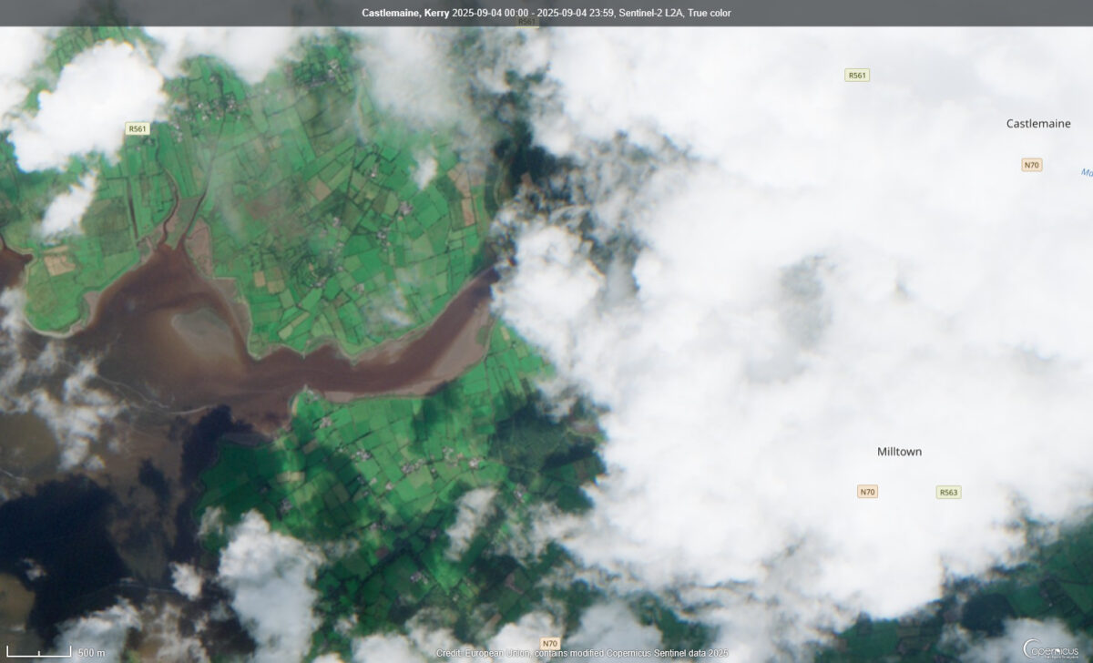
Scientists explain that these plumes occur when intense or prolonged rainfall increases runoff from the land. Water flowing off fields, hillsides and riverbanks carries loose soil and organic material into rivers, which in turn deliver the sediment into the sea. The effect is most visible where freshwater meets the clearer waters of bays and estuaries.
Ireland’s west coast is particularly prone to these events due to high levels of rainfall and catchments made up of loose soils and peat, which are easily eroded. After long wet spells, large quantities of sediment can be released in a short period of time. Over the longer term, sediment deposits can alter the shape of river mouths and harbours.
The Sentinel-2A satellite is equipped with high-resolution sensors that can track changes in land and water quality. Its data are widely used by environmental agencies and scientists studying the impact of weather events on Ireland’s natural systems.
Share this WeathÉire story:

