 in Irish Weather History 1")


There She Blows: The Science Behind Storm Amy
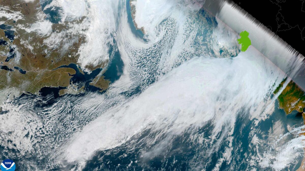
Storm Amy will bring heavy rain and strong winds to Ireland during Friday, marking the arrival of the first named storm of the 2025-2026 season.
Ireland is on the receiving end of an atmospheric river stretching 5,000 kilometres to Bermuda, which was impacted by Hurricane Imelda Wednesday night.
This narrow, powerful band of concentrated water vapour is funnelling large amounts of tropical and subtropical moisture toward northwestern Europe.
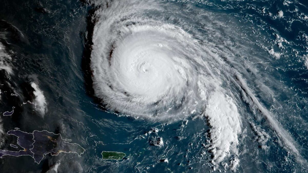
Embedded within the energised jet stream are the remnants of ex-Hurricane Humberto, which is expected to undergo rapid cyclogenesis early Friday morning before tracking to the northwest of Ireland through the afternoon and evening.
Hurricane Humberto caused widespread disruption across the Caribbean in mid to late September, before rapidly weakening from a powerful Category 5 to a Category 1 storm.
The storm has now merged with the North Atlantic jet stream, becoming extratropical as Storm Amy.
As the remnants of Hurricane Humberto move northeastward across the Atlantic this evening and tonight, they will undergo a process of rapid cyclogenesis, transforming from a weakening tropical system into an extratropical storm, named Storm Amy by the UK Met Office.
This intensification is driven by the interaction of Humberto’s remaining warm, moist air with the much cooler North Atlantic waters and strong upper-level jet stream winds. The rising air released latent heat, deepening the low-pressure system and accelerating surrounding winds, resulting in a rapidly strengthening storm.
Storm Amy is expected to bring heavy rain, strong gusts, and unsettled conditions to Ireland, illustrating how the remnants of a hurricane can fuel intense weather thousands of kilometres away. View all weather warnings related to Storm Amy here.
Humberto not the first or last ex-Hurricane to impact Ireland
Humberto is just the latest in a series of “ex-hurricanes” to affect Ireland’s weather. Ex-hurricanes and post-tropical cyclones frequently pass close to or over the country, particularly in late summer and autumn when the hurricane season overlaps with the Atlantic storm season. However, once they transition into extratropical cyclones, they are not always classified as ex-hurricanes in official records.
Ireland is typically impacted by one or two such systems per decade in a significant way, though many more remnants pass by with little effect. Most occur between late August and October.
Here’s a historical outline of notable ex-hurricanes and tropical remnants that have affected Ireland (not a complete list, but the major, well-documented ones):
20th Century
- September 1938 – The Great New England Hurricane remnants: After devastating the US East Coast, its remnants brought unsettled weather to Ireland.
- September 1961 – Hurricane Debbie: The strongest ex-hurricane on record to strike Ireland. Transitioned to an extratropical cyclone but retained hurricane-force winds. Claimed 11 lives in Ireland and 60 in total along its path.
- August 1986 – Hurricane Charley: Produced extreme rainfall. On August 25th, Dublin recorded its heaviest daily rainfall on record with 200 mm at Kippure.
21st Century
- September 2006 – Hurricane Gordon: Downgraded but still brought winds over 70 knots to the south coast.
- August 2009 – Hurricane Bill: Passed west of Ireland, generating high seas and strong winds.
- September 2011 – Hurricane Katia remnants: Brought widespread power cuts and gusts of up to 130 km/h in Donegal.
- August 2017 – Hurricane Gert remnants: Triggered flooding and landslides in Donegal.
- October 2017 – Hurricane Ophelia: Among the most severe storms to ever hit Ireland. On October 16th, three people were killed, with widespread damage and record-breaking winds reported.
- August 2018 – Hurricane Ernesto remnants: Delivered heavy rain and gusty winds.
- October 2020 – Hurricane Lorenzo: Arrived as an ex-hurricane, producing strong winds and high seas, though weaker than initially feared.
- September 2021 – Hurricane Larry remnants: Passed to the north but added to unsettled conditions.
- August 2025 – Hurricane Erin remnants: Anchored to the northwest of Ireland, bringing cooler and unsettled conditions following a lengthy dry spell.


