in Irish Weather History 1")


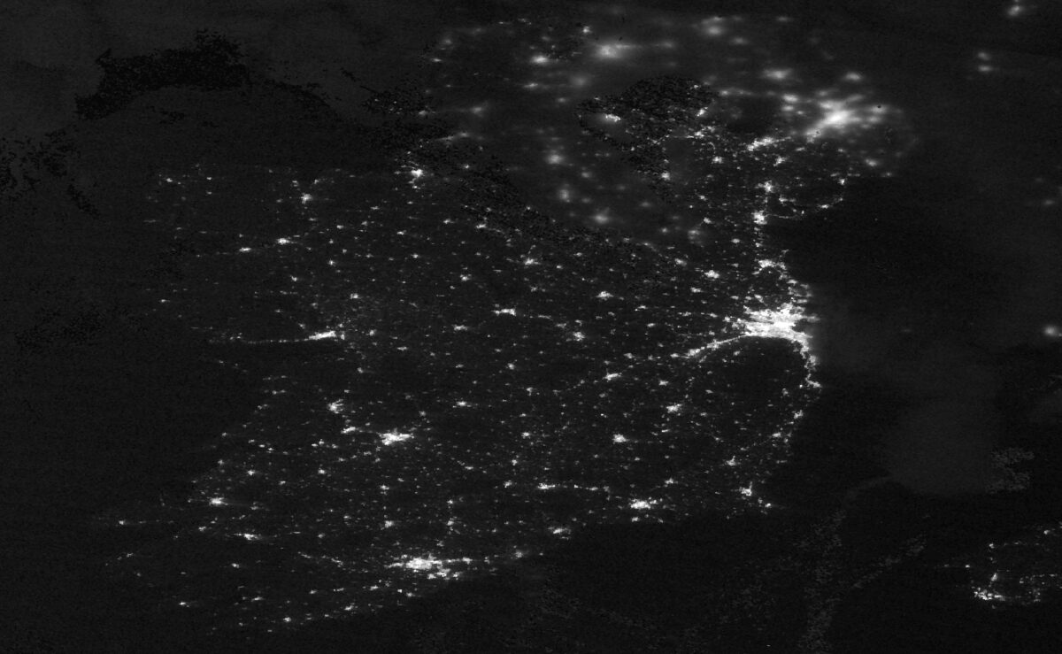
Ireland Glows: NASA Satellite Captures Midnight Lights from Space
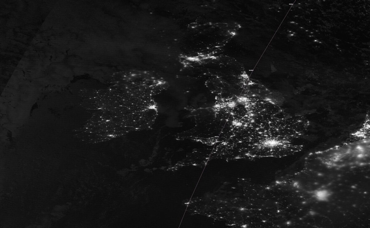
The lights of towns and villages across Ireland and Britain were captured by a NASA satellite image of Ireland shortly after midnight on Wednesday morning. The image was provided by the NOAA-20 satellite.
The NOAA-20 satellite, part of the Joint Polar Satellite System (JPSS), is equipped with the Visible Infrared Imaging Radiometer Suite (VIIRS). This instrument captures high-resolution nighttime imagery using its Day/Night Band (DNB), which allows it to detect low-light emissions such as city lights, gas flares, and auroras.
The DNB operates in the visible to near-infrared spectrum, providing detailed images even under moonless conditions. NOAA-20 orbits the Earth in a polar orbit, passing over the same regions twice daily, which enables it to monitor changes in nighttime lighting patterns over time.
The satellite’s ability to capture such detailed nighttime imagery is invaluable for various applications, including monitoring urban development, assessing energy consumption, and responding to natural disasters.