 in Irish Weather History 1")


Cloud Streets over The Celtic Sea as low pressure moves south
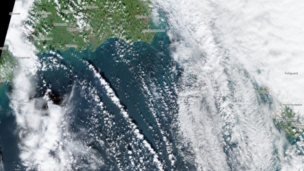
Striking cloud formations known as cloud streets were captured from space by the Copernicus Sentinel-2 satellite as it passed over Ireland and Britain on Thursday.
The long, parallel rows of cumulus clouds were clearly visible off the coasts of Waterford and Wexford, stretching across the Celtic Sea to Cornwall in southwest England.
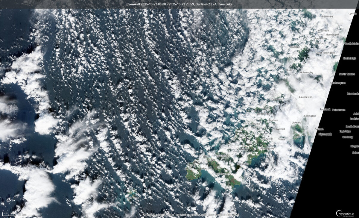
Cloud streets form when cooler air moves over a warmer surface, in this case the relatively mild waters of the Celtic Sea.
The contrast triggers rising columns of warm air known as thermals, with clouds forming along their tops to create the distinctive striped pattern.
Meanwhile, a NASA Modis satellite image taken at 11.30am on Thursday showed a low-pressure system to the north of Ireland, currently tracking southeast.
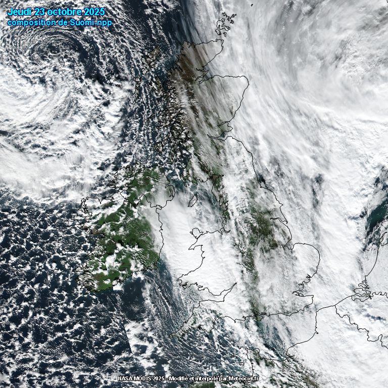
The system is expected to bring outbreaks of rain and strong winds, particularly along Atlantic coastal areas overnight and through Friday afternoon. It will remain largely dry in eastern counties.
Drier conditions are forecast to develop from Friday evening through Sunday afternoon, before another band of rain moves in from the northwest later on Sunday.


