in Irish Weather History 1")


Storm Floris Produces Ireland’s Strongest Wind Gusts Since February
Ireland has been battered by the strongest winds in over five months as Storm Floris swept across the country early Monday, bringing damaging gusts, widespread power outages, and coastal impacts.
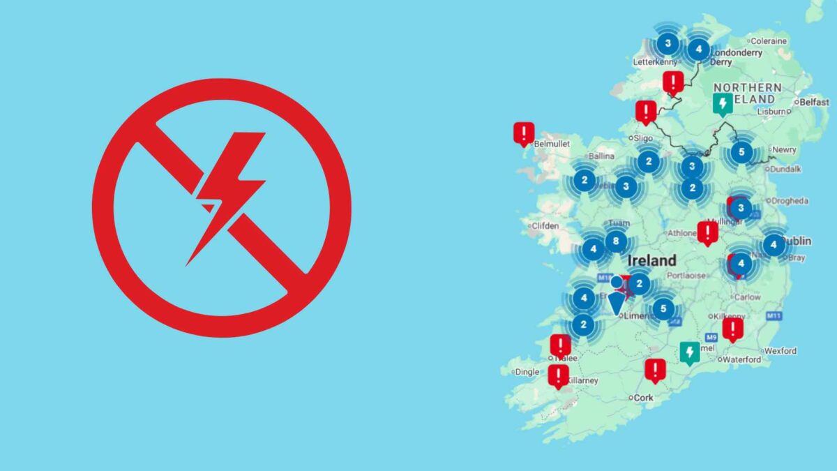
According to ESB Networks, more than 10,000 homes and businesses in the west and northwest lost electricity as the system moved through, with restoration efforts ongoing.
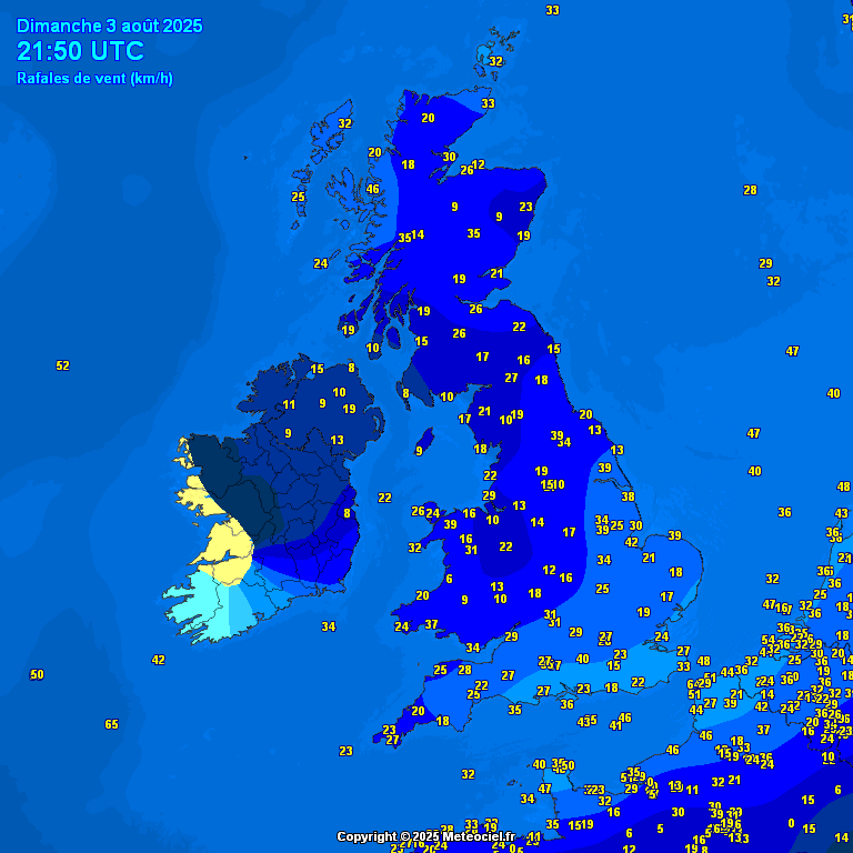
Malin Head in County Donegal reported a peak gust of 104.5 km/h at 8.00am, the highest recorded in the country since Valentia Observatory logged a gust of 109 km/h on February 20th. That event followed Storm Éowyn, which produced a record-breaking gust of 184 km/h at Mace Head in County Galway on January 24th.
Malin Head also recorded a sustained wind of 76 km/h this morning. According to weather analyst Sryan Bruen on X (formerly Twitter), this is the station’s highest sustained wind speed since August 2020, when storms Ellen and Francis produced 80 km/h winds. Only nine August days since 1955 have seen stronger sustained winds at the north Donegal site.
Other notable maximum gusts from Storm Floris include 94 km/h at Magilligan in Derry, 90 km/h at Ballypatrick Forest in Antrim, Mace Head in Galway and Finner in Donegal, 86 km/h at Belmullet in Mayo, and 85 km/h at Casement Aerodrome in Dublin.
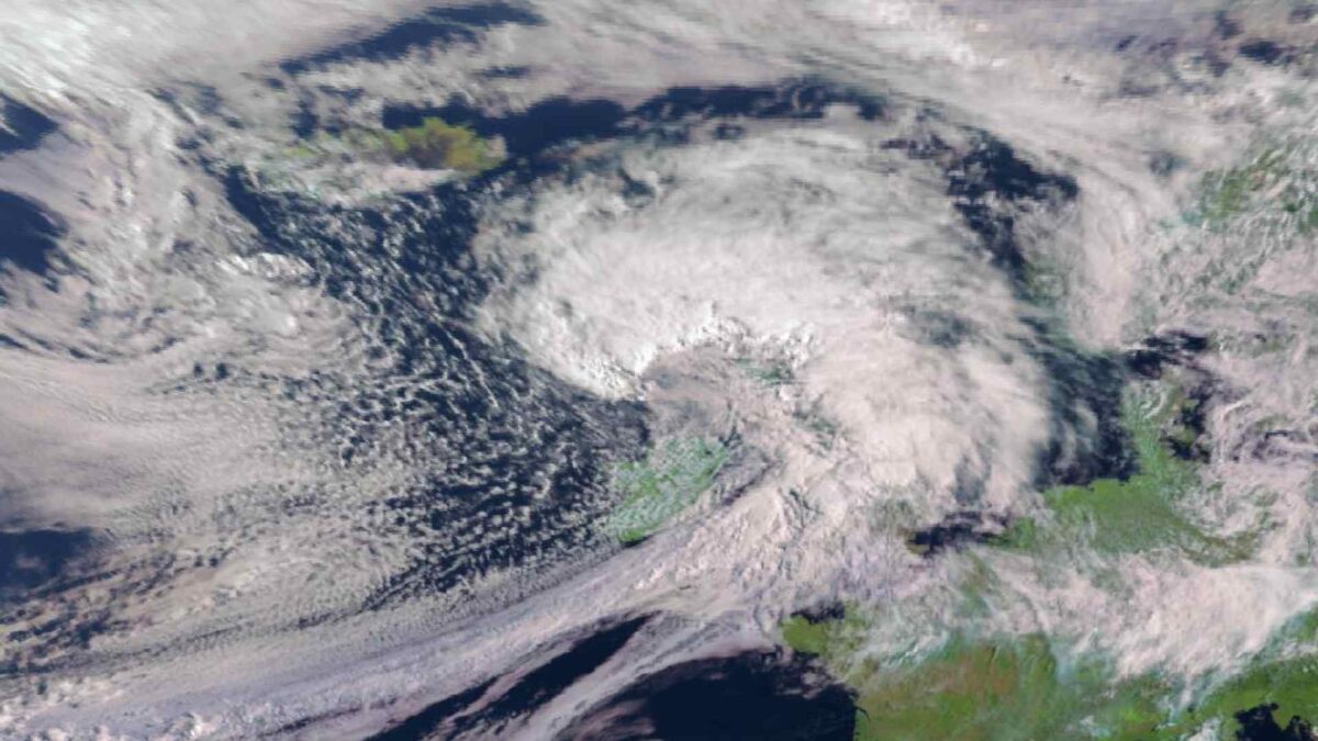
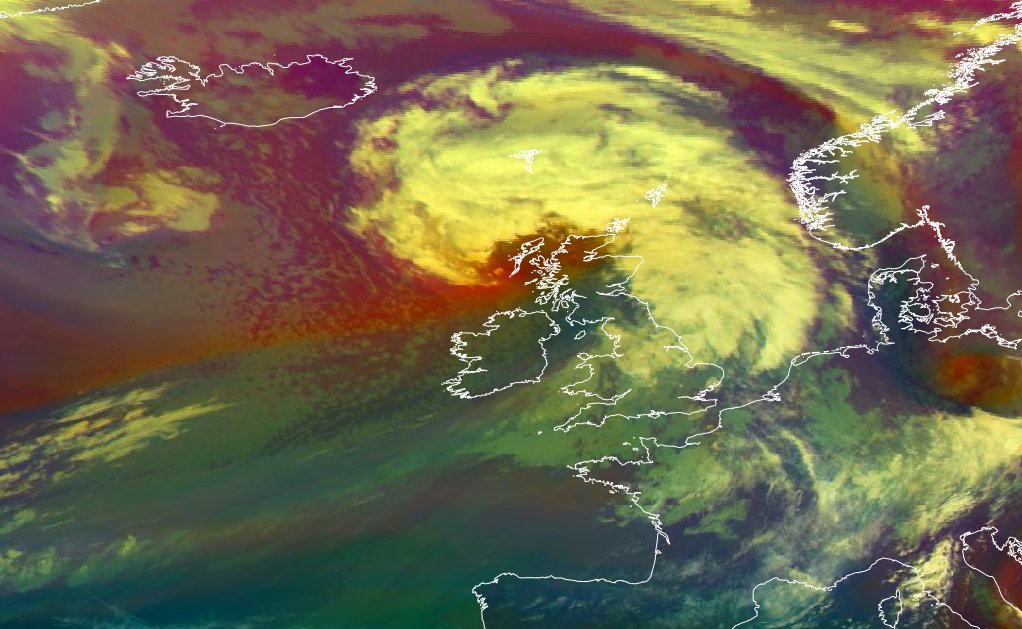
Satellite imagery from EUMETSAT at 10.00am showed Storm Floris displaying a distinctive comma-shaped cloud pattern, often associated with damaging winds on the southern flank of the system. The strongest winds are expected to impact parts of northern Scotland this afternoon, particularly the Western Isles where a 115 km/h wind gust was recorded at 10.00am.
The UK Met Office has issued an Amber Warning for wind, with central pressure in the system dropping to 981 hPa.

In Ireland, the heaviest rainfall largely missed forecast targets. A Status Yellow Rainfall Warning had been in effect for Donegal, Galway, Leitrim, Mayo and Sligo until 10am Monday, with predictions of 30 to 40 millimetres of rain in 12 hours. However, most synoptic stations reported rainfall totals of just 10 to 15 millimetres.
While gusts of this strength are rare in August, they are not without precedent. Malin Head recorded a gust of 115 km/h on August 1st, 1986. Storm Ellen brought a gust of 143 km/h to Roches Point on August 19th, 2020, while Storm Lilian produced a 96 km/h gust at the same station on August 23rd, 2024. Hurricane Charley, which struck on August 25th, 1986, also delivered severe wind and rain to many parts of the country.
Storm Floris is expected to clear away from Ireland by Monday afternoon, though blustery conditions will persist in northern areas into the evening.
Weather Warnings in Effect
Met Éireann has issued multiple Status Yellow weather warnings:
- Wind Warning for Clare, Galway, Mayo and Sligo (valid until 1pm Monday)
- Wind Warning for Cavan, Donegal, Monaghan and Leitrim (valid until 4pm Monday)
These warnings highlight risks including falling trees, localised power outages, minor structural damage, and hazardous road conditions. Wave overtopping is also possible along exposed Atlantic coastlines.
The UK Met Office has issued a Yellow Wind Warning for Antrim, Armagh, Down, Fermanagh, Tyrone and Derry, valid until 6am Tuesday. It warns of travel disruption, debris on roads, and potential temporary power loss due to unseasonably strong winds.
Marine Warnings
Met Éireann has also issued several marine advisories:
- A Nationwide Small Craft Warning (valid until 1pm Tuesday), as south to southwest winds veer westerly and reach force 6 or higher.
- A Status Yellow Gale Warning from Loop Head to Bloody Foreland to Carlingford Lough and for the Irish Sea north of Anglesey (valid until 7pm Monday), with winds expected to reach gale force 8, occasionally strong gale force 9.