 in Irish Weather History 1")


Warm, dry spell could give way to Hurricane Erin’s remnants
Ireland will remain largely dry and warm over the coming week but the remnants of Hurricane Erin are expected to bring unsettled weather from mid-week of next week.
If Erin does reach Ireland, it will do so in a weakened, post-tropical state. The system is expected to lose its hurricane characteristics well before approaching the northeast Atlantic, though it may still bring wind, rain and unsettled conditions.
Long-range weather models, including the GEM, ECMWF and GFS, indicate that Erin’s remnants are likely to affect Ireland from late Tuesday or Wednesday next week.
In the meantime, temperatures will stay above average for the time of year in the meantime, with sunny spells for most regions. Some cloud and scattered showers are likely in the south and west today, but dry conditions will dominate through the working week.
Latest from NHC
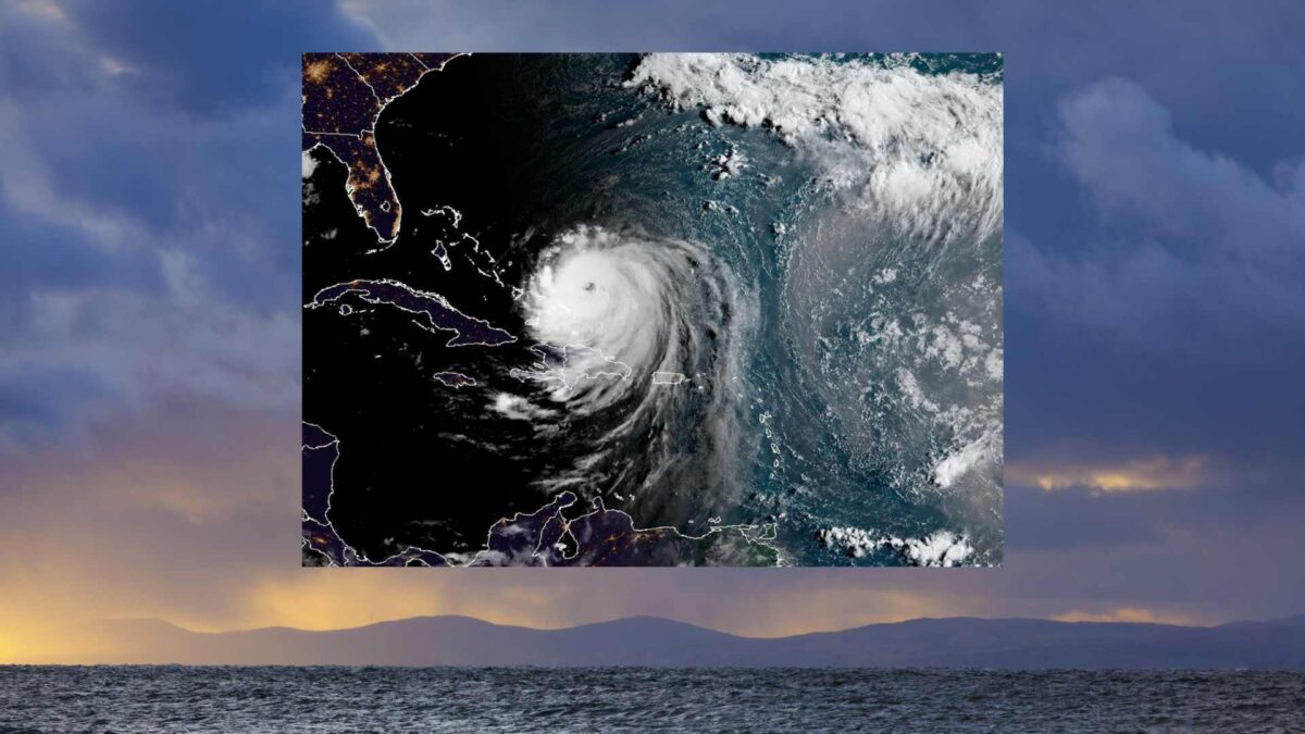
In its latest advisory, the US National Hurricane Center (NHC) and NOAA reported that Erin has increased in size, with hurricane-force winds extending up to 70 nautical miles from its centre and tropical-storm-force winds out to 200 nautical miles. The storm’s maximum sustained winds remain near 115 knots (213 km/h). Reconnaissance aircraft also detected concentric eyewalls and mesovortices, signs of a strong and complex hurricane structure.
The NHC warned that Erin’s growing wind field will generate hazardous surf and rip currents along the US east coast, Bermuda, Atlantic Canada and the Bahamas. Heavy rainfall is expected across Hispaniola, the Turks and Caicos, and parts of the Bahamas, with flash flooding possible.
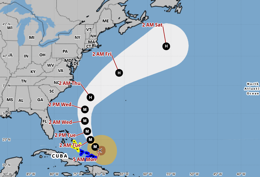
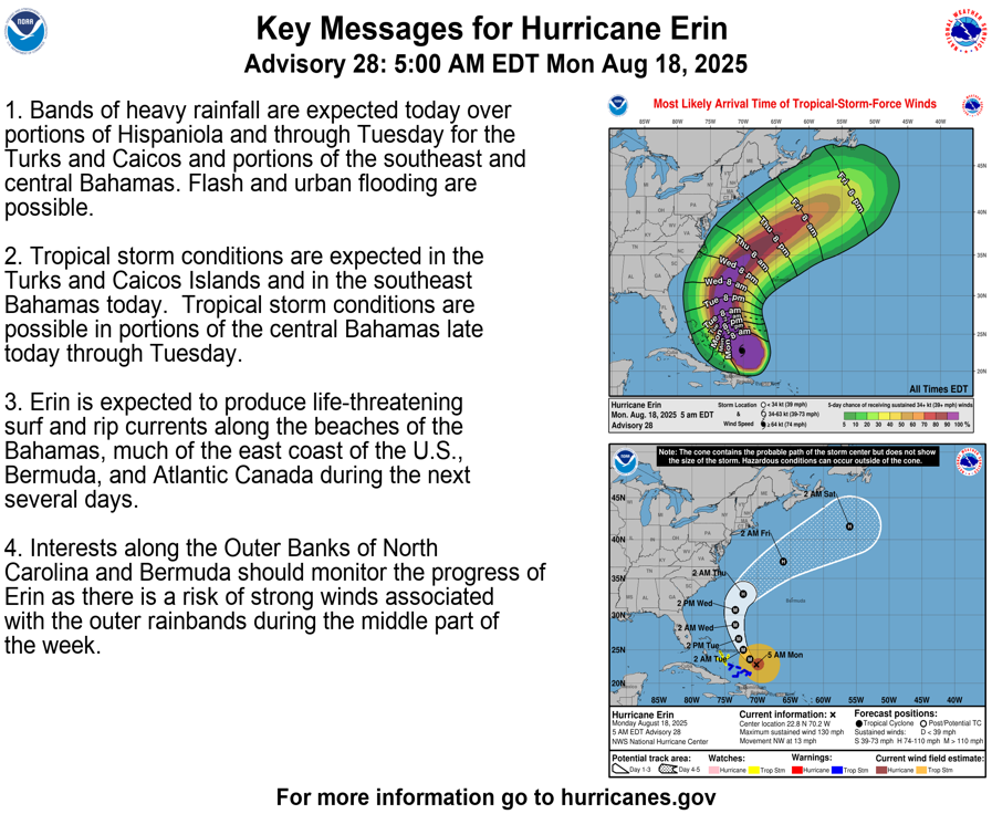
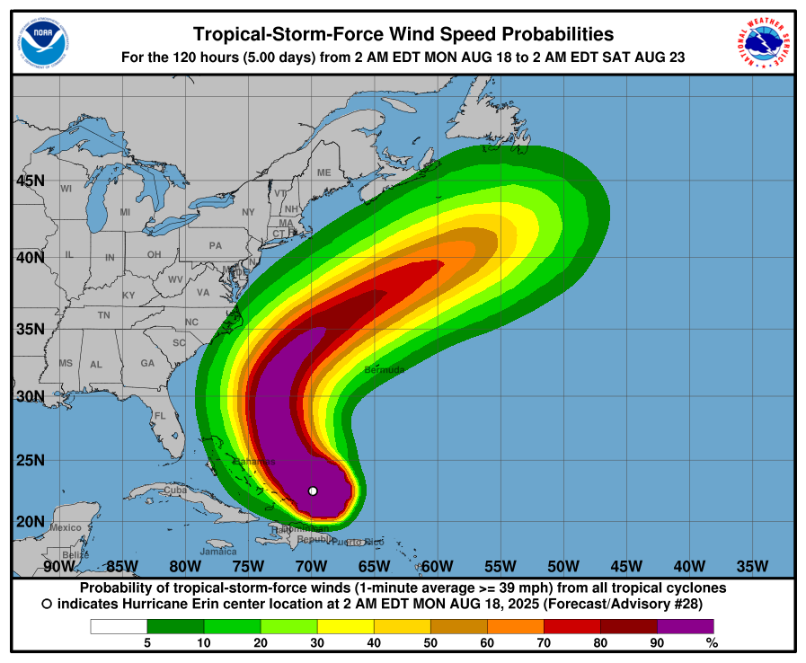
Erin is moving west-northwest at around 11 knots but is forecast to turn north on Tuesday, tracking between Bermuda and the US east coast midweek before accelerating northeastward over the Atlantic. It is expected to weaken gradually but remain a powerful hurricane in the short term.


