 in Irish Weather History 1")


Ireland on Close Watch Ahead of Saturday’s Atlantic Low
Ireland is increasingly likely to experience blustery conditions and heavy rain on Saturday as an Atlantic depression rapidly deepens on Friday night before crossing the country.
Significant uncertainty remains over the severity of the winds and overall rainfall totals, but weather models currently place the centre of the low over the northwest, moving on a northeast trajectory.
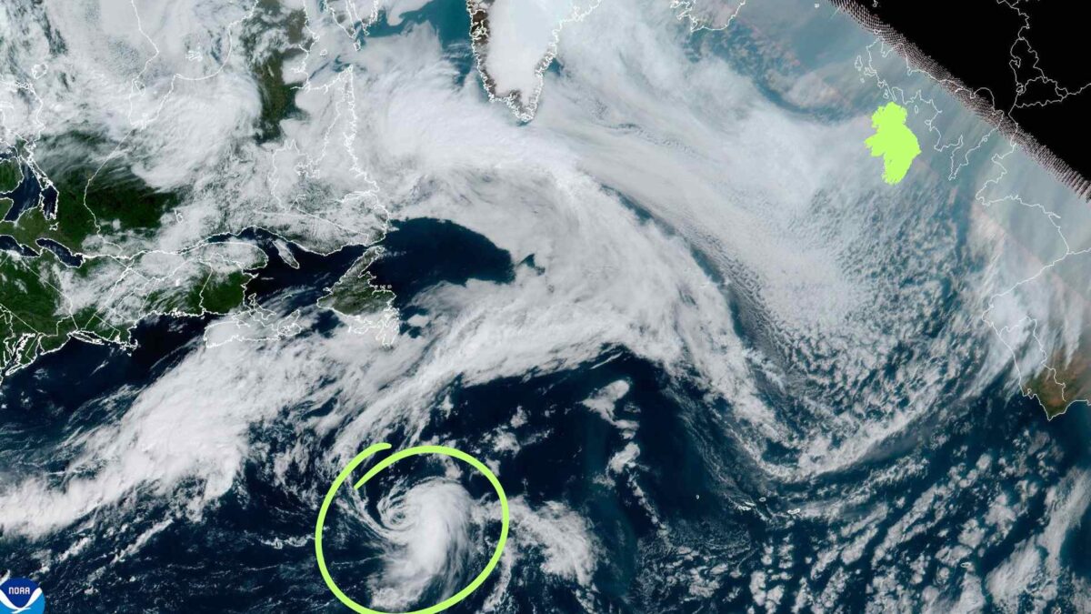
As reported yesterday, the system is linked to the remnants of Tropical Storm Fernand, which is weakening over the mid-Atlantic. It is expected to lose its tropical characteristics over the next 24 hours, breaking down into a trough before interacting with a shortwave to its north and merging to form a deepening depression as it approaches Ireland’s west coast. Considerable uncertainty remains over its exact track and intensity.
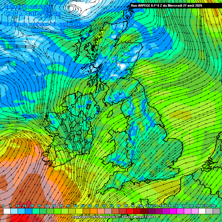
Latest projections position the centre of the low over Connacht on Saturday afternoon, with the strongest winds forecast across Munster and Connacht before shifting towards north Leinster and Ulster later in the day.
The ARPEGE weather model shows gusts reaching or exceeding 90 to 100 km/h in exposed coastal locations during Saturday. Rainfall will be widespread, quickly clearing northeast due the fast moving nature of the system. Other weather models show a slack low crossing Ireland before deepening over The Irish Sea as it tracks toward northern Britain.
Met Éireann warns of uncertainty over exact conditions but says there is potential for significant rainfall and blustery winds, especially on Saturday.

In its latest forecast discussion on Tropical Storm Fernand, the US National Hurricane Center (NHC) reports that the storm remains disorganised, with most convection confined to the southern semicircle and a stretched, elongated low-level circulation. Current winds are estimated at 40 kt. The storm is moving east at around 10 kt, slightly east of previous forecasts, but is expected to accelerate east-northeast later as it is steered by southwesterly flow from a mid-latitude trough over eastern North America.
Guidance indicates Fernand is likely to remain a tropical cyclone for only another 24 hours. As it moves over cooler waters near the north wall of the Gulf Stream, it is forecast to become post-tropical and eventually dissipate into a trough within approximately 60 hours.
Share this WeathÉire story:

