 in Irish Weather History 1")


Omega High Promises Calm After a Stormy Start to October
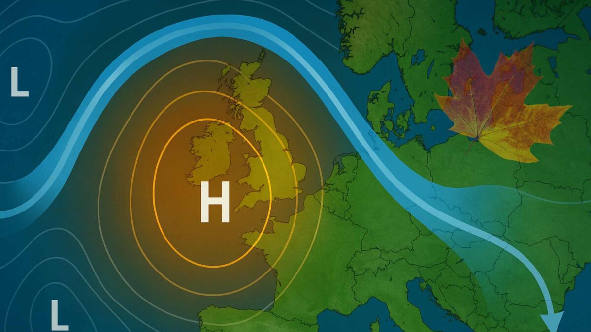
An omega high is expected to establish itself over or close to Ireland next week, ushering in a spell of calm, settled and largely dry weather that could persist well into mid-October.
After an unsettled start to the month, weather models are signalling a major shift in the atmospheric pattern. High pressure is forecast to build strongly from the Atlantic during the coming days, becoming centred over or just to the east of Ireland by midweek. Once in place, this dome of high pressure is likely to block the usual train of Atlantic weather systems, keeping low-pressure areas and their rain-bearing fronts well at bay.
What is an Omega High?
An omega high takes its name from the Greek letter Ω, which it resembles on weather charts. The shape forms when a large ridge of high pressure becomes sandwiched between two low-pressure systems, one to the west and one to the east. The resulting pattern is highly stable and can persist for several days or even weeks.
Under such conditions, the air sinks and warms, suppressing cloud formation and rainfall. While some areas may see cloud trapped under temperature inversions, particularly overnight and in the mornings, days tend to be dry and bright with light winds. Nights, however, can turn chilly, with mist, fog and even a touch of frost where skies clear.
How the Jet Stream Plays a Role
In an omega block, the jet stream buckles and meanders northward into an “Ω” shape, with a stationary high-pressure system sandwiched between two low-pressure systems. This forces the jet stream to lose its typical zonal (west-to-east) flow and causes it to stall. The result is a prolonged and stagnant weather pattern that often brings settled, dry conditions to the area beneath the high-pressure ridge.
The below video shows the jet stream, wind speeds and upper-air temperatures (at around 850 hPa, or roughly 1,500 metres). With high pressure centred over Ireland, winds fall light as shown in the video, and cooler nights are likely to develop beyond Day 7 in the forecast period.
Calmer Days Ahead
As the omega high becomes established, Ireland can expect a spell of more settled autumn weather from Wednesday onward. Daytime temperatures will likely reach the mid-teens, while nights turn cooler. Winds will be light and variable, and rainfall amounts will remain well below average for the time of year.
Settled conditions are expected to continue into the following week, with light easterly or northeasterly winds and cool, clear nights that may bring frost in places by next week.
As we enter the final 10-12 days of October, Ireland will find itself on the dividing line between high pressure over Britain and Atlantic systems to the west. A return to less settled conditions is likely during this period, at least in Atlantic coastal counties, according to current model guidance.
Wet And Windy Start to October
Ireland was hit by its strongest winds since Storm Éowyn as Storm Amy swept along the northwest coast on Friday. Malin Head in Donegal and Magilligan in Derry both recorded gusts of 148 km/h, the latter recording the highest ever gust measured in October in Northern Ireland, according to the UK Met Office. Elsewhere, Belmullet in Mayo and Mace Head in Galway reported gusts of 122 km/h, while Shannon Airport in Clare logged 113 km/h.
8 out of Met Éireann’s 24 synoptic weather stations have also recorded more than half their average monthly rainfall in the first three days of October, with the west of the country worst affected. At Mace Head in Galway, 70 per cent of the station’s October long-term average fell by Friday night. Almost three inches of rain (74.2mm) were logged in just 72 hours. Athenry also passed the halfway mark, with 66mm recorded compared with a long-term monthly average of 118mm.
Other stations to exceed half their monthly totals include Knock, Newport and Claremorris in Mayo, Markree in Sligo, Ballyhaise in Cavan and Mount Dillon in Roscommon.
Share this WeathÉire story:

