 in Irish Weather History 1")


Tropical Storm Jerry set to become next Atlantic Hurricane
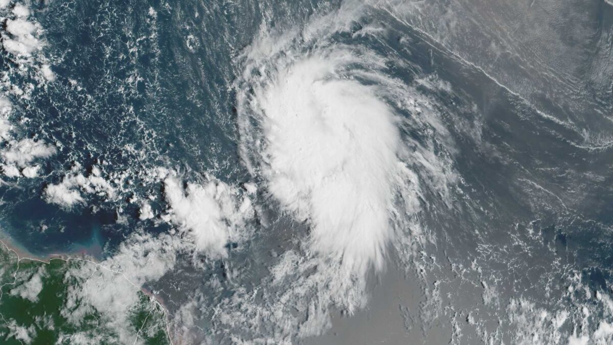
Tropical Storm Jerry has formed in the central Atlantic, according to the US National Hurricane Center (NHC).
A new tropical storm has developed over the central Atlantic, marking the tenth named storm of the 2025 hurricane season.
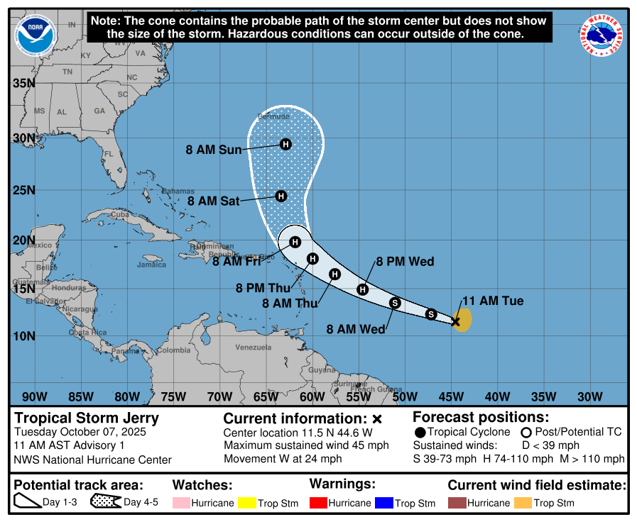
Located 2,120 kilometres east-southeast of the northern Leeward Islands, Tropical Storm Jerry is moving west at around 39 km/h and has maximum sustained winds of 75 km/h, with higher gusts. The storm is expected to slow down and shift slightly to the west-northwest over the next few days. Forecast models indicate that the system could pass near or north of the northern Leeward Islands by Thursday and Friday.
Meteorologists warn that steady strengthening is likely, with Jerry expected to reach hurricane strength within a day or two. Tropical-storm-force winds extend up to 220 kilometres from the centre of the storm.
Currently, no coastal watches or warnings are in effect. Residents in the northern Leeward Islands are advised to monitor the storm, as tropical storm watches may be issued later this week.
Swells generated by Jerry are expected to reach the Leeward Islands by Thursday, creating dangerous surf and rip current conditions. Local authorities have urged the public to stay informed through official weather channels.
Jerry is the tenth named storm of the 2025 Atlantic hurricane season. The system will be closely monitored as it moves across the Atlantic, though at this stage there is no indication it poses any threat to Europe or Ireland.
The Atlantic hurricane season runs from June 1st to November 30th, with activity typically peaking in early September.
Yucatan System
Forecasters are monitoring an area of low pressure over the Yucatán Peninsula that is bringing widespread showers and thunderstorms to parts of southern Mexico and Belize.
The US National Hurricane Center (NHC) said the trough of low pressure is expected to move into the Bay of Campeche later today, where some slow development is possible before it moves inland again over southern Mexico late Wednesday or early Thursday.
While the NHC gives the system only a 10 per cent chance of development into a tropical cyclone over the next week, forecasters warned that heavy rainfall and gusty winds are likely across the region regardless of whether it strengthens.
The disturbance is not expected to affect the United States or other parts of the Caribbean, but it could bring localised flooding to coastal and inland areas of southern Mexico and the Yucatán Peninsula.
Share this WeathÉire story:

