 in Irish Weather History 1")


Tropical Storm Jerry strengthens as it nears Leeward Islands
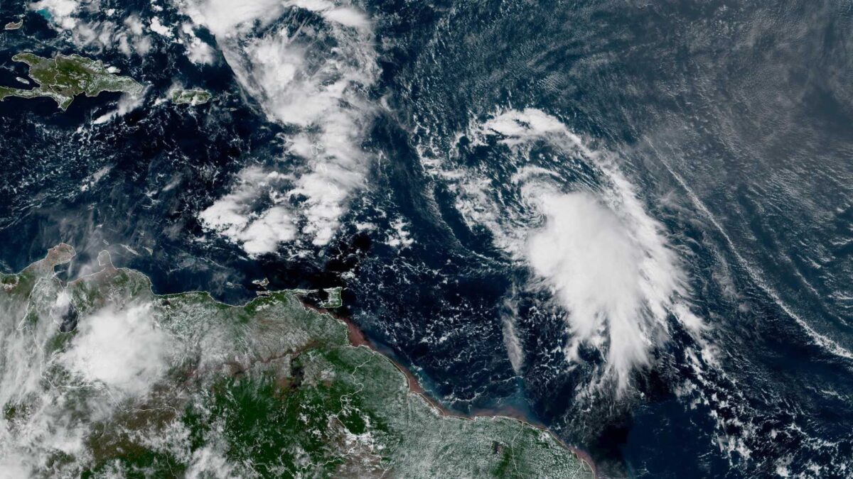
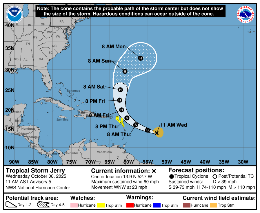
Tropical Storm Jerry has gained strength in the central Atlantic and is forecast to pass very close to the northern Leeward Islands late on Thursday and into Thursday night, according to the latest advisory from the US National Hurricane Center.
At 4pm GMT, the centre of Jerry was located approximately 750 miles east-southeast of the northern Leeward Islands. The storm is moving west-northwest at 23 miles per hour, with maximum sustained winds now reaching 60 miles per hour.
Forecasters expect Jerry to continue strengthening over the coming days and it could become a hurricane by the weekend.
Tropical storm watches have been issued for several islands in the region, including Antigua, Barbuda, Anguilla, St Kitts, Nevis, Montserrat, St Barthelemy, St Martin, Sint Maarten, Saba, St Eustatius and Guadeloupe. Residents in these areas are advised to monitor updates closely as tropical storm conditions are possible from late Thursday into Friday.
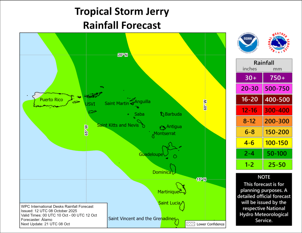
Rainfall totals of between two and four inches are expected across the Leeward Islands, the British Virgin Islands and the US Virgin Islands, with isolated areas potentially receiving up to six inches. This brings a risk of flash flooding, particularly in mountainous terrain. Swells generated by Jerry are also forecast to reach the Leeward and Windward Islands on Thursday and spread westward toward the Greater Antilles on Friday, creating dangerous surf and rip current conditions.
The storm is expected to slow down and begin turning northward by Friday, steering it away from the US mainland. Forecast models currently show Jerry curving into the open Atlantic over the weekend.
At present, Tropical Storm Jerry does not appear to pose any threat to Ireland or north-western Europe.
Meanwhile, in the Bay of Campeche, a trough of low pressure is producing disorganised showers and thunderstorms as it moves westward.
Although the system has only a low chance of developing into a tropical cyclone, 10 percent over the next 48 hours and the same over the next seven days, it is still expected to bring heavy rainfall and gusty winds to southern Mexico through Thursday.
Jerry is the tenth named storm of the 2025 Atlantic hurricane season, which has so far included Hurricanes Erin, Felix and Humberto, among others.
The season has been marked by several rapidly intensifying systems and a higher-than-average number of tropical cyclones forming in the eastern Atlantic. The official hurricane season runs from 1 June to 30 November.
Share this WeathÉire story:

