 in Irish Weather History 1")


Something Wicked This Way Comes? Strong winds possible next week
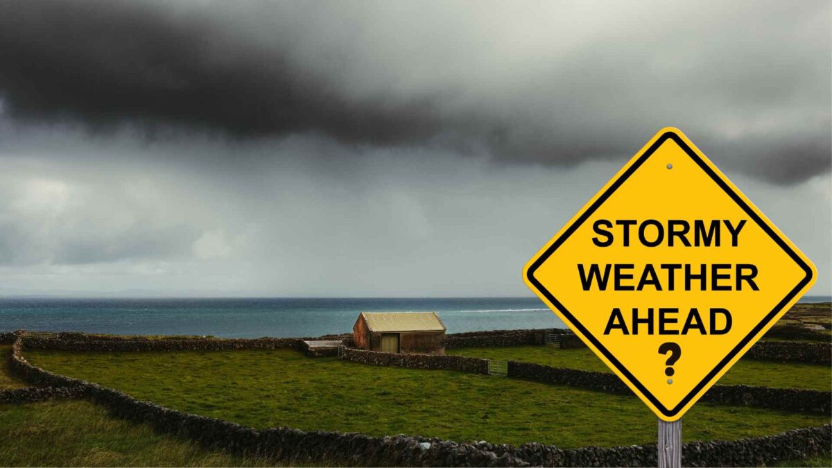
Ireland could experience a spell of wet and very windy weather later next week, followed by a marked drop in temperatures as colder air moves in from the northwest.
A developing Atlantic weather system is expected to track eastwards towards Ireland from Thursday into Friday, bringing widespread heavy rain and strong winds. As the system passes, it will draw in a polar maritime airmass, resulting in a noticeably colder feel by late Friday and into the weekend.
Daytime temperatures are forecast to fall to between 6 and 9 degrees, possibly a little higher in the southwest. As winds ease, some frost is likely in sheltered inland areas.
There remains some uncertainty regarding the exact track of the low-pressure centre, though all major forecast models indicate strong southwesterly winds veering northwesterly as the system passes. Heavy rain is expected to spread across the country on Thursday, followed by scattered showers once the system clears eastwards on Friday.
The next named storm on the 2025-26 list is Storm Bram after Storm Amy impacted Ireland on October 3rd.
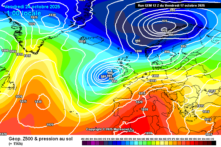
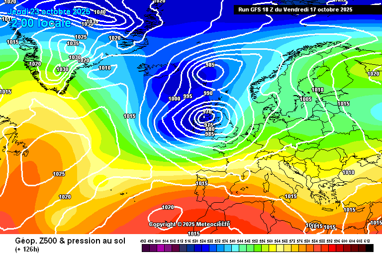
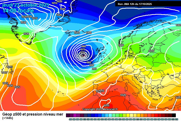
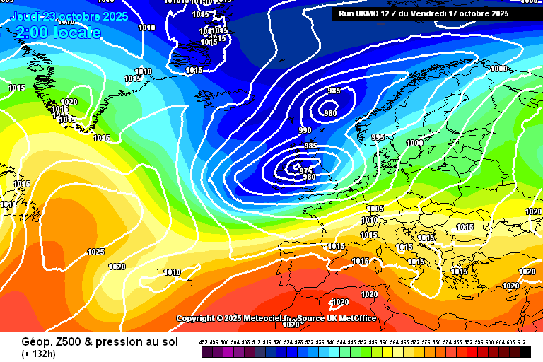
The finer details, including rainfall totals and wind strength, will become clearer closer to the time, as this period remains outside the most reliable three-day forecasting window for computer models.
In the meantime, 7 counties are under Rainfall Warnings, issued on Friday by the UK Met Office and Met Éireann.
Wet Weekend Ahead
Met Éireann has escalated its weather alert for Cork and Waterford to Status Orange, warning of intense rainfall and possible thundery downpours from Saturday evening into early Sunday morning.
The advisory cautions of river flooding, especially in upland areas, and warns motorists to expect treacherous conditions overnight.
Up to two inches of rain could fall across south Cork, Waterford and southwest Kerry over the weekend, with the heaviest accumulations likely on higher ground.
Status Yellow rain warnings are in place for Kerry, Carlow, Wexford and Kilkenny. Met Éireann has warned of heavy showers and isolated thunderstorms, with a risk of localised flooding and hazardous travel conditions.
In Northern Ireland, the UK Met Office has issued a Yellow rain warning for Antrim, Armagh and Down, with overnight rainfall from Saturday into Sunday morning likely to cause flooding and travel disruption.
At sea, a small craft warning is in effect for all Irish coastal waters, as southeasterly winds are forecast to reach force 6 or stronger from late Friday through Sunday morning. A separate warning has also been issued for the stretch from Bloody Foreland to Strangford Lough to Hook Head on Sunday.
Additionally, a Status Yellow gale warning is in place for coastal waters from Loop Head to Belfast Lough to Roche’s Point and across the Irish Sea, where southeasterly winds may reach gale force 8 from Saturday evening until midnight.
Share this WeathÉire story:

