 in Irish Weather History 1")


Deepening system may bring strong gales to Atlantic coasts on Tuesday
Forecast models remain divided on the likely impact of a developing weather system due on Tuesday morning.
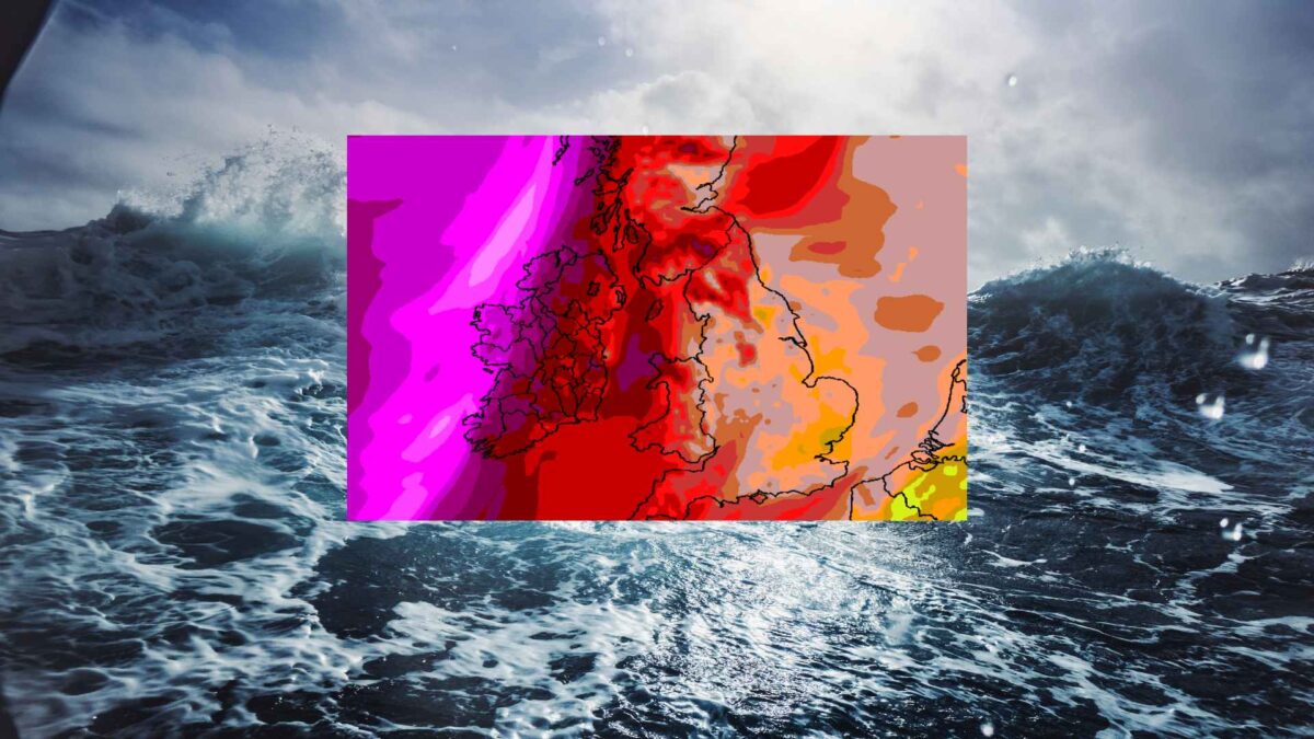
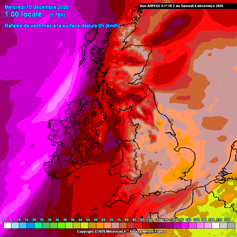
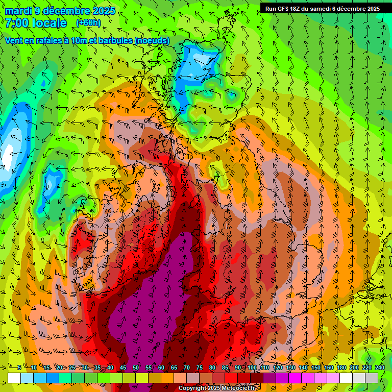
The latest Arpege runs have shifted the risk towards the west and northwest, a familiar track for winter storms in Ireland. The GFS model, however, continues to project the strongest winds in the far southeast.
Such a marked disparity between the two models at 72 hours out is unusual. The system has yet to fully form and much remains uncertain.
Other models suggest Tuesday may bring little more than a blustery, wet day. In its Saturday evening update Met Éireann said Tuesday will bring “fresh to strong and gusty southwesterly winds, with gales or strong gales possible near western and northwestern coasts.”
The most likely outcome is that strong winds will develop in the far southwest before daybreak on Tuesday, with a rapidly deepening system tracking quickly north‑north‑east off Ireland’s west coast. Based on an assessment of all weather models, the strongest winds are expected in the west and northwest, with Valentia in Kerry, Mace Head in Galway, Belmullet in Mayo and Malin Head in Donegal likely to report the highest gusts.
The next named storm system is Bram. The decision to name the next storm rests with the UK Met Office, Met Éireann and the KNMI.
Share this WeathÉire story:

