 in Irish Weather History 1")


Deep Atlantic low to bring strong winds and heavy seas on Friday
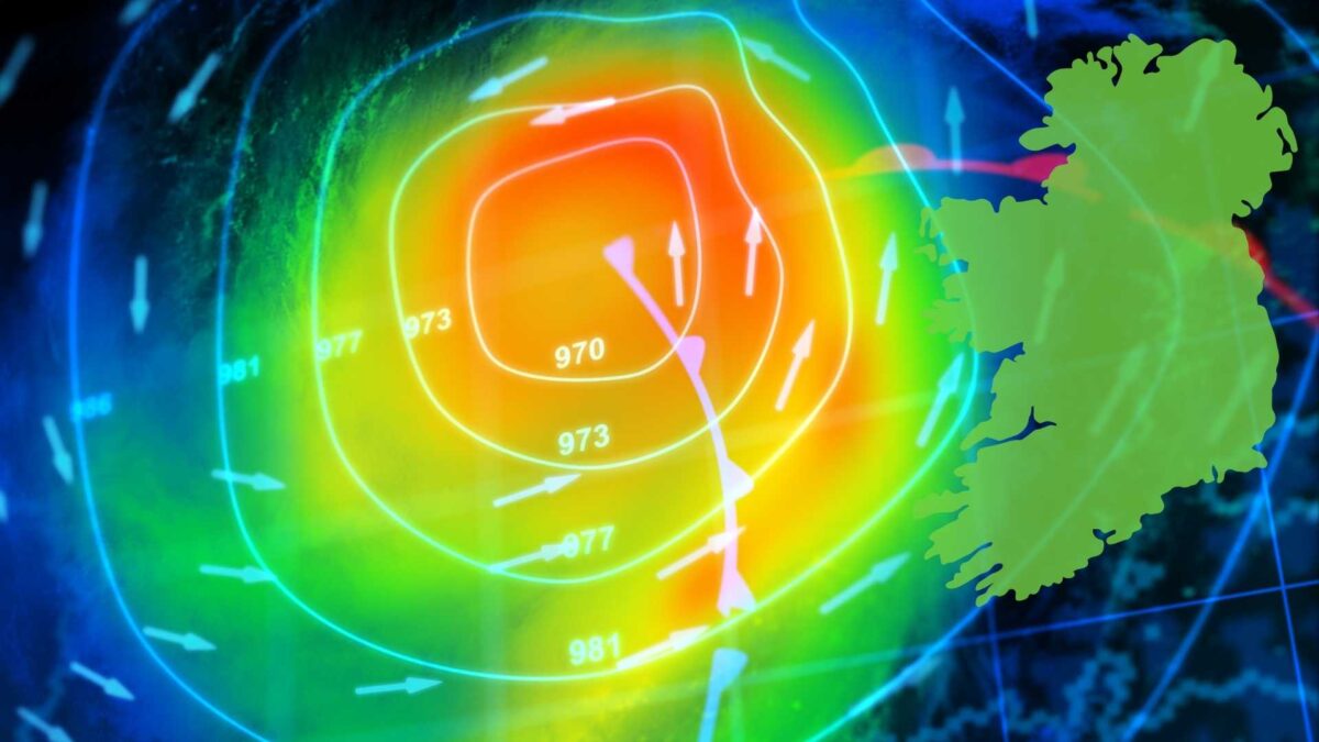
Ireland is expected to face a spell of wet and windy weather from Friday into Saturday morning as a rapidly deepening Atlantic low-pressure system tracks northwest of Ireland towards Scotland.
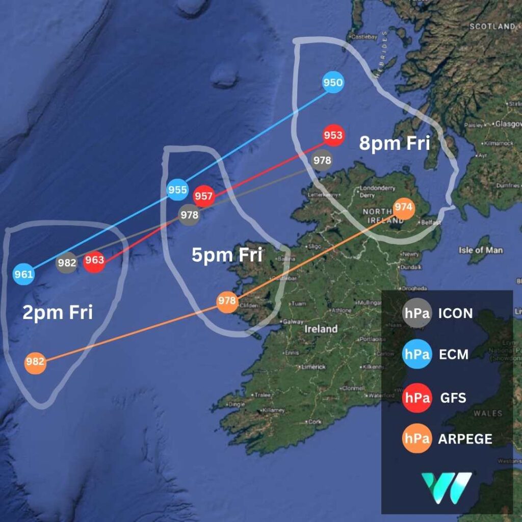
There is still significant uncertainty about the storm’s precise track and intensity. Current projections indicate it will deepen to the northwest of Ireland on Friday afternoon and evening before moving towards north-western Scotland overnight.
On its present path, the system is expected to generate high seas along the Atlantic seaboard and bring strong, potentially damaging winds, particularly on its southern flank. The strongest gusts are likely to develop first in western counties before extending into the north.
Weather models suggest gusts of 110–120 km/h in western and north-western counties, with 90–100 km/h possible further inland. At the more severe end of forecasts, exposed coastal sites such as Mace Head in Co Galway and Belmullet in Co Mayo could see gusts exceeding 140 km/h. Extensive power cuts would be likely, particularly as many trees remain in leaf.
Wave heights of up to seven metres are also anticipated along the west coast, raising the risk of coastal flooding in low-lying areas.
Rainfall is not expected to be excessive, with totals of 10–15mm in the west and lesser amounts further east. However, with soils already saturated and further rain forecast for Wednesday and Thursday, the risk of localised flooding remains high.
The system is linked to the remnants of Hurricane Humberto, which has weakened from a Category 5 hurricane to a Category 1 and is expected to be downgraded further to a tropical storm. Its remains are forecast to track northeast towards Ireland before being absorbed into the Atlantic westerly flow and undergoing rapid cyclogenesis on Thursday night and Friday morning.
Met Éireann has not yet issued weather warnings but said “Friday will be a wet and windy day with widespread rain, heavy at times, accompanied by strong and gusty southerly winds.”
Should the system be deemed strong enough to warrant official warnings, it may be designated Storm Amy by Met Éireann, the UK Met Office or the Dutch weather service, KNMI, under the joint European storm-naming system.
It is worth noting that the storm, which is currently on track to impact Ireland, has not yet fully developed, adding to the uncertainty around both its track and severity. While some comparisons have been drawn on social media with Storm Éowyn, at more than 72 hours out shifts in the storm’s trajectory and impact remain highly likely.


