 in Irish Weather History 1")


Next Atlantic Storm ‘Jerry’ Brewing in Eastern Tropics
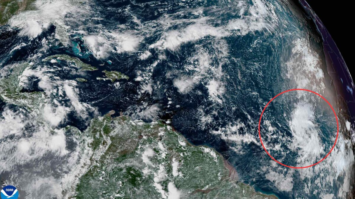
A broad area of low pressure associated with a tropical wave is showing signs of development several hundred miles southwest of the Cabo Verde Islands in the eastern tropical Atlantic, the US National Hurricane Center (NHC) has reported.
The system is producing widespread but disorganised showers and thunderstorms. Forecasters say conditions are favourable for further strengthening, with a tropical depression likely to form this week. If development occurs, the storm could approach parts of the Leeward Islands by later in the week.
The NHC has given the system a 50% chance of forming over the next 48 hours, rising to 70% over the next seven days. Should it reach tropical storm strength, it would be named Jerry, the next name on the 2025 Atlantic hurricane list.
Residents and authorities in the Caribbean are being urged to monitor the system closely. At this stage, it remains uncertain how strong the storm will become or its exact track, but forecasters warn conditions are conducive to rapid development once a well-defined centre forms.
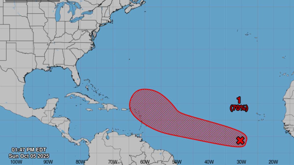
systems originating near the Cabo Verde Islands are common in October, the peak month of the Atlantic hurricane season. These storms can travel thousands of kilometres across the Atlantic before reaching the Caribbean or, in some cases, the US mainland.
Ireland and the UK are not expected to be affected by the system. Instead, an omega high is expected to establish itself over or close to Ireland next week, ushering in a spell of calm, settled and largely dry weather that could persist well into mid-October.


