 in Irish Weather History 1")


The Browning of Ballydehob: Satellite reveals autumn shades in West Cork
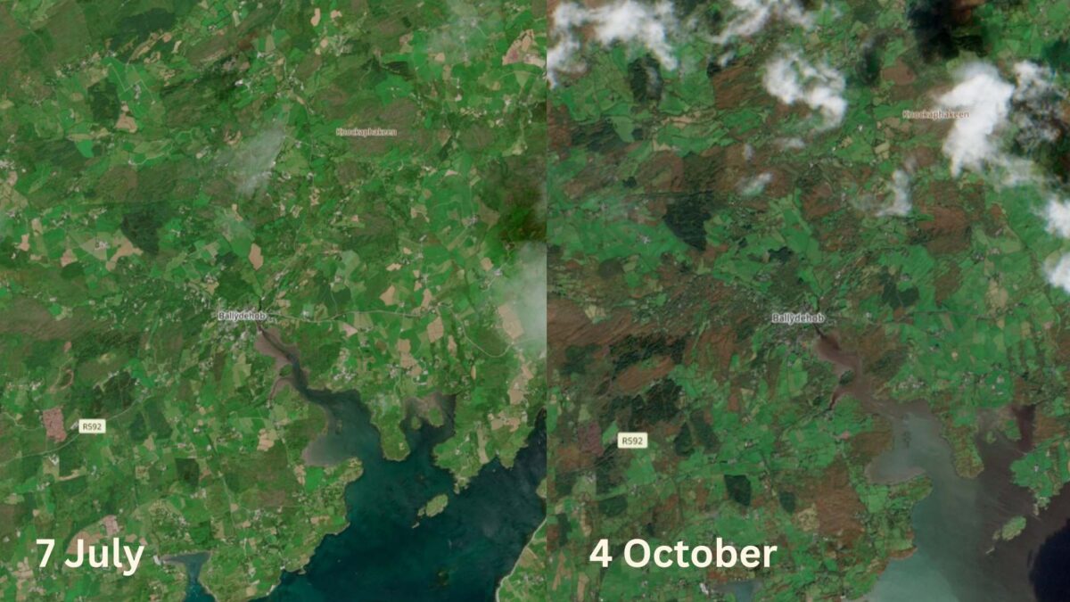
The extensive gorse lands surrounding Ballydehob in West Cork have taken on their autumn colours, as captured by the Copernicus Sentinel-2 satellite on Saturday.
In stark contrast to the greener hues of early July, Saturday’s satellite image provides a clear example of gorse turning brown in autumn, not due to the usual seasonal leaf drop but as a result of waterlogging and the dying of older stems and flowering branches.
The effects of heavy rain on Thursday and Friday, associated with Storm Amy, can also be seen where the River Bawnaknockane flows through Ballydehob into Roaringwater Bay.
The brown plume visible in the bay occurs when intense or prolonged rainfall increases runoff from the land. Water flowing off fields, hillsides and riverbanks carries loose soil and organic material into rivers, which in turn deliver the sediment into the sea. The effect is most visible where freshwater meets the clearer waters of bays and estuaries.
Ireland’s west and southwest coast is particularly prone to these events due to high levels of rainfall and catchments made up of loose soils and peat, which are easily eroded. After long wet spells, large quantities of sediment can be released in a short period of time. Over the longer term, sediment deposits can alter the shape of river mouths and harbours.
Share this WeathÉire story:

