 in Irish Weather History 1")


Ireland Faces Wet and Windy Sunday

Ireland faces the risk of wet and windy weather from Sunday evening into Monday morning as a deepening area of low pressure approaches the northwest.
Forecasts from multiple models, including ECM, GFS, GEM, and JMA, show strong southwesterly winds developing on Saturday afternoon and evening, later shifting to the west and northwest. The UKMO model, however, is less bullish on a deep area of low pressure forming as of Tuesday morning’s update.
While the finer details will evolve over the coming days, there is broad agreement on the likely track of the system.
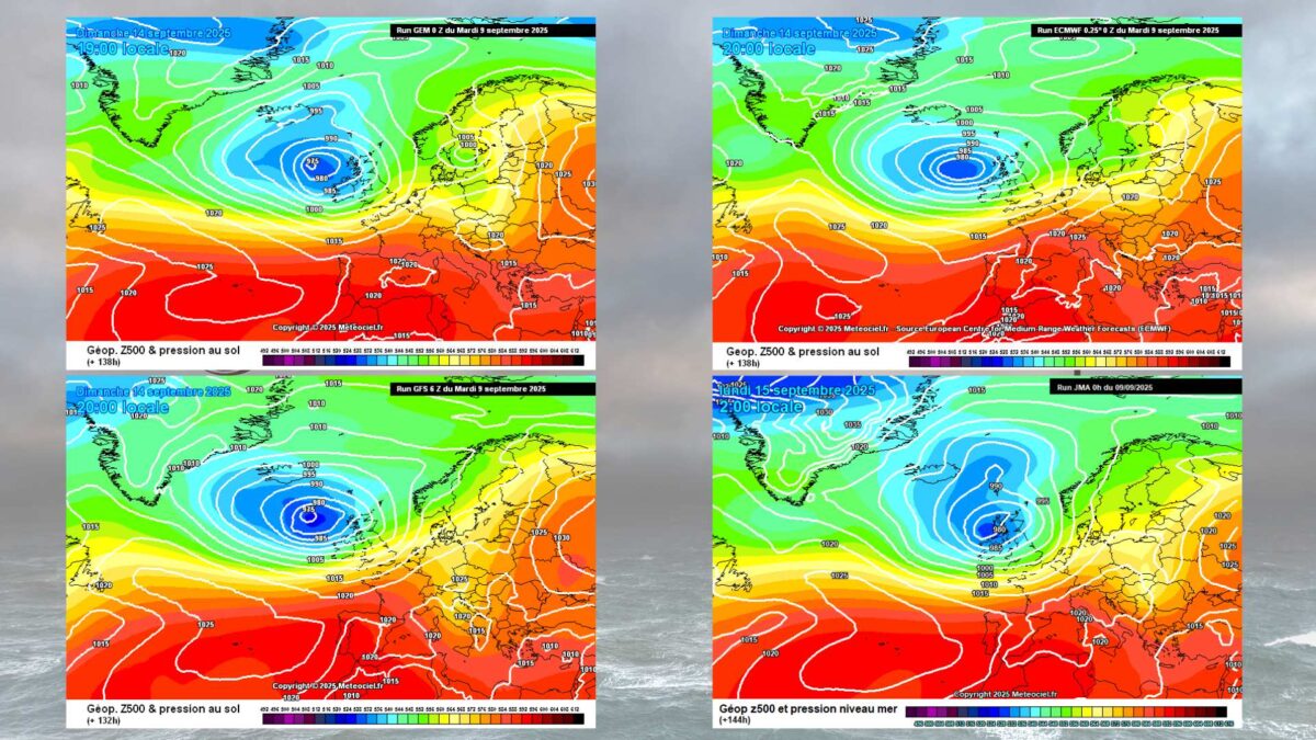
The first named storm of the 2025–26 season will be Storm Amy, but current forecasts suggest that Sunday evening’s winds are unlikely to meet the criteria for naming in Ireland. Maximum gusts of 85–90 km/h are expected along the Atlantic seaboard, particularly in northwest counties. Gusts further inland are currently estimated at 60-70 km/h.
Storms are named when they pose a medium or high impact in any of the three “western” partner meteorological services: the UK Met Office, Met Éireann, and the KNMI (Netherlands).
Meanwhile, a cool, unsettled week lies ahead. A mobile Atlantic airflow will bring frequent rain and gusty winds, with the west seeing above-average rainfall while the east remains closer to seasonal norms. Next week is expected to remain unsettled, with frequent showers, below-average temperatures, and chilly nights inland. Some southern counties may see brief improvements, but a prolonged dry spell is unlikely.


