 in Irish Weather History 1")


Sun Vanishes as Ireland Records Dullest Week of 2025
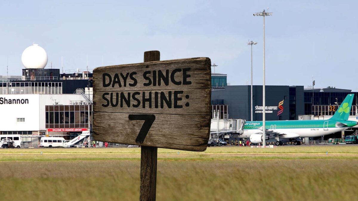
Two of Met Éireann’s synoptic stations, Shannon Airport and Valentia, did not record a single minute of sunshine over the past week, as persistent cloud cover blanketed much of the country.
The lack of sunshine is attributed to a dominant anticyclonic weather pattern, which has brought settled but gloomy conditions across Ireland.
Between 8 and 14 October, sunshine levels remained well below average across Ireland. Johnstown Castle in Wexford recorded just 12 minutes of sunshine, or 1 percent of the normal amount for this time of year. Claremorris was the brightest location, though it only managed 1.1 hours, representing just 4 percent of the norm.
Despite the overcast skies, rainfall totals were unusually low. Malin Head recorded the highest amount at just 1.9 millimetres, which is 6 percent of its average. Several stations, including Belmullet and Roches Point, measured only 0.2 millimetres, while Shannon Airport registered no rainfall at all, according to Met Éireann.
Temperatures were slightly above seasonal norms, with average air temperatures ranging from 10.1 degrees Celsius at Knock Airport to 12.1 degrees at Roches Point, Shannon Airport and Valentia. Soil temperatures at 10 centimetres depth also exceeded expectations, reaching up to 13.6 degrees at Shannon.
The reason for the cloudy conditions
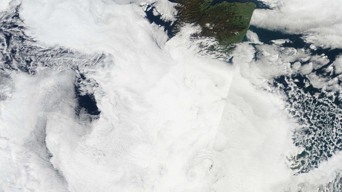
Despite a dominant high-pressure system becoming established over Ireland, the past week has been overcast and dull across much of the country. This might seem surprising, as high pressure is typically associated with clear skies and settled weather. However, the current setup has produced quite the opposite.
On Saturday, mean sea level pressure over Ireland reached 1037 hPa in the southern half of the island, one of the highest readings recorded in 2025.
While such a strong high often brings sunshine, its position is key. This particular high was initially centred over the southern half of Ireland, which resulted in a largely westerly airflow across much of the island. Westerly winds tend to bring in moist Atlantic air, and under the stable conditions of high pressure, this moisture becomes trapped near the surface. With little vertical movement in the atmosphere and weak autumnal sunshine, low cloud has persisted with occasional patches of mist and drizzle. The impact has been felt across the island.
Looking ahead
The settled conditions are expected to continue through until Saturday morning, with daytime temperatures between 11 and 15 degrees Celsius and night-time lows between 7 and 12 degrees. However, a shift to more unsettled weather will take place over the weekend.
A slack Atlantic airflow will bring a mix of dry spells and scattered heavy showers next week. The driest conditions will likely be in the east and south. Rainfall totals will be near average. Daytime temperatures will be close to or slightly below average and will fall to single figures by next weekend, especially in the north and west, with an increasing risk of overnight frost as winds turn more northerly.


