NASA Spots Storm Clouds Towering Over Ireland

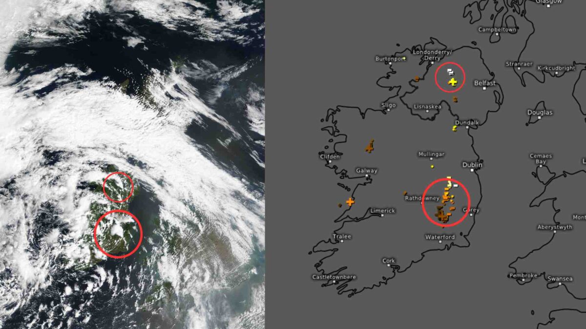
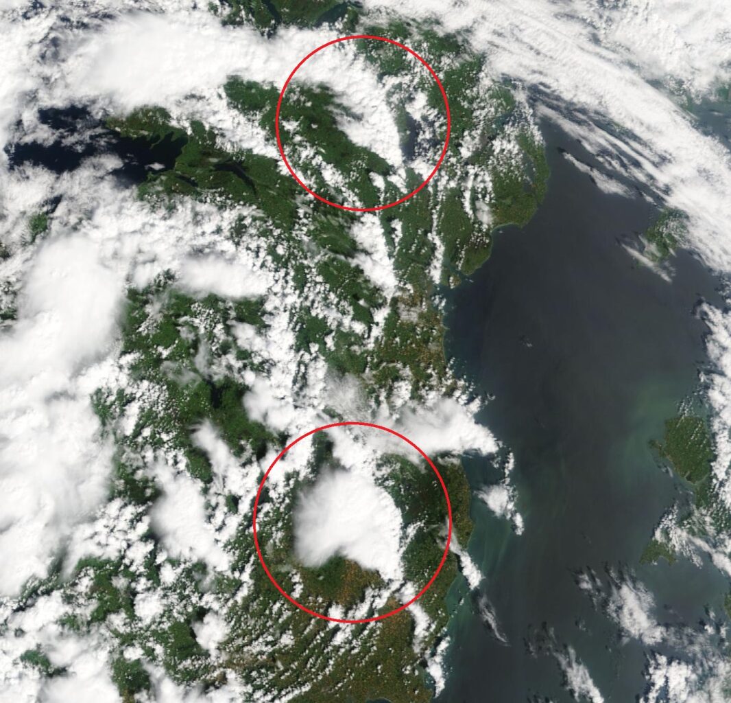
A NASA satellite image taken at 11.30am today captured thunderstorm activity developing over Leinster and Ulster, with towering cumulonimbus clouds visible over affected areas.
The image aligns with lightning reports from Kildare, Laois, Tyrone, and Derry at the same time.

A cumulonimbus cloud forms when warm, moist air rises rapidly, cools, and condenses into a cloud. If the atmosphere is unstable, the cloud continues to grow vertically, often developing from a cumulus into a towering cumulonimbus.
Triggered by surface heating and convection, these clouds can reach up to 15 kilometres high, with their tops flattening into an anvil shape at the tropopause. Inside, strong updrafts and downdrafts produce heavy rain, thunder, lightning, hail, and sometimes tornadoes—making them the source of severe weather and thunderstorms.
A Rain and Thunderstorm warning has been introduced for Clare, Kerry, Limerick, and Galway, valid until 7am Tuesday.
Sunday evening also brought intense downpours, frequent lightning, and widespread thunderstorm activity across Connacht, with numerous lightning strikes and extensive power outages reported in parts of Mayo, Galway, Roscommon, and Sligo.
Share this WeathÉire story:


