in Irish Weather History 1")


Earthquake in Indonesia Reaches Irish Monitors
A magnitude 6.3 earthquake in the eastern Indonesian region of Papua on Tuesday morning was recorded by seismometers in Dublin and Kerry.
The quake struck at around 9.24am Irish time, with the United States Geological Survey locating the epicentre about 193 kilometres northwest of the town of Abepura in Papua.
According to the Pacific Tsunami Warning Center, there was no tsunami threat.
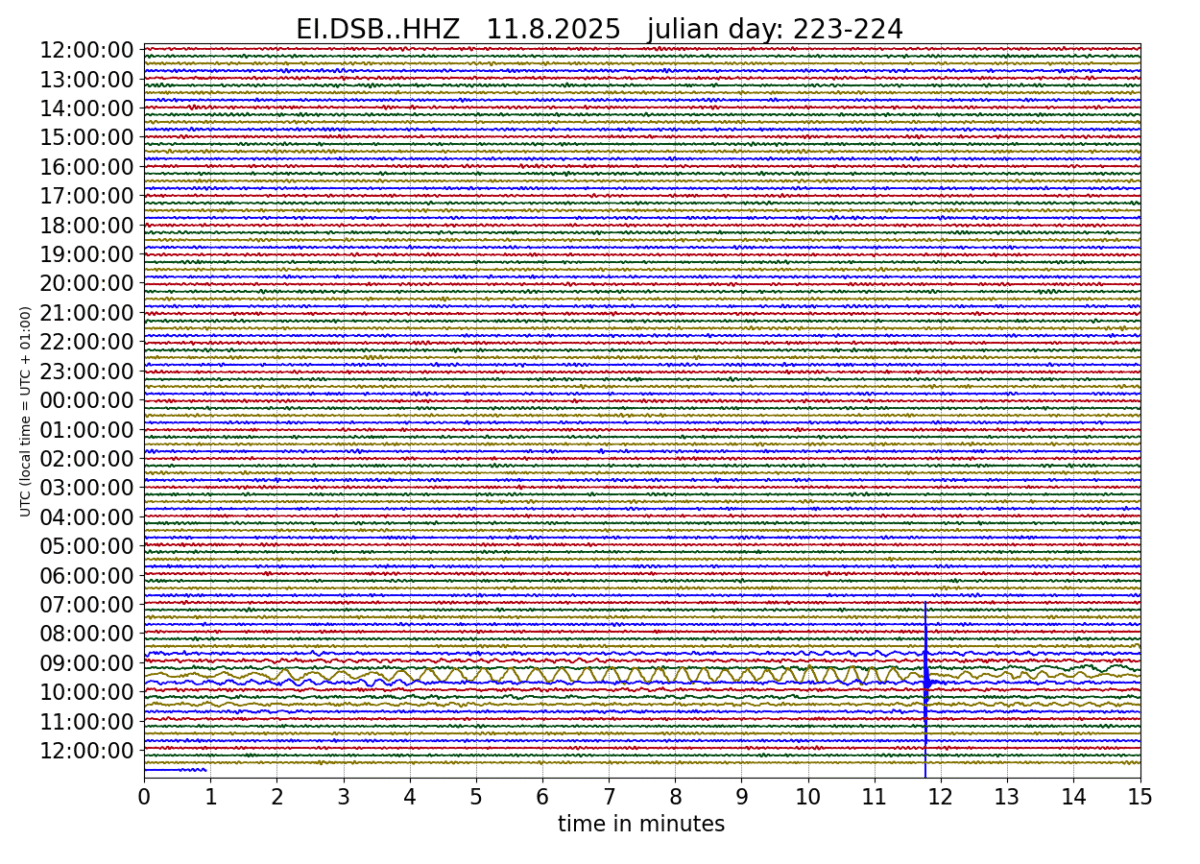
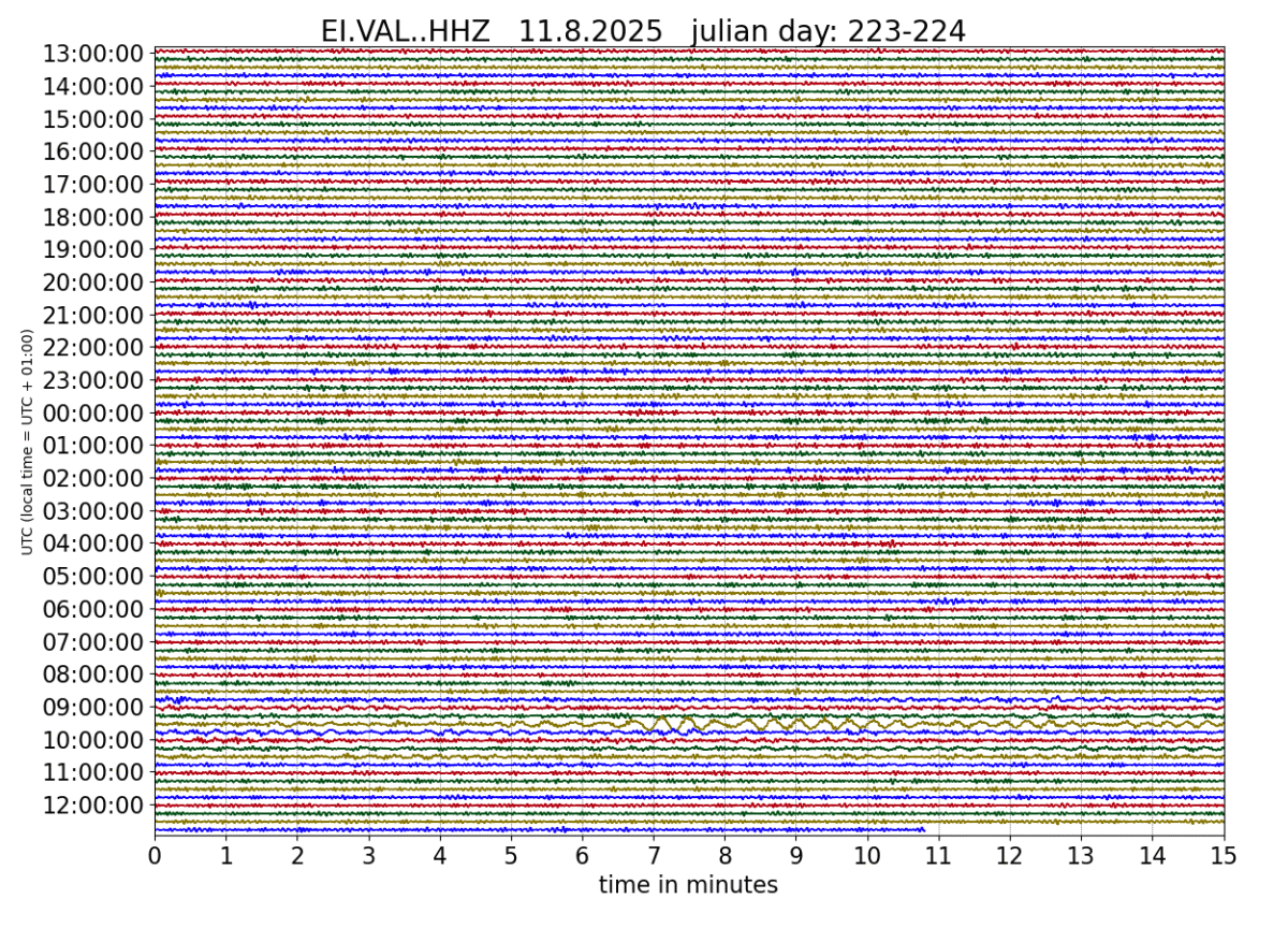
It took approximately 13 minutes for the seismic waves to travel across the globe and be registered by Irish monitoring stations, according to data from the Irish National Seismic Network.
Indonesia is one of the most seismically active countries in the world, lying on the Pacific Ring of Fire where several tectonic plates meet, and experiences thousands of earthquakes each year.