 in Irish Weather History 1")


Irish seismographs record Turkey earthquake and Scottish tremor

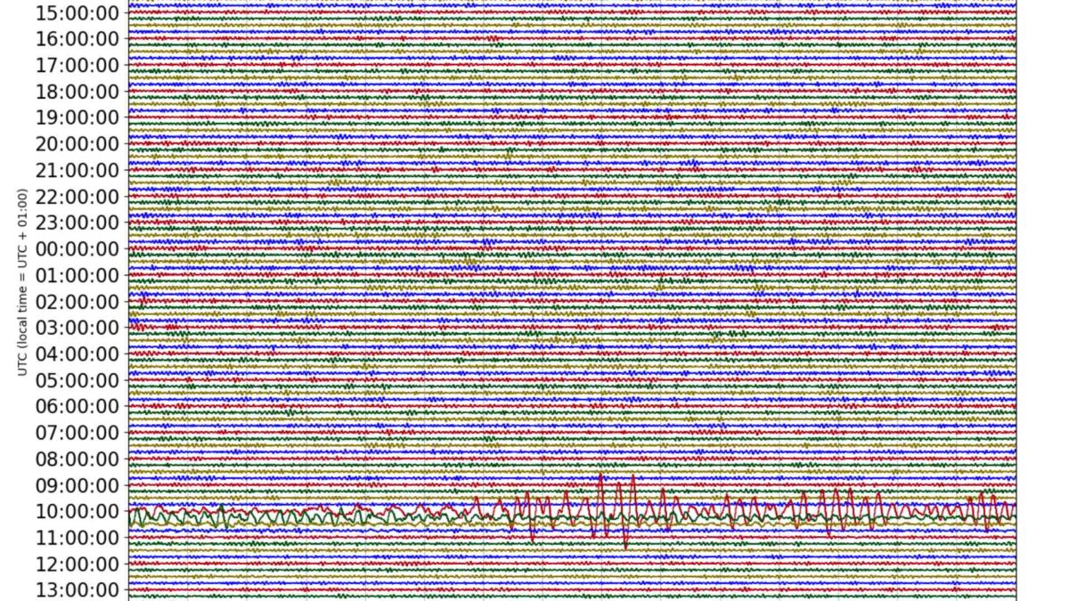
A magnitude 6.2 earthquake in western Turkey was picked up by seismographs throughout Ireland on Wednesday morning.
The quake struck in the Sea of Marmara near Marmara Adasi Island at 12.49pm (9.49 am GMT) at a depth of 10km, according to the US Geological Survey.
More than 150 people were injured during the earthquake, while there have been no reports of significant structural damage.
It took an estimated 10 minutes for the soundwaves from the earthquake to make the 3,000-kilometre journey to Ireland.
The INSN seismograph at Valentia Observatory recorded soundwaves over a 31-minute period from 9.59am to 10.30am.
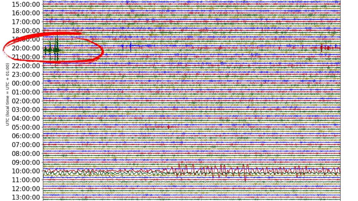
Meanwhile, a magnitude 1.2 earthquake recorded at Mallaig in the Scottish Highlands was also recorded on Irish seismographs.
The shallow earthquake struck at 8.24pm on Tuesday night, the British Geological Survey reported.
A 5.4 magnitude earthquake in July 1984 was the largest ever recorded on mainland Britain, on the Llyn Peninsula in North Wales, to be precise.
It was felt throughout Ireland’s east coast, as well as Wales and England.
It released approximately 15.8 trillion Joules of energy compared to just 400 thousand Joules released by Tuesday night’s quake in Scotland.


