 in Irish Weather History 1")


Storm Amy to Bring Heavy Rain and Strong Winds to Ireland
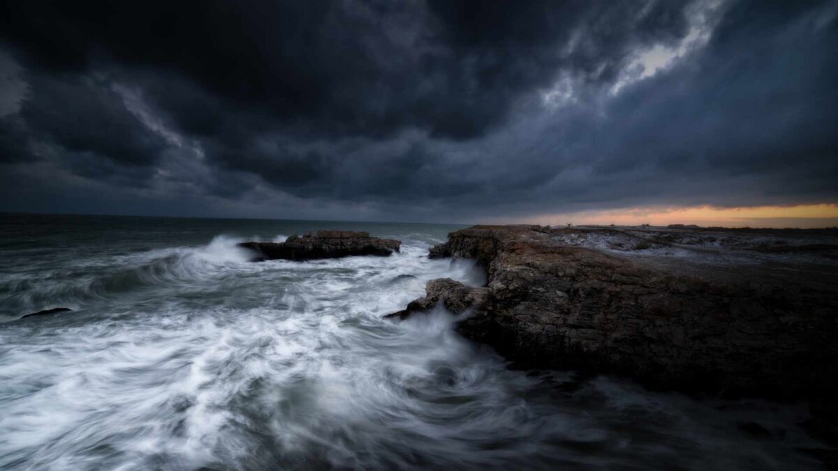
Storm Amy, named by the UK Met Office, is the first storm of the 2025/26 season and is set to impact Ireland on Friday.
Before the arrival of the storm, a spell of heavy rain will spread across the country on Thursday, particularly affecting the north-west, west and south-west. On Friday, Amy will bring strong south-westerly winds nationwide, accompanied by further heavy rainfall.
Met Éireann meteorologist Ailís Hankinson said, “Storm Amy will bring wet and very windy conditions on Friday, and it’s preceded by a band of heavy rain on Thursday. It is the first storm of the season so it’s essential to be prepared for potential impacts caused by the strong winds and the rain. There could be difficult travelling conditions, loose objects or flying debris. Trees are still in leaf at this time of the year, so there could be higher impacts from fallen trees and leaves blocking drains, causing localised flooding.”
The unsettled Atlantic weather pattern, linked to the remnants of Hurricanes Humberto and Imelda near Bermuda, is fuelling a powerful jet stream and creating the conditions for this rapidly deepening low pressure system.
Warnings in place
Met Éireann has issued yellow and orange rainfall warnings for Thursday and Friday, alongside yellow wind warnings for Friday. Wind alerts could be extended into Saturday for parts of the north-west, depending on the track of the storm.
Main impacts expected
- Localised flooding, especially in upland catchments in the south-west and west.
- Difficult or hazardous travelling conditions.
- Risk of fallen trees and debris due to strong winds and saturated ground.
- Surface water flooding as blocked drains and high river levels combine.
- Isolated spray overtopping at times of high tide along western coasts.
Advice to the public
Authorities are urging people to stay updated via Met Éireann’s app, website and social media channels. Householders are advised to secure loose outdoor items, keep phones fully charged, and stock small amounts of food, water and medical supplies in case of disruption.
Drivers are asked to take particular care on exposed routes and to avoid driving through floodwaters. The Irish Coast Guard has reminded people to keep away from coastal areas during periods of strong winds and high waves.
ESB Networks has warned of the dangers of fallen power lines and urged the public to report any outages or hazards to its emergency service at 1800 372 999.
Why was the storm named?
Storms are named when they are expected to bring medium or high impacts in Ireland, Britain or the Netherlands, under the western storm naming partnership. Amy is the first in the 2025/26 list, which also includes Bram, Chandra, Fionnuala, Tadhg and Violet among others.
The last storm season saw six named storms affect Ireland, including Storm Éowyn in January which produced the strongest wind gust ever recorded in the country, at 184 km/h in Co Galway.
Met Éireann has stressed that Storm Amy is being closely monitored and updates will be issued as new forecast data becomes available.
Share this WeathÉire story:

