 in Irish Weather History 1")


New Satellite Delivers Stunning First Look at Earth
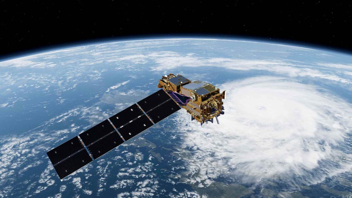
EUMETSAT has released the first images from its METimage instrument aboard the newly launched Metop Second Generation A1 (Metop-SGA1) satellite, offering a glimpse into the future of high-resolution Earth observation.
The images, captured on 24 September and published this week, showcase remarkable detail and colour, promising to enhance weather forecasting and climate monitoring across Europe and beyond.
The initial scene spans Europe and North Africa, revealing cloud formations linked to a cold front over central Europe, storm activity over the Adriatic and Mediterranean, and vivid surface features including the Carpathian and Balkan forests, Türkiye’s lakes and the contrasting landscapes of North Africa.

METimage’s first global sweep also captured Hurricane Humberto over the Atlantic.

Other highlights include sediment-stirred ocean colour shifts near Australia and the Caribbean, fog over the US Great Lakes and a clear view of Asia with the Himalayas visible down to individual snow-filled valleys.

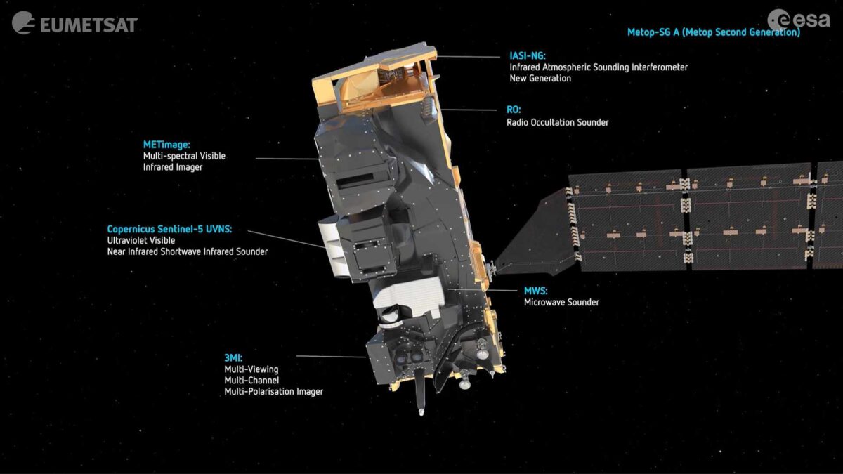
Orbiting 830 kilometres above Earth, METimage is a multi-spectral radiometer that observes in 20 visible-to-infrared channels at a resolution of 500 metres. It replaces the AVHRR instrument on earlier Metop satellites, which offered only one-kilometre resolution. The new instrument supports detailed monitoring of clouds, aerosols, water vapour, surface temperatures, vegetation, ice cover and active fires.
Early data products, including detailed cloud maps, are already being tested and show promise for improving storm nowcasting, wildfire detection and air-quality forecasts. The satellite and its ground infrastructure are currently undergoing calibration and validation before full operational use.
Phil Evans, Director-General of EUMETSAT, said the images were “truly exceptional” and would help national meteorological services deliver more reliable forecasts and earlier warnings. Simonetta Cheli, ESA’s Director of Earth Observation Programmes, highlighted the importance of collaboration in tackling increasingly erratic weather patterns.
Walther Pelzer, Director General of the German Space Agency at DLR, said METimage’s high spatial resolution would significantly improve forecast quality. He noted that Germany’s contribution to the mission, jointly financed by the federal Ministry of Transport and EUMETSAT, sets new standards in climate observation.
The Metop-SGA1 satellite is part of the EUMETSAT Polar System – Second Generation, a collaborative effort involving EUMETSAT, ESA, DLR, Airbus and other international partners.
The Metop-SGA1 satellite is part of the EUMETSAT Polar System – Second Generation, a collaborative effort involving EUMETSAT, ESA, DLR, Airbus and other international partners.
Share this WeathÉire story:

