


Tropical Storm Erin forecast to strengthen into hurricane
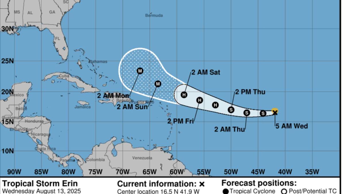
Tropical Storm Erin is expected to intensify into a hurricane in the coming days as it tracks across the Atlantic, according to the latest advisory from the US National Hurricane Center (NHC).
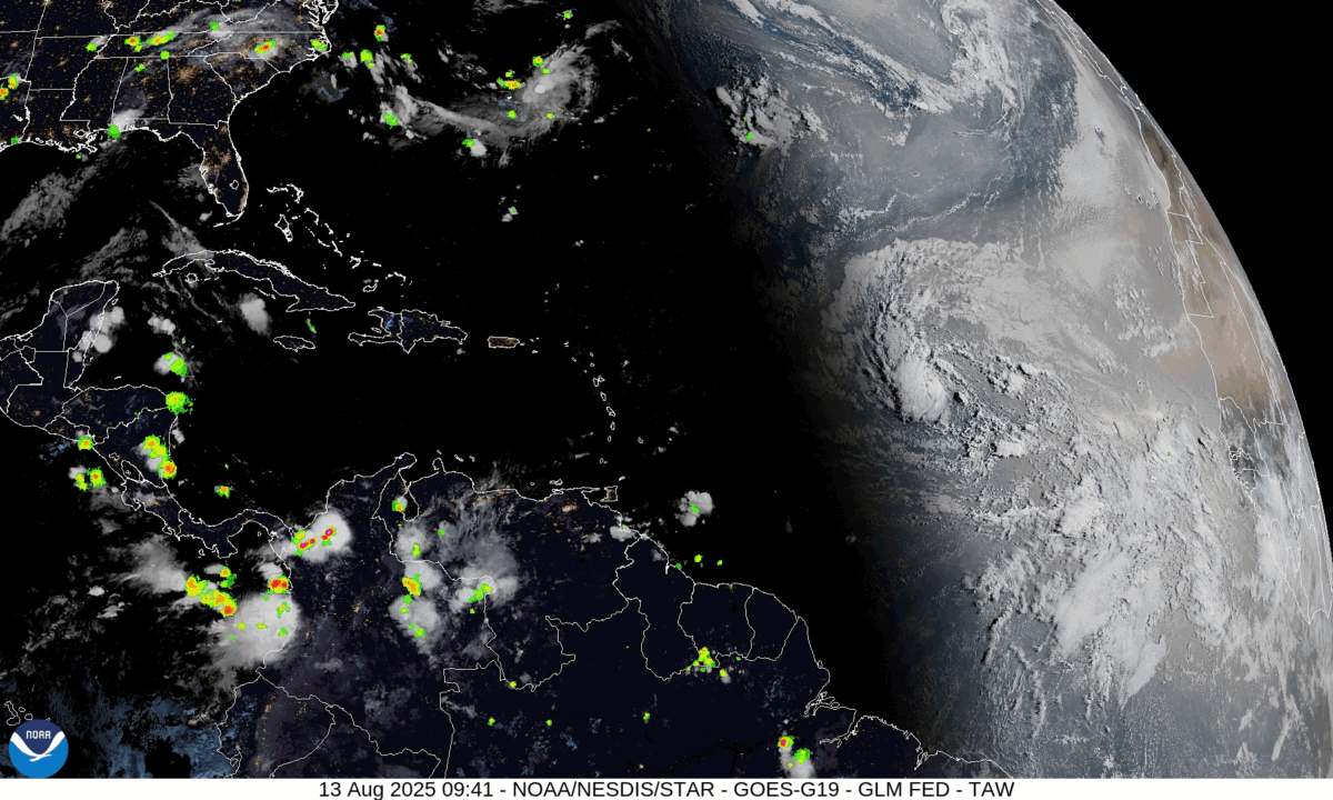
The storm, currently packing maximum sustained winds of about 75 km/h (40 knots), remains disorganised with limited convective banding and intermittent bursts of thunderstorm activity. Erin has been unable to strengthen significantly over recent days due to cooler sea surface temperatures and dry air in the mid- to lower atmosphere.
Conditions are forecast to become more favourable for development over the next 48 hours, with the storm moving over progressively warmer waters. Computer models continue to project Erin will reach hurricane strength later this week.
The system is moving west at around 31 km/h under the influence of a strong atmospheric ridge to its north. A slight turn towards the west-northwest is expected in the coming days.
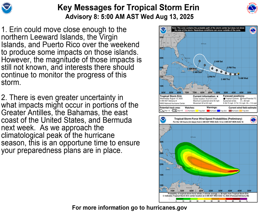
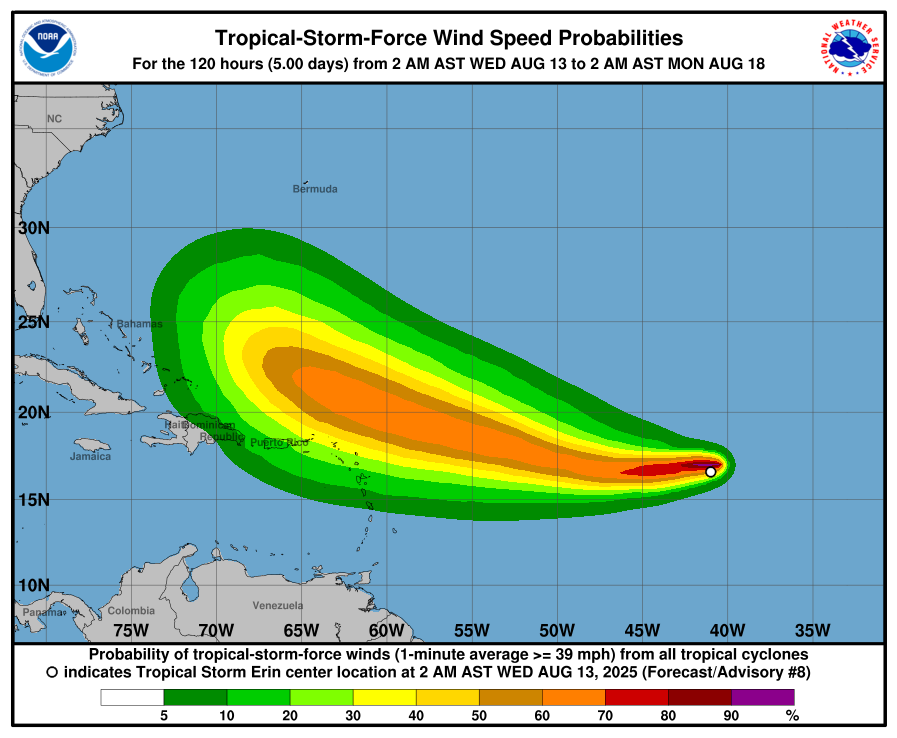
The centre of Erin could pass close enough to the northern Leeward Islands, the Virgin Islands and Puerto Rico over the weekend to bring potential impacts, though forecasters say the severity remains uncertain.
There is even greater uncertainty over possible effects on the Greater Antilles, the Bahamas, Bermuda and the US east coast next week. The NHC is advising residents across the region to remain vigilant as the peak of the Atlantic hurricane season approaches.
Hurricane season 2025 expected to be above average
The 2025 Atlantic hurricane season is forecast to be more active than usual, with US meteorologists predicting an increased number of tropical storms and hurricanes.
The National Oceanic and Atmospheric Administration (NOAA) expects between 13 and 18 named storms, including 5 to 9 hurricanes and 2 to 5 major hurricanes reaching Category 3 strength or higher. The agency has given a 50 per cent probability of above-normal activity, slightly lower than its earlier projection of 60 per cent.
Colorado State University’s forecast is similarly active, projecting 17 named storms, 9 hurricanes and 4 major hurricanes. This outlook is based on warmer-than-normal sea surface temperatures and a transition to neutral El Niño–Southern Oscillation conditions.
AccuWeather forecasters also expect heightened tropical activity, particularly in mid-August, with three to five named storms likely to form in the Atlantic basin during that period.
Meteorologists say several factors are contributing to the increased risk. Sea surface temperatures are currently 1 to 2 degrees Celsius above average, and reduced wind shear will make it easier for storms to strengthen. The absence of El Niño this year further supports the likelihood of a busy season.
The names for this year’s Atlantic storms, as set by NOAA, are Andrea, Barry, Chantal, Dexter, Erin, Fernand, Gabrielle, Humberto, Imelda, Jerry, Karen, Lorenzo, Melissa, Nestor, Olga, Pablo, Rebekah, Sebastien, Tanya, Van and Wendy.
Share this WeathÉire story:


 in Irish Weather History 79")


