 in Irish Weather History 1")


Hurricane Erin retains power, remnants could end settled spell in Ireland
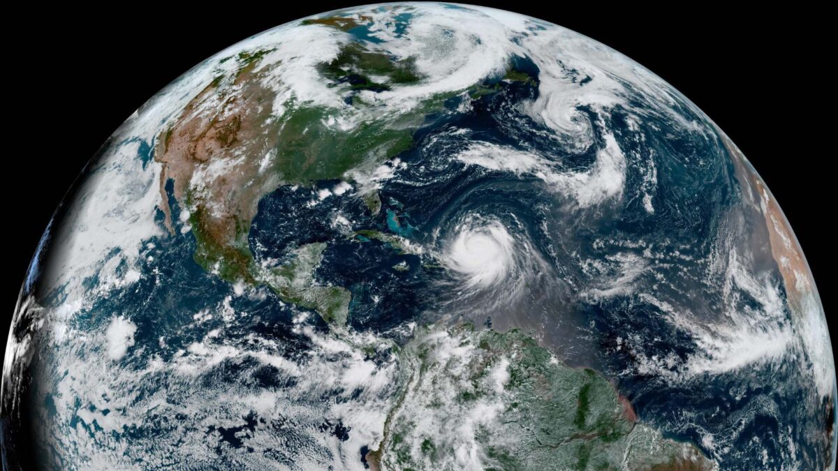
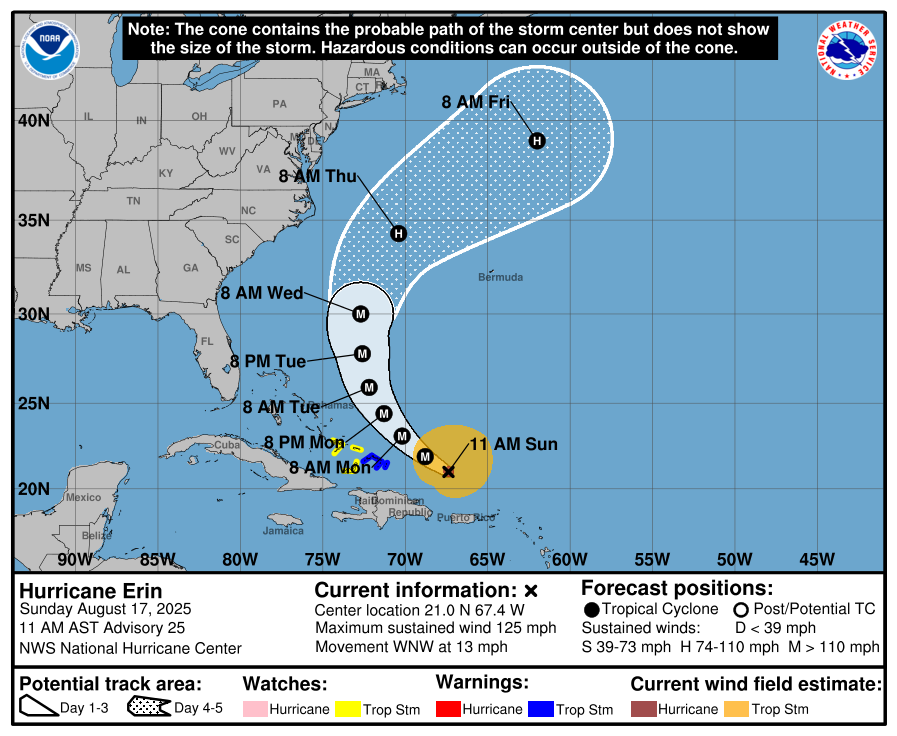
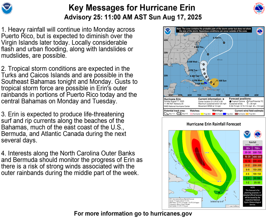
Hurricane Erin remains a dangerous major hurricane in the western Atlantic, with maximum sustained winds near 110 knots (203 km/h), according to the latest update from the US National Hurricane Center (NHC).
The storm is undergoing an eyewall replacement but is expected to strengthen again over very warm waters.
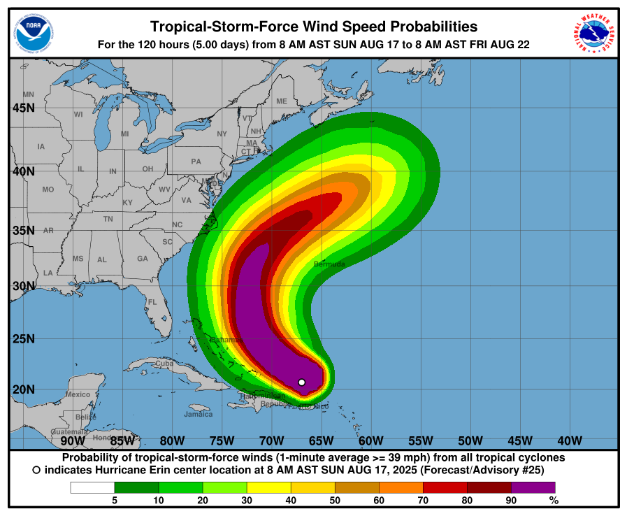
Erin is growing in size, expanding its wind field and raising the risk of rough seas across the region. Forecasters expect the hurricane to turn north in the coming days, but there is uncertainty over how close it will pass to the US east coast.
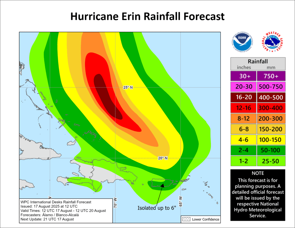
Heavy rain continues over Puerto Rico, while tropical storm conditions are expected in the Turks and Caicos and possibly the Bahamas. The system will generate hazardous surf and rip currents from the Bahamas to Atlantic Canada.
Likely Impact on Northwest Europe
The remnants of Hurricane Erin could play a part in ending Ireland’s prolonged dry spell in about 8 to 9 days from now.
While Erin will not reach Irish shores as a hurricane, its track across the Atlantic is likely to disrupt the current settled weather pattern. As the system curves north and east in the coming days, it is expected to inject energy into the wider Atlantic circulation. This in turn could steer low pressure systems closer to Ireland, breaking the dominance of high pressure that has kept conditions dry for much of August.
Although the timing remains uncertain, the influence of Erin’s remnants could bring a shift towards more unsettled conditions by late next week. That may mean outbreaks of rain and fresher winds, particularly in the west.
For now, the country is set for several more days of warm and largely dry weather.


