 in Irish Weather History 1")


Flooding Hits Parts of Ireland
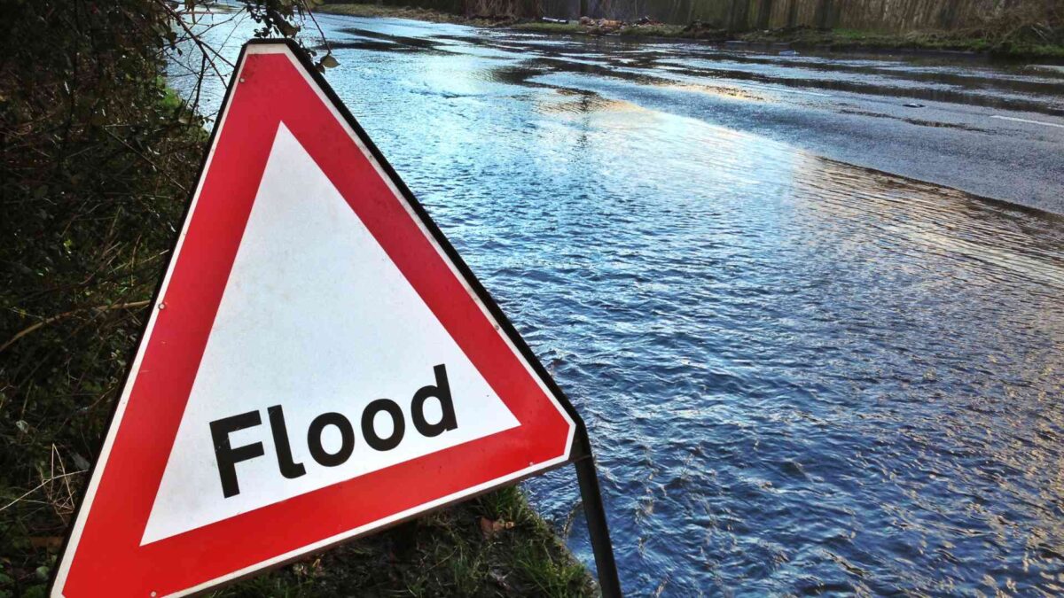
Torrential rain brought significant disruption across the island on Sunday and into Monday, with Met Éireann recording 60mm of rainfall in Dundalk, Co Louth—well above the July average for eastern counties.
50mm was also reported in parts of Dublin and Meath, as heavy rain swept through the region. At Casement Aerodrome, 59mm of rain fell in the 24-hour period up to midday Monday.
In Northern Ireland, flooding forced the closure of the M12 carriageway in Craigavon, Co Armagh this morning, while roads near Blacks Road in west Belfast were also affected. In Fermanagh, some roads around Enniskillen became impassable due to standing water.
The weekend’s severe conditions weren’t limited to the east. Thunderstorms broke out across parts of the west on Sunday evening, triggering flash flooding in several areas.
In Dromcollogher on the Cork-Limerick border, dramatic video footage showed torrents of water gushing down the main street following an intens downpur. Limerick City and County Council deployed pumping equipment to bring rising water levels under control. Athenry in Co Galway recorded 31mm of rainfall during the day.
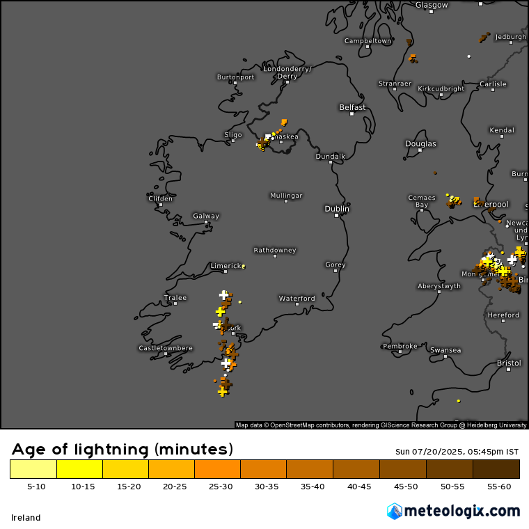
Status Orange and Yellow rain warningsfor parts of Leinster were lifted at 2pm, while the UK Met Office has issued a Yellow Warning for Antrim, Armagh and Down until 6pm, cautioning of further flooding and possible travel disruption.
Looking ahead, the rest of the week promises more typical summer conditions, with a mix of dry spells, scattered showers, and occasional sunshine. Temperatures will remain mild, rising into the low to mid-twenties later in the week. High pressure is expected to bring more settled weather to the south early next week, while the north and west may continue to experience more frequent rainfall. No extreme conditions are currently forecast.
Share this WeathÉire story:

