A More Settled Spell of Weather on the Horizon

There has been much talk about a warm, dry and settled spell of weather for Ireland from the middle of the month, and there is good evidence to suggest this will be the case.
Long-range weather models are indicating a shift towards more settled conditions, with high pressure systems likely to become more dominant. This would bring a noticeable drop in rainfall and a gradual rise in temperatures as we move into the middle third of the month.
Despite occasional sunny spells in recent weeks, rainfall totals across the country have been significantly above average — with some areas recording between 237% and 280% more rainfall than usual over the past 10 days.
The unsettled weather pattern that began around May 20th is expected to continue into much of next week.
The transition to more settled conditions has been a slow process, with numerous false starts in the past 10 days. However, signs are emerging that a more stable and pleasant spell could follow for the middle of the month.
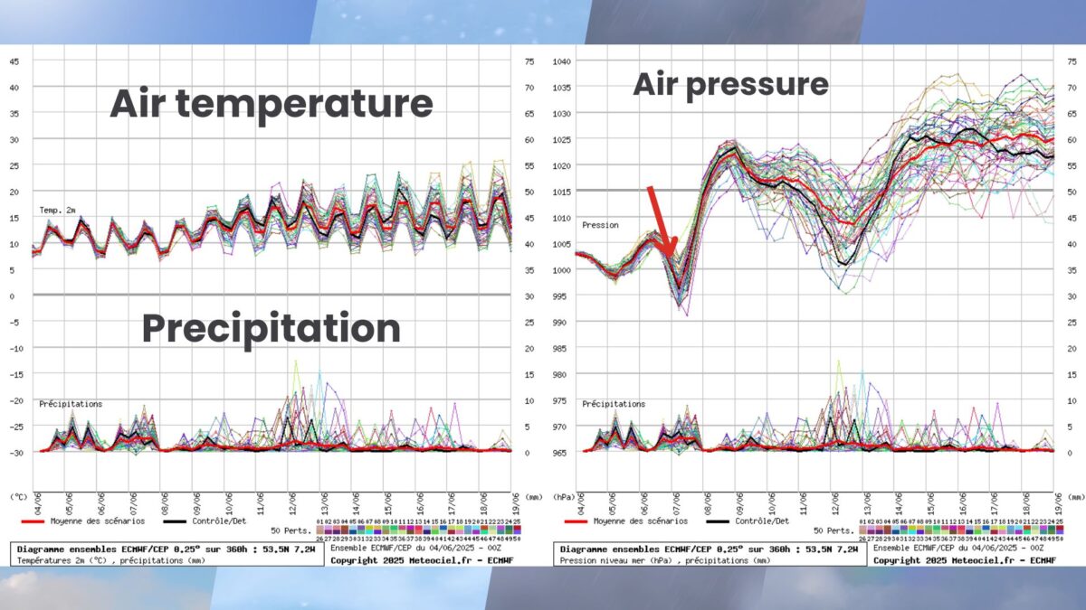
Looking ahead, high pressure is forecast to build across Ireland by mid-June, bringing more frequent dry periods, lighter winds, and higher-than-average temperatures. The latest 16-day outlook from the European ECMWF model suggests a decrease in rainfall during the latter part of the forecast period, up to 19 June.
Ensemble model data — which runs 50 forecast variations to account for uncertainty — also supports a warming trend, with the average of all runs pointing to a steady rise in temperatures next week. This data is based on a sample location in the Midlands.
Meanwhile, Met Éireann reports that seasonal models (C3S) are signalling a warmer-than-average summer for Ireland. For the June–August period, mean temperatures are very likely to be above normal, particularly in the south and east, where temperatures in June may trend 1.0°C to 2.0°C above average. Rainfall over the summer is expected to be close to average overall.
Share this WeathÉire story:


