


 in Irish Weather History 14")


Mostly Cloudy Saturday Over Ireland
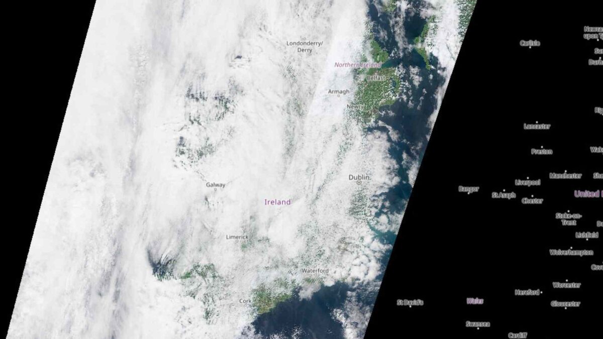
Much of Ireland was under cloud cover around midday Saturday when the Copernicus Sentinel-2 satellite passed overhead. The only clear skies at the time were spotted over parts of east Ulster and east Cork.
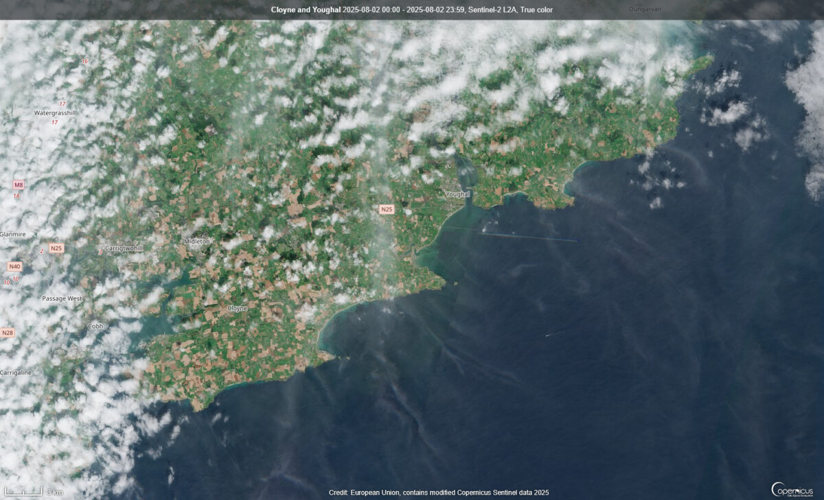
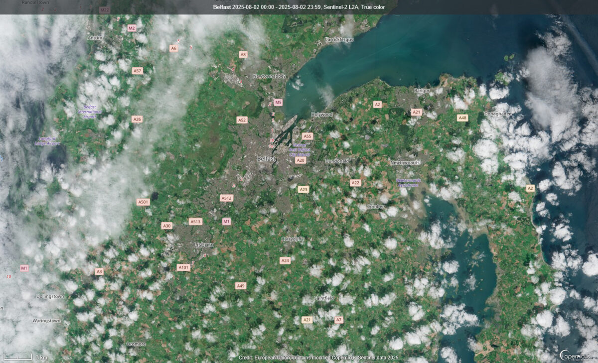
Belfast and Carrickfergus enjoyed some sunshine, as did Cloyne and Youghal in east Cork.
Brighter spells developed in eastern areas by mid-afternoon, but cloud lingered further west. By early evening, drizzle and light rain—occasionally heavier—had returned to western counties. The west has seen frequent damp conditions over the past week, while the south has enjoyed the best of the dry weather.
Cork has stood out as one of the warmest and driest parts of the country. Roches Point recorded no measurable rainfall over the past week, making it Ireland’s driest weather station during an already dry spell across much of the country.
Met Éireann figures show that rainfall totals were below average nationwide last week. Most areas were classified as either “drier than normal” or “much drier than normal.” Valentia in Co. Kerry saw the highest total, but it was just 13mm—only 54% of its normal weekly rainfall.
Looking ahead, conditions will deteriorate by Sunday night as Storm Floris moves in. The system is expected to bring heavy rain, strong winds, and possible disruption across the country on Monday, especially in western and northern regions. While conditions will improve somewhat by Tuesday, the outlook remains unsettled, with occasional rain and temperatures near the seasonal average.
Share this WeathÉire story:


 in Irish Weather History 68")


 in Irish Weather History 75")


