


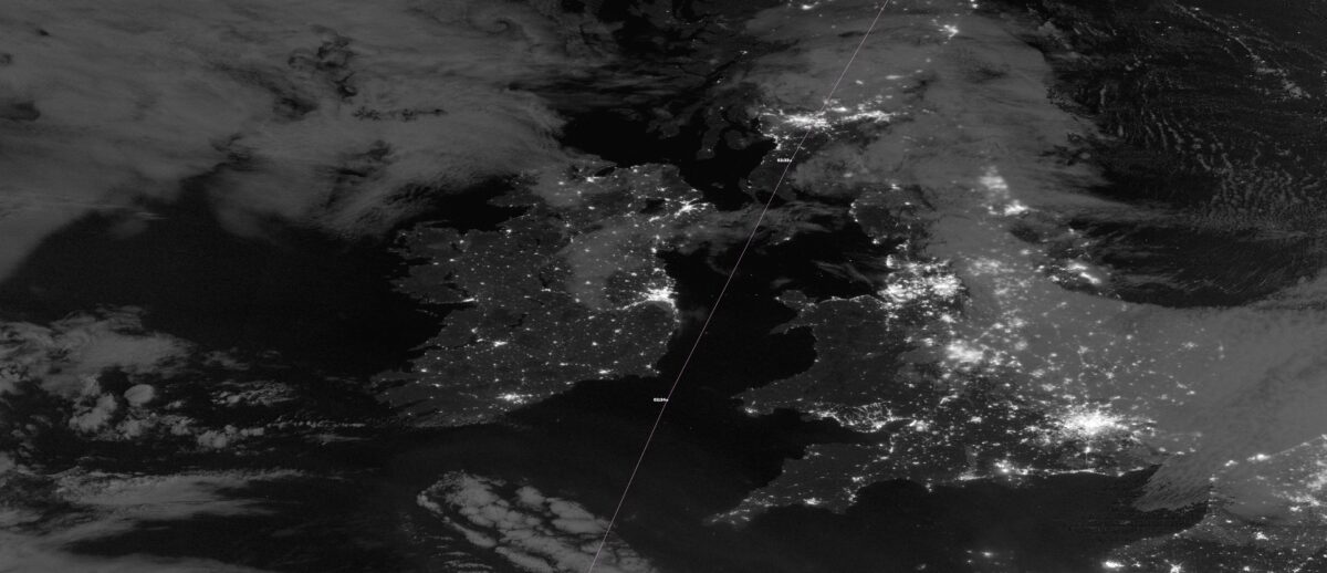
NASA satellite captures Ireland aglow under clear skies
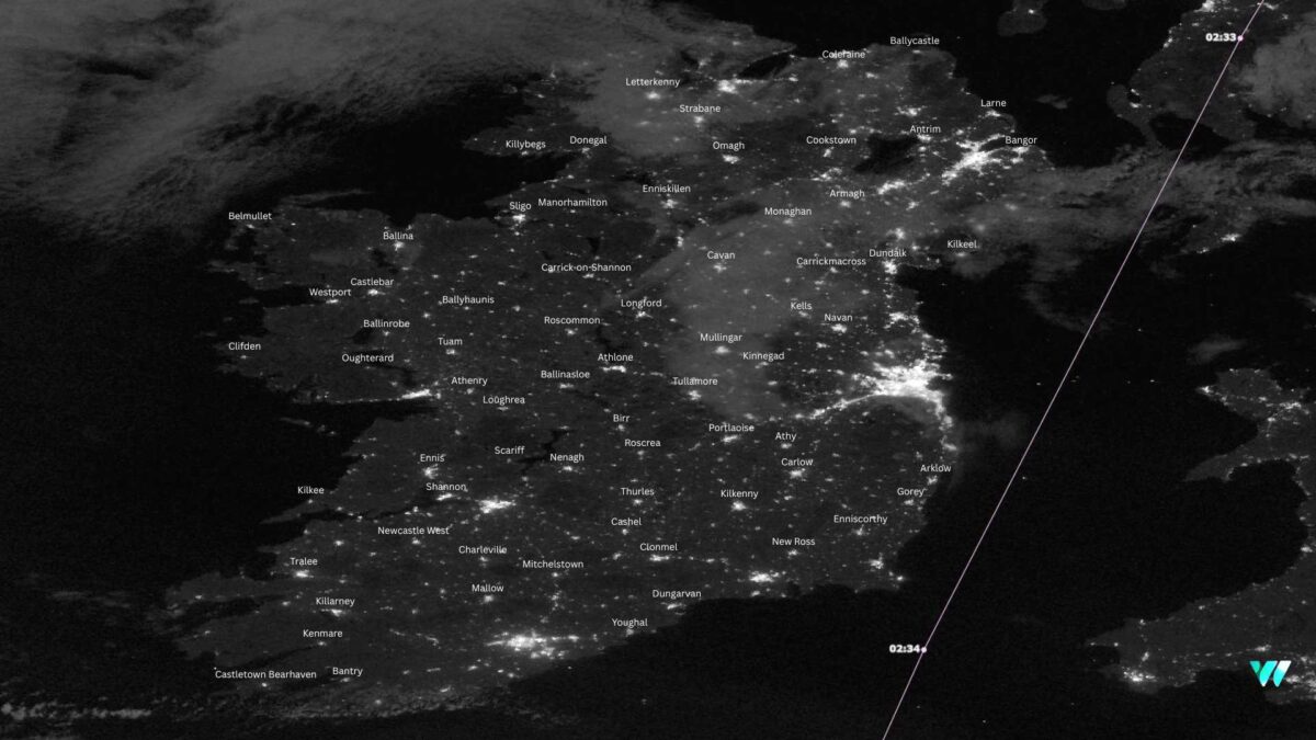
A NASA satellite view of Ireland early on Saturday morning has revealed a striking image of the island lit up by towns and cities under largely clear skies.
The image, taken by the VIIRS (Visible Infrared Imaging Radiometer Suite) instrument, shows a sweep of urban settlements from Castletownbere in the southwest to Ballycastle in the northeast. The skies were mostly clear, with some high cloud visible over parts of north Leinster and Ulster.
VIIRS was first launched in 2011 aboard the Suomi NPP satellite, a joint NASA and NOAA mission. Orbiting 824 kilometres above the Earth, the satellite completes about 14 passes each day, providing near continuous coverage of the globe.
The instrument is designed to capture faint light emissions at night, allowing scientists to monitor city growth, energy use, and even temporary power outages after extreme weather events.


 in Irish Weather History 77")


