Mixed Week Ahead After Dry Spell

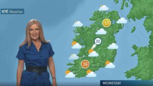
After a largely dry week across much of the country, Ireland is set for a more unsettled spell with spells of rain and showers forecast to return – particularly in western counties.
Over the past seven days, according to Met Éireann, rainfall totals were well below seasonal norms in most areas. Dublin Airport recorded just 1.6mm – a mere 11% of its average for this time of year – making it the driest location in the country.
In contrast, Malin Head in Co. Donegal topped the rainfall charts with 14.1mm, roughly 85% of the norm. Other parts of the north and west also saw slightly higher totals, but still below average overall.
Looking ahead, the coming week is shaping up to be more unsettled. Rainfall amounts are expected to range from one to three times the normal levels, especially in western and northwestern counties. The southeast and east may escape the worst of it, with some areas remaining drier than average.
Despite the wetter outlook, temperatures will continue to run above normal. Last week, mean air temperatures ranged from 15.4°C at Cork Airport to a balmy 18°C at Casement Aerodrome in Dublin – up to 4.1 degrees higher than the seasonal average.
Soil temperatures followed suit, reaching between 16.7°C and 20.4°C nationwide. While slightly cooler conditions are expected this week, mean air temperatures will still remain 1 to 3 degrees above average, especially in the east and southeast.
Sunshine levels, which were well above normal last week – with Casement Aerodrome recording a sunny 69.3 hours – are set to dip over the coming days. Sunshine will still feature, but amounts are expected to fall below normal nationwide.
The wetter and more unsettled pattern will bring knock-on impacts for farming and field work. Drying conditions will often be poor, with only brief improvements at times. Spraying opportunities will be limited as a result.
Soil moisture deficits currently range from 5–15mm in the north and northwest to 40–50mm in the far south. However, these are expected to decrease by 10–15mm in most areas due to the incoming rainfall, with parts of the north, west and north midlands possibly becoming saturated. In contrast, the southeast and east may see deficits increase slightly as conditions there remain relatively dry.
Share this WeathÉire story:


