 in Irish Weather History 1")


Ireland’s Electric Storm: Revisiting the Thunderstorms of 25/26 July 1985
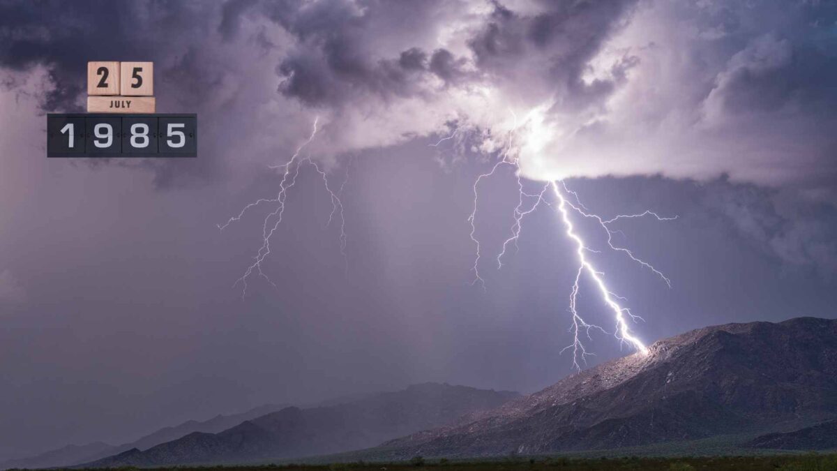
On July 25th and 26th, 1985, Ireland experienced one of the most intense and widespread thunderstorm outbreaks of the decade. The event brought with it torrential rainfall, hail, and significant lightning activity.
Though little remembered today, records from Met Éireann and eyewitness accounts confirm that the event marked a rare convergence of atmospheric instability over the island.
Weather conditions on the morning of July 25th were unusually humid and warm for the time of year, following a prolonged spell of unsettled conditions in which parts of the east recorded more than double their average monthly rainfall. A combination of warm, moist air at ground level and an incoming upper-level trough over the Atlantic created ideal conditions for thunderstorm development.
On July 25th, a frontal trough approached Ireland from the west, while the outflow from a thundery trough over the Bay of Biscay moved northward ahead of it. As the two systems interacted, widespread and dramatic thunderstorm activity developed across the country by evening, continuing into the night and early hours of July 26th.
The greatest intensity was observed along a line from Kilkenny City to east Tyrone / Armagh in which there were bursts of very heavy rain and severe hail activity.
Parts of the west and southwest escaped the worst of the thunderstorms. The thundery activity dissipated on the morning of the 26th.
Recorded Impacts
Lightning Strikes: Met Éireann later confirmed that over 3,000 lightning strikes were recorded across the country on July 25th alone, an exceptionally high figure for Ireland. Belfast Aldergrove experienced intermittent lightning for at least nine consecutive hours, from 11 p.m. on the 25th to 8 a.m. on the 26th.
Rainfall and Flooding: Rainfall accumulations ranged between 30mm and 50mm in under two hours in parts of the east and midlands, overwhelming drainage systems. In some areas, up to 30mm fell in 30 minutes or less, including Naas in Kildare and Coon in Kilkenny, according to Met Éireann. 22mm of rainfall was recorded in a 15 minute period at Oak Park in Carlow. Castleshane in Monaghan recorded 78mm during the 25th-26th. Urban flooding occurred in Dublin, Portlaoise, and Athlone.
Hail Reports: Large hailstones, some up to 3cm in diameter, were reported in County Offaly and Laois. Several vehicles sustained minor damage due to hail impact, an uncommon occurrence in Irish summer storms.
Power Disruptions: ESB reported numerous short-duration power outages across the Midlands and southeast, with lightning damaging local substations and transformers.
Transport Delays: Flash flooding caused localised disruption on roads and rail services. A section of the main Dublin–Cork line experienced delays due to waterlogging.
Disruption to agriculture: Cloud to ground lightning strikes extensive damage to crops and farm buildings, with hundreds of animals killed after being struck by lightning. Millions of pounds worth of damage of was caused.
RTÉ News report.
Meteorological Significance
Climatologists consider the July 25th, 1985 thunderstorms to be among the most severe single-day convective weather events in Ireland during the 1980s. The episode is often cited in retrospective analyses of Irish thunderstorm activity and is notable for the widespread geographical impact and relatively high lightning density for the region.
At the time, Ireland lacked the advanced radar and lightning detection systems now operated by Met Éireann. As a result, public warnings were limited, and forecasting of convective outbreaks relied heavily on satellite imagery and surface reports.
Eyewitness Accounts (IWO)
“A neighbours barn was struck by lightning. The were poor calves that were trapped inside as it burned down. I remember my Dad and all the neighbours doing their best to get them out and put out the fire to no avail.”
“Probably the best day of my teens. Simple Minds in Croke Park and a free lightning show to boot for the evening.”
“Went to cabanas in greystones disco and there was a few dubs out. The electric went off and we were all in candle light. We started a sing song . And going home in the car the fork lightening went straight across the downes hill in front of us.”
“I was just home from hospital with our first baby. She was just 1 week old. The storm began at 4pm and continued until about 7am. I prayed all night that she would sleep as I was terrified. At one point about 2am the lightening struck a transformer in a neighbours field. It felt like the ground exploded. We had no electricity for several days. At times the sky resembled a broken windscreen with lightening flashing in all directions.”
“My Mum woke us up so we could sit at her window and watch. The lightning kept hitting the power station at Tagadoe across the fields. Amazing fork lighting across the sky. Stunning. Our Dad pulled up outside the house and ran from the car. He was soaked through to the skin.”
“Terrified we all stayed on the one room & crawled on our knees if we needed to leave the dark room it was blue lightening the roars of the thunder like ud hear in a horror movie”
A Rare but Not Isolated Event
While thunderstorms are not uncommon in Ireland, those of July 1985 stood out for their ferocity, coverage, and the suddenness with which they struck. Similar severe convective outbreaks were recorded in July 1982 and again in August 1986, but July 25th, 1985 remains one of the most impactful in terms of lightning activity and damage. According to the European Severe Storms Laboratory (ESSL), several lowland sites in Northern Ireland recorded rainfall totals and intensities with frequencies of about 1 in 100 years.
July Weather Records Set On This Date
The thunderstorms of July 25th aren’t the only extreme weather event linked to that date in Ireland’s history. On July 25th, 1988, Malin Head in Donegal recorded a wind gust of 137 km/h—the strongest ever measured in Ireland during the month of July. The station also logged a sustained mean wind speed of 102 km/h, reaching storm force levels—another July record that still stands today. Meanwhile, the record low mean sea level pressure ( 978.0 hPa) was set at Belmullet, County Mayo, on the same day.
 in Irish Weather History 17")

